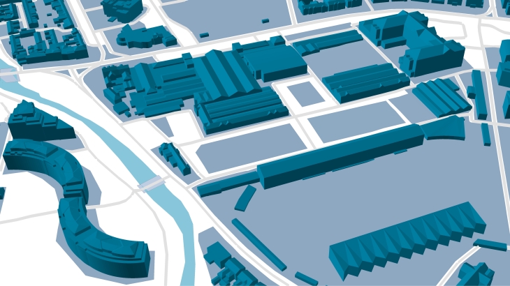
LOD3 3D buildings manufactured by Visicom, including such small elements as roof furniture, elevators shafts, towers, spires, as well as taking into account the sloping roof elements. The assigned parameters of azimuth, tilt angle, area of flat parts, and roof height are calculated for each element separately creating the background for producing solar rooftop maps (solar cadaster). The high accuracy of the building elements' footprints is tailored specifically to the estimation and calculation of the solar energy potential for each roof.
Visicom geospatial data provides a high level of details in urban areas that allow recognize, visualize and analyze the changes in the natural and manmade environment. LOD3 3D data for various tasks of environmental management are produced and developed in multiple GIS formats like ArcGIS, ERDAS Imagine/ER Mapper, MapInfo, and AutoCAD Map.
- 3D Maps

- 3D Models
- LoD 2 buildings
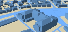
- 3D SLOPED ROOFS MODEL
- Precise and up-to-date mapping information
- Extra-accurate 3d buildings
- Detailed and high-resolution terrain
- Flexible price fitted to customer budget
- Delivery in any RF planning tool and GIS format
- Alcatel A955
- Aircom Asset
- Atoll Forsk
- CelPlanner
- ICS Telecom
- NetPlan
- AutoCAD
- ESRI ArcGIS
- MapInfo
- Microstation
- Neva
- Odyssey
- Pathloss
- Mentum Ellipse
- Mentum Planet
- Nokia NetAct
- ASCII XYZ
- Raster images
- TIFF and GeoTIFF
- ERDAS Imagine Image
- ER Mapper Raster
- ENVI Image Format
- Generic Binary