Population Distribution Map is a significant element for wireless networks planning and optimization. This type of map enables to process values of population distribution with level of details from countrywide areas to separate cities.
Input data:
- Land Use Model (Clutter) - Administrative Boundaries - Population Census Data
Population Distribution Data may include:
- Population quantity for each administrative unit (Vector Model) - Population density per area units (Raster model) - Population density per each cell of the raster grid
Population Map can be delivered in the any popular format of RF planning tool or GIS as: Vector Model & Raster model
Click here to download samples of Population Distribution Regional Model
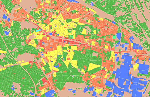
Click here to download samples of Population Distribution City Model
Inside formats: MapInfo (*.tab); Atoll Forsk; Vertical Mapper
Explore more and download brochure "Current Visicom Population Map Projects"
- Precise and up-to-date mapping information
- Extra-accurate 3d buildings
- Detailed and high-resolution terrain
- Flexible price fitted to customer budget
- Delivery in any RF planning tool and GIS format
- Alcatel A955
- Aircom Asset
- Atoll Forsk
- CelPlanner
- ICS Telecom
- NetPlan
- AutoCAD
- ESRI ArcGIS
- MapInfo
- Microstation
- Neva
- Odyssey
- Pathloss
- Mentum Ellipse
- Mentum Planet
- Nokia NetAct
- ASCII XYZ
- Raster images
- TIFF and GeoTIFF
- ERDAS Imagine Image
- ER Mapper Raster
- ENVI Image Format
- Generic Binary