2.5D or 3D geodata which one do you choose?
2019-02-20
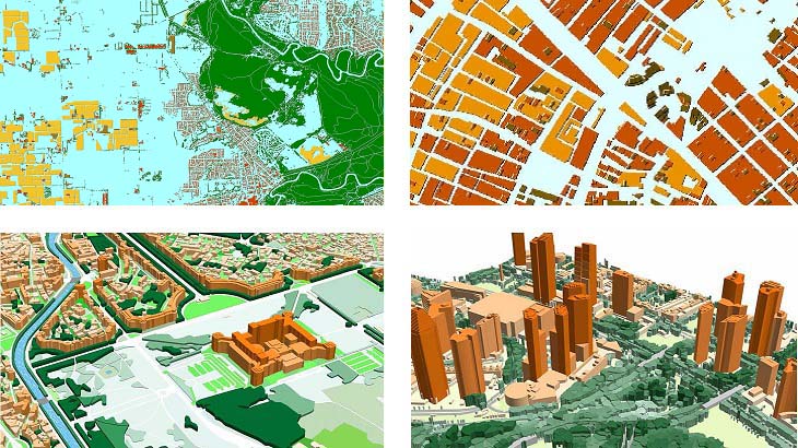
COMPARATIVE ANALYSIS OF 3D AND 2.5D MODELS
Which one do you choose?
2.5D GEODATA
From 5m to 10m resolution models.
Usually, it’s used for the suburb and rural areas.
Provide precise and cost-effective modelling of obstacles height over large areas.
Individual buildings footprints, trees, bridges etc. and their heights are not included.
- 2.5D buildings: buildings and buildings blocks with assigned height attributes, 3m-5m accuracy.
- 2.5D vegetation: vegetation polygons with assigned height attributes, 5m accuracy.
- DSM/DTM: 3-5m accuracy in terrain features.
- SOURCES: 1.5-2.5 m resolution Stereo satellite imagery.
3D GEODATA
1-2-5 m resolution geodata for highly accurate networks planning.
All individual features of roofs and buildings construction are provided.
3D vegetation or individual trees are included.
- 3D buildings: 1-3 m accuracy in height, with small roof details.
- 3D bridges: 1-3 m accuracy and detailed engineering construction.
- 3D vegetation: detailed vegetation with assigned height attributes.
- Clutter/land use: includes all land-use features and detailed vegetation layer.
- SOURCES: 0.3-0.5-1 m resolution stereo satellite imagery, air photos, Lidar data.
Send us your request for more information and free data samples of 3D and 2.5D models.
Our geodata catalogue includes over 4000 cities and 80+ countries.
Share this story


Order product