2D GEODATA FOR MALI
2D REGIONAL MAP OF MALI
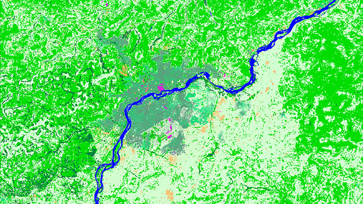
2D Regional map is a medium resolution database generated for nationwide RF network optimization.
2D Regional map of Mali (Modèle (Сarte) numérique 2d du Mali) covers 1 257 000 sq. km. The latest vintage of Sentinel satellite images were used for land use structure recognition.
DTM produced from recalculated SRTM V4 data and topographic maps of 1:100 000 scales. Clutter/Land Use/Land Cover are classified into 19 classes of landscape, vegetation, and built-up areas.
Model package contains:
- ✅ Land Use Map (Clutter Model)
- ✅ Digital Terrain Model (DTM)
- ✅ Vector layers
- ✅ Orthoimage
Data are ready for immediate delivery in major RF planning formats – Mentum Planet, Atoll, Asset, ESRI .shp
Let us know if you need additional info.
Our geodata database contains over 4000 cities and 80+ countries.
Please visit our web-page: 2D REGIONAL MODELS.


