2D MODELS AND MAPS OF GEORGIAN CITY AND GEORGIA
2017-08-17
This project was created for RF, GIS and WEB-applications and contains:
data for RF planning:
2D Urban Model of Batumi – 115 sq km
2D Urban Model of Kutaisi – 160 sq km
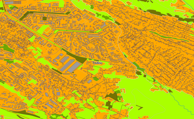
2D Urban Model Tbilisi and 2D Urban Model of Rustavi – 750 sq km
Countrywide 2D Regional Model of Georgia – 73750 sq km
data for GIS project and WEB project:
Map of Batumi – 115 sq km
Map of Kutaisi – 160 sq km
Map of Tbilisi and map of Rustavi – 750 sq km
Countrywide map of Georgia (Georgia Country map) – 73750 sq km
See our maps to view online map of Georgia and
online map of Tbilisi
online map of Batumi online map of Kutaisi
Project package includes 3 types of data representation:
- Vector data model provided as a composition of vector layers in ESRI ArcGIS or Mapinfo formats.
- Raster data model presented in Geo-tif format and includes:
• Digital Elevation Model (DEM) (data placed in Height.tif file);
• Land Use Map (Clutter Model) - Service Data for RF planning tools:
• Digital Terrain Model (DTM);
• Land Use Map (Clutter Model) in matrix representation;
• Text labels;
• Vector layers.
Resolution of 2D model(cell size of matrix): 5m and 20 m
Share this story


Order product