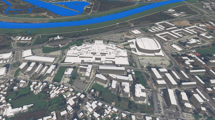
3D buildings and hydrography of Croatia
3D BUILDINGS FOR CROATIAN CITIES, 2021
Our new 3D countrywide project was realized for Croatia with its magnificent Adriatic Sea, mesmerizing mountains, beautiful greenery located between lots of rivers and lakes.
Geodata represents 3D Buildings collected for whole country and also include detailed hydrography - every river, lake, pond etc., that can be used for radio frequency planning of 4G or 5G mobile communication networks, urban planning, architecture, etc.
Visicom, having many years of experience in 3D map creating, constantly improves the technology, quality, and speed of production, which allows us to provide our customers with high-quality 2D maps, 3D maps, population maps, and any other spatial data in a short time.
Download the free 3D data sample of Croatia 3D city model**
Download the booklet "3D buildings and hydrography of Croatia"
Send us the request for more information


