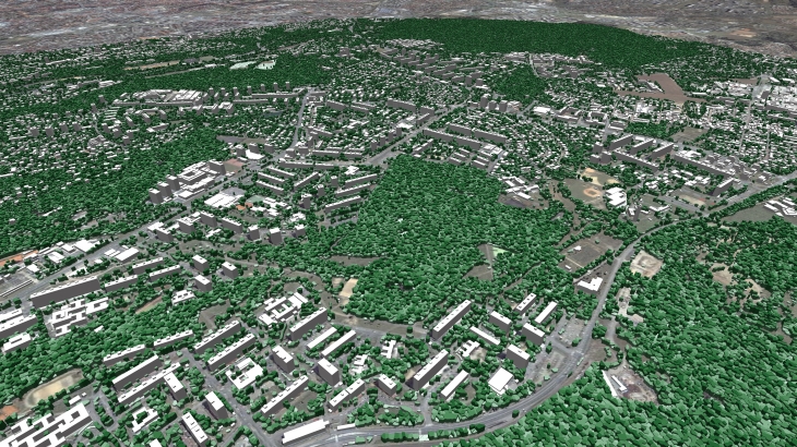
3D countrywide model of Czech Republic

3D DATA FOR ALL CZECH REPUBLIC INCLUDE
The Czech Republic is an incredible and impressive country with a large number of architectural monuments of different eras. Whenever we do such radio planning projects, we see the charm of these old buildings and really want to visit this country and breathe the atmosphere of this vintage environment, drink a cup of fragrant coffee made according to ancient recipes.
The team of Visicom, as always, tries to save the most details of the cities in our 3D maps, reflecting not only the location of buildings, structures, vegetation, road network, etc but the spirit of the cities.
This time we present to your attention a detailed 3D model of the Czech Republic, which includes
- 3D City model of Prague - 416sq.km
- 3D City model of Ostrava - 195sq.km
- 3D City model of Brno - 155sq.km
- 3D City model of Liberec - 96sq.km
- 3D City model of Zlin - 82sq.km
- 3D City model of Plzen - 74sq.km
- 3D City model of Ceske Budejovice - 58sq.km
- 3D City model of Hradec Kralove - 56sq.km
- 3D City model of Olomouc - 52sq.km
- 3D City model of Pardubice - 50sq.km
- 3D City model of Usti nad labem - 49sq.km
- 3D City model of Jihlava - 32sq.km
- 3D City model of Karlovy Vary - 20sq.km
- and all other cities, towns, villages,
with the possibility of use not only in radio planning projects but also in other markets, such as the web, electronic games, solar cadaster, urban planning, smart cities, etc.
DELIVERED DATASETS
DTM / Clutter Model (Land Use) / Vector Model / Building footprints
LANGUAGE SUPPORT CZECH & ENGLISH
3D BUILDINGS LOD2 INCLUDE ATTRIBUTES:
Street name/ Building number /Number of floors /Number of flats / Populations
Download the booklet about the project "3D map of Czech Republic" to see more details.
You may also be interested in: 3D GEODATA FOR EUROPEAN 5G NETWORK DEPLOYMENT


