3D Digital Maps of 86 Thailand cities for LTE, 5G, IoT
Thailand 3D
Visicom finished the huge Thailand Map Project for Thai mobile operator and extend the 3D digital map coverage over 86 biggest Thailand cities with a total area of 4310 sq.km.
Data relevance: 2017-2018
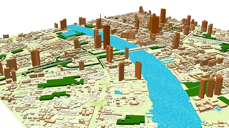
The Thailand digital map package for Radio Network Planning and simulation (5G, LTE) includes:
Digital Terrain Model (DTM), Digital Surface Model (DSM), Highly accurate 3D Buildings with roof details, 3D vectors of Vegetation and Bridges, Clutter/Land Use/Land Cover, Obstacles (Clutter) Heights, transportation network/roads, vector data layers and Population map.
The Thailand 3D digital map package for GIS-projects/services (BIM, IoT, smart city, a base map for navigation/land management) includes:
3D building footprints, built-up-blocks bridges, overpasses, roads, vegetation (classified by types), POI (points of interest), hydrography, population distribution models.
3D geodata accuracy is 2-3 meters in X,Y,Z along with over than 98% completeness of buildings layer for each city .
Thailand 3D City geodata could be recalculated in any customized data format.
Download the brochure with detailed coverage of Thailand city maps in order to explore more details.
Our geodata catalogue includes over 4600 cities and 110+ countries.
Send us your request for more information


