3D GEODATA FOR 11 CITIES OF PALESTINE (WEST BANK AND GAZA)
3d geodata of Palestine
Total coverage of Palestine (West Bank and Gaza) 3D city maps is 557 km2
This project includes the following cities (areas):
- Ramalla -33 sq.km
- AlRam - 4 sq.km
- Salfit - 3 sq.km
- Qalqilia - 9 sq.km
- Bethlehem - 22 sq.km
- Jenin - 16 sq.km
- Jericho - 34 sq.km
- Tulkarem - 27 sq.km
- Hebron - 66 sq.km
- Nablus -8 sq.km
- Gaza – 295 sq.km
Palestine (West Bank) 3D geodata are produced to be used in any RF planning tool etc.
Delivered layers:
- Digital Terrain Model (DTM): 2 m resolution
- Digital Height Model (DHM): 2 m resolution
- 3D Building Model: 2 m resolution
- Accuracy of Building heights: 2m
- Accurate clutter classifications: 3-4 m plane accuracy
- Accurate Street Vector classifications: 3-4 m plane accuracy
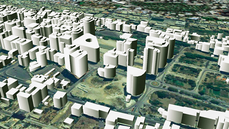
Highly accurate Palestine (West Bank) building vectors with associated height values as attributes are captured through three-dimensional feature extraction in our photogrammetric software.
Clutter/Land Use/Land Cover describe the surface and built-up features which influence on radio wave (RF) propagation. Land Use map is produced from multispectral satellite imagery by the method of automatic classification with subsequent manual photo-interpretation and modification.
Please download free 3D data sample for Gaza with 1m resolution . Sample dataset presented in Atoll, Asset, Planet formats.
We propose 2D Urban Models, 2.5D Urban Models, 2D Regional Models with 5 m and 10 m resolutions.
3D maps of cities are fully compatible with Visicom 2D Urban maps of Palestine (West Bank), Visicom geodata for IoT, LTE, smart cities, etc.


