3D GEODATA FOR BUCHAREST CITY (ROMANIA)
3D GEODATA FOR BUCHAREST
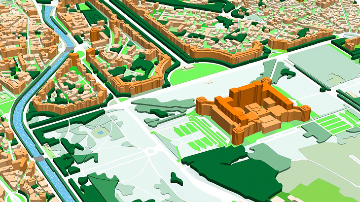
410 sq,km of Bucharest city (Romania) was the first 3D map among other 3D mapping models for 9 biggest Romania cities.
Bucharest 3D model produced for one of the biggest Romanian operators for 4G network development using Atoll RF planning tool.
Bucharest Geodata Dataset contains: Digital Terrain Model (DTM), Digital Surface Model (DSM), highly accurate 3D Buildings with roof details, 3D Vegetation and Bridges, Clutter/Land Use/Land Cover Model, Obstacles Heights (Clutter Heights) Model, Vector model, Transportation networks and Population map.
3D geodata accuracy – 2-3 m in X,Y,Z.
In addition, Bucharest 3D map package could be used for any GIS, IoT planning projects, all data formats are supported.
Download the free data sample of Bucharest digital model in order to explore more details.
Our geodata catalogue includes over 4000 cities and 80+ countries.
Send us your request for more information


