3D GEODATA FOR HONG KONG
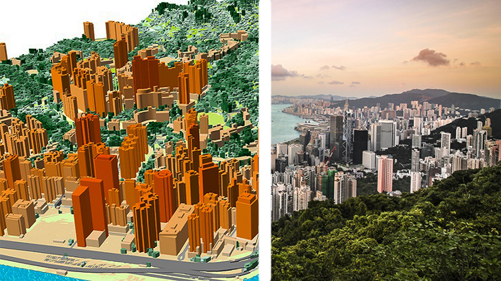
3D GEODATA FOR 5G PLANNING OF HONG KONG
- Resolution: 1/2/5m
- Vertical accuracy - 1-2m
- Planimetric accuracy - 1-2m
Our geodata for Hong Kong is the best solution for planning a 5G network. High-resolution, up-to-date map provides the valuable context—an advantageous difference between making informed decisions in the mm-wave environment and taking a guess.
3D models of Hong Kong include:
- 3D buildings - small roof details, 1-2m accuracy
- 3D bridges - detailed engineering constructions
- 3D vegetation - with assigned height attributes
3D maps are essential for any smart GIS project. 3D data enable creating virtual urban-utility platforms to make city management more efficient. Visicom manufactures precise, geographically accurate and up-to-date 3D rendering of cities that contains all infrastructure features at various levels of detail.
Send us a request for more information
You can download for free a brochure of Hong Kong 3D map.
List of OTS 3D City Models for SEA Region.
Please explore the 3D sample dataset of Hong Kong in Atoll, Mentum, ESRI formats.


