3D map for rf planning of Cairo Egypt
3D DATA FOR RF PLANNING OF CAIRO EGYPT
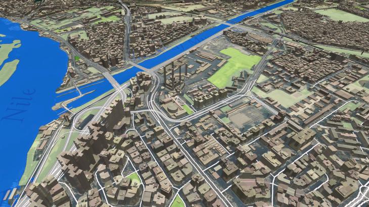
With a population of over 9 million people, Cairo is by far the largest city in Egypt and one of the world's great megacities. Cairo is associated with Ancient Egypt, rich in historical heritage, namely ancient mosques, madrasas, hammams, and fountains.
However, now it is a well-developed megapolis which keeps on building up with many contemporary constructions and houses. Our last project for Cairo includes 2 587 sq. km of a detailed 3D mapping model of Big Cairo tailored for RF-planning as well as for smart city planning. Learn more with the city virtual tour
The team of Visicom, as always, tries to save the most details of the cities in our 3D maps, reflecting not only the location of buildings, structures, vegetation, road network, etc but the spirit of the cities.
DELIVERED DATASETS
DTM / Clutter Model (Land Use) / Vector Model / Building footprints
Download the booklet about the project "3D MAP OF CAIRO EGYPT" to see more details.
You may also be interested in: 3D DATA FOR MIDDLE EAST


