3D Maps for 5G pilot projects
2018-09-06
Explore our 3D Maps for 5G pilot projects all over the world
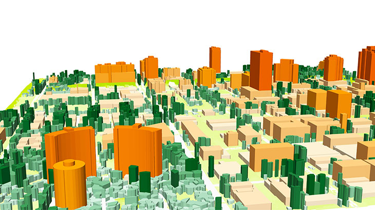
1m resolution 3D Maps with detailed 3D Trees layer were produced for testing, planning and trials of 5G Networks.
• Territory of US: Chicago, New York, Santa Clara, San Francisco
• Europe: Barcelona, Brussels
• Asia: Seoul, Singapore
• Middle East: Dubai
Small cell geodata. 5G cell planning in mm wave sprectrum requires advanced accuracy for geodata, namely using of such map layers as tree (canopy) heights and 3d buildings with detailed roof details both in vector and matrix representation.
Download the 3D Geodata overview.
Send us your request for more information or for free data sample.
Share this story


Order product