3D MODEL FOR 5G PLANNING OF MONTREAL, CANADA
Visicom contributes to 5g network planning in Montreal
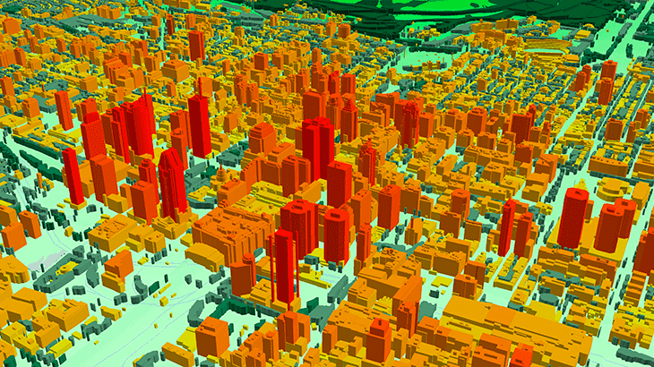
5G networks will be launched in the early 2020s. Telecommunication operators now are on the stage of signal propagation planning and defining of the optimal locations of antennas. High-resolution geospatial 3D data are vitally important to realize the benefits of the 5G network. Due to the high sensitivity of mmWaves from all obstacles, successful propagation signal setup requires very accurate and detailed obstruction representation including building construction small details and precise 3D canopy.
3D project for Montreal city center provides high-quality 3D model fitted to all requirements of 5G planning.
3D model covers 50 km2 of the core city in LOD2 quality.
3D model resolution: 1m or 2m.
3D geodata accuracy – 2-3 m in x,y,z.
Usually delivered layers:
- ✅ Digital Terrain Model (DTM)
- ✅ Digital Surface Model (DSM)
- ✅ Highly accurate 3D building vectors
- ✅ Clutter/Land Use
- ✅ 3D Obstacles
- ✅ Vegetation
- ✅ Road networks, water bodies, coastline Additional layers: Street names, Addresses
☑ More information about 3D geodata for 5G planning.
☑ Our geodata catalogue includes over 1500 cities across 120 + countries.
✉ Contact us to receive a free sample of the 3D city Model.


