3D MODEL OF DHAKA (BANGLADESH)
2017-08-16
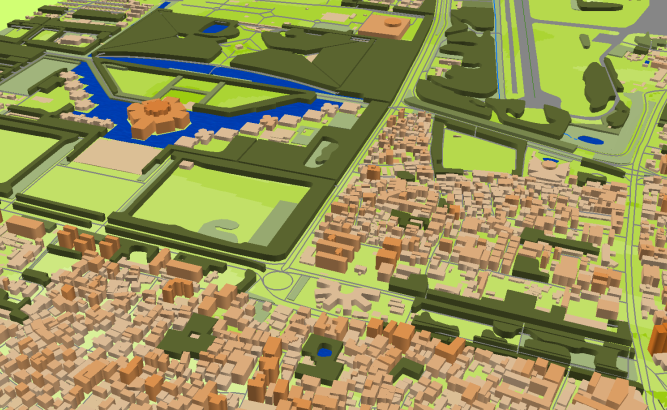
3D BANGLADESH
Project for Radio Frequency planning, Geoinformation System and WEB-applications that covers of 3D model of Dhaka (Bangladesh) – 180 sq km
Project package includes 3 types of data representation:
- Vector data model provided as a composition of vector layers in ESRI ArcGIS or Mapinfo formats.
- Raster data model presented in Geo-tif format and includes:
• Digital Elevation Model (DEM) (data placed in Height.tif file);
• Land Use Map (Clutter Model) - Service Data for RF planning tools:
• Digital Terrain Model (DTM);
• Land Use Map (Clutter Model) in matrix representation;
• Text labels;
• Vector layers.
Resolution of 3D model(cell size of matrix): 5 m
Share this story


Order product