3D model of Kyiv (Ukraine)
2017-09-06
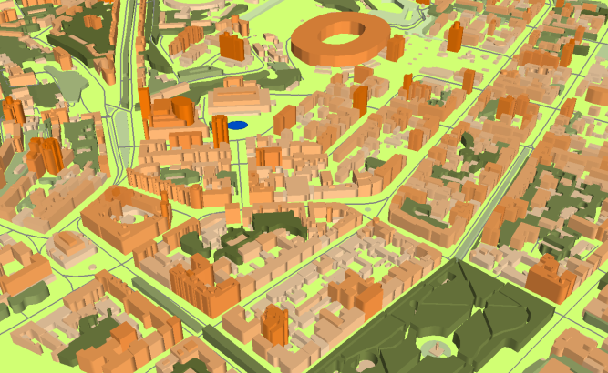
3D geodata of Kyiv
Project for Radio Frequency planning, Geoinformation System and WEB-applications and contains:
data for RF planning:
2D urban model of suburban area of Kyiv – 1681 sq km and built-in 3D model of Kyiv – 692 sq km
data for GIS project and WEB project:
Map of Kyiv and suburban area – 2373 sq km
Its a part of detailed map of Ukraine – 610000 sq km
Project package includes 3 types of data representation:
- Vector data model provided as a composition of vector layers in ESRI ArcGIS or Mapinfo formats.
- Raster data model presented in Geo-tif format and includes:
• Digital Elevation Model (DEM) (data placed in Height.tif file);
• Land Use Map (Clutter Model) - Service Data for RF planning tools:
• Digital Terrain Model (DTM);
• Land Use Map (Clutter Model) in matrix representation;
• Text labels;
• Vector layers.
Share this story


Order product