3D Model of Marseille, France
Digital Map of Marseille
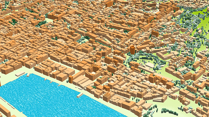
Recently Visicom produced 3D map of Marseille, France that will be used for 5G networks planning! Our maps are based on the most recent satellite imagery and therefore reflect an up-to-date snapshot of urban growth. This is crucial for accurate and up-to-date radio planning, especially in areas with widespread construction.
✅ This geographic product covers 27 sq. km of Marseille city area (France)
✅ 3D vegetation Model: a group of trees and individual trees with canopy heights
✅ 3D Buildings: small roof details, sloping roofs, elevators shafts, tower, spires
✅ 3D Bridges with detailed constructions
✅ Our data are compatible with any propagation models
Visicom team presents 3D geodata of Marseille tailored to the new standards of advanced networks. We support requirements of 5G networks providing the best level of details featuring the for obstacles that might block or weaken the radio signals.
Please explore 3D sample dataset of Marseille ✉ Please contact us if you need some additional information
🔎 Here you can find free data samples of over 5000 cities


