3D model of Sydney (Australia)
2017-01-27
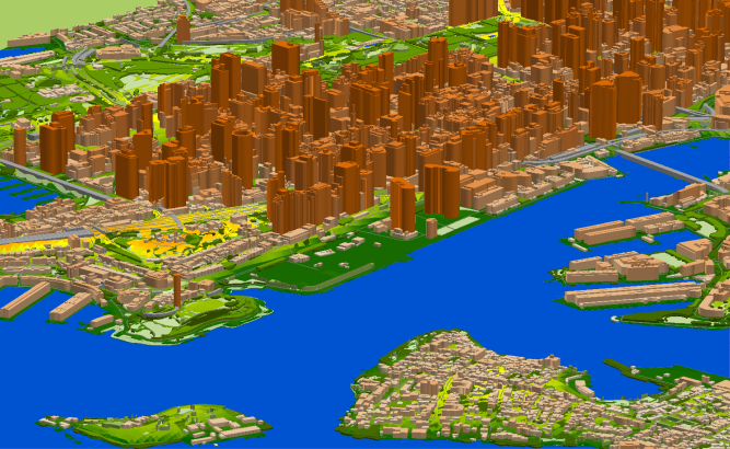
Digital map of Sydney
3D model of Sydney details:
- Area: 1110 sq.km
- Layers: DTM, LandUse, Vectors, Buildings with heights, Orthoimage
- Resolution: 2 m
- Data vintage: 08.2016
Project for Radio Frequency planning, Geoinformation System and WEB-applications and contains:
data for RF planning:
3D model of Sydney (Australia) – 1100 sq km
data for GIS project and WEB project:
Map of Sydney (Australia) – 1100 sq km
Project package includes 3 types of data representation:
- Vector data model provided as a composition of vector layers in ESRI ArcGIS or any other including Buildings with heights
- Raster data model presented in Geo-tif format and includes:
• Digital Elevation Model (DEM) (data placed in Height.tif file);
• Land Use Map (Clutter Model) - Service Data for RF planning tools:
• Digital Terrain Model (DTM);
• Land Use Map (Clutter Model) in matrix representation;
• Text labels;
• Vector layers.
You can download our sample data here Sample of 3D model of Melbourne
Share this story


Order product