3D MODELS OF GEORGIAN CITIES
3D MODELS OF GEORGIAN CITIES
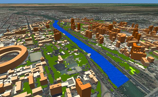
Project for Radio Frequency planning, Geoinformation System, Smart Cities and WEB-applications and contains:
data for RF planning:
3D model of Tbilisi & Rustavi – 747 sq km;
3D model of Poti – 249 sq km;
3D model of Kutaisi – 161 sq km;
3D model of Batumi – 115 sq km;
3D model of Senaki – 103 sq km;
3D model of Zugdidi – 87 sq km;
3D model of Khashuri – 79 sq km;
3D model of Gori – 56 sq km;
3D model of Telavi – 42 sq km;
data for GIS project and WEB project:
Map of Tbilisi & Rustavi – 747 sq km;
Map of Poti – 249 sq km;
Map of Kutaisi – 161 sq km;
Map of Batumi – 115 sq km;
Map of Senaki – 103 sq km;
Map of Zugdidi – 87 sq km;
Map of Khashuri – 79 sq km;
Map of Gori – 56 sq km;
Map of Telavi – 42 sq km;
Project package includes 3 types of data representation:
- Vector data model provided as a composition of vector layers in ESRI ArcGIS or Mapinfo formats.
- Raster data model presented in Geo-tif format and includes:
• Digital Elevation Model (DEM) (data placed in Height.tif file);
• Land Use Map (Clutter Model) - Service Data for RF planning tools:
• Digital Terrain Model (DTM);
• Land Use Map (Clutter Model) in matrix representation;
• Text labels;
• Vector layers.
Please download the data sample of Algerian cities project or brochure


