3D RF PLANNING MAPS FOR CITIES OF GERMANY
3D GEODATA FOR GERMANY 2020
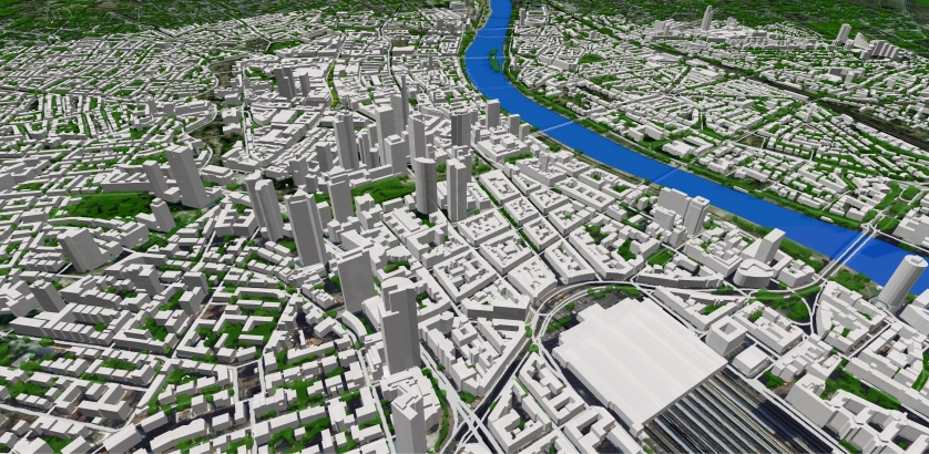
Visicom as an established and well recognized enterprise keeps on supporting all telecom and GIS companies in Germany providing them with accurate 3D city maps. All the models are performed at high quality level with attention to every little detail of building, terrain, transportation network, etc. In the previous year, VIsicom completed several projects for Germany that cover various large cities with 3D and 2.5D models. More information is in the brochure PDF here!
This project includes the following cities:City | Area |
|---|---|
| - Berlin | > 1 100 sq.km |
| - Cologne | > 650 sq.km |
| - Frankfurt | >300 sq.km |
| - Hamburg | > 800 sq.km |
| - Jenna | > 100 sq.km |
| - Leipzig | > 400 sq.km |
| - Montabaur | > 100 sq.km |
| - Munich | >700 sq.km |
| - Rosenheim | ~50 sq.km |
More cities will be available soon.
For more than 20 years, we have been studying all the nuances of creating geospatial data and the needs of our customers pertaining to different industries. The learnt experience allows us to optimize the processes and ensure maximum cost-effectiveness.
Contact us for the free samples and more information about 2D/2.5D/3D geodata.
Download the free 3D data sample of Germany 3D cities model
Send us the request for more information


