BELGRADE 3D AND 2D GEODATA
2019-04-12
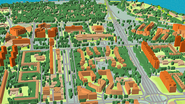
BELGRADE 3D AND 2D DIGITAL MAP
Map dataset contains Digital Terrain Model (DTM), extremely precise 3D Buildings with roof details, 3D Vegetation and Bridges, Clutter/Land Use/Land Cover, Obstacles (Clutter) Heights, Transportation Networks.
- ✅ 3D Geodata resolution - 2m or 5m
- ✅ 2D Map of suburb are delivered in 10/20m resolution
- ✅ 206 sq.km - 3D Map of the core city
- ✅ 2811 sq.km - 2D Map of suburban areas
- ✅ Supporting any RF tools format
Our geodata, created specifically for telecommunication business, gives explicit information concerning the 3D urban location in order to assist operators design plan and to improve the performance of their radio networks. Visicom's advanced mapping products support (Atoll, Asset, Planet, Mentum Planet, Pathloss formats).
Please explore 3D sample dataset of Belgrade.
Contact us to receive a free sample.
Share this story


Order product