Countrywide 3D model of Bahrain 2020
We continue our excursion to the Middle East ...
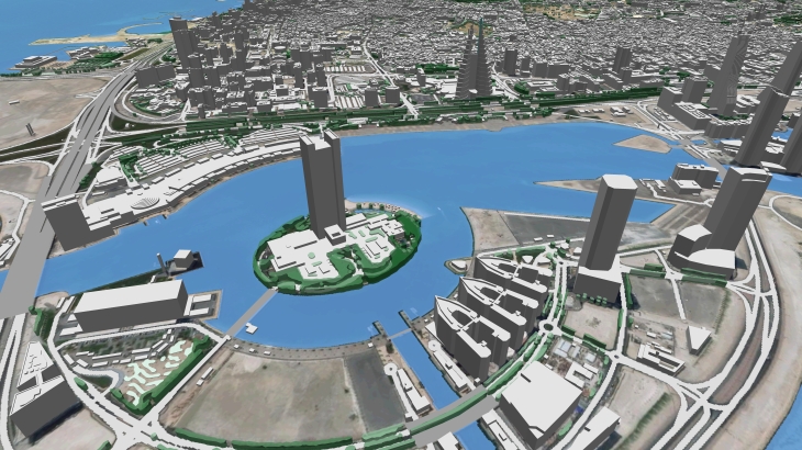
This time Visicom team accomplished a project for the Bahrain telecom market and collected geodata for a 3D model across the country, which is about 766 sq. Km. Most of the area of this marvelous country is a desert with refineries, but the capital of Bahrain - Manama and other settlements are masterpieces of contemporary architecture with complicated architectural shapes of buildings. We were able to partially convey this beauty in our 3D models, which can be observed in the video below.
This telecom project includes not only the full coverage of 3D geodata of Bahrain but also detailed 3D models of the following settlements:
- 3d map of Manama - 31.62 sq.km
- 3d map of Muharraq - 34.6 sq.km
- 3D map of the Reef - 41 sq.km
- 3D map of the Sitra - 22.5 sq.km
- ...
By the way, this geodata can also be used in other industries and markets, for example, web, electronic games, urban planning, architecture, agriculture, and many others


