Greenland 3D cities
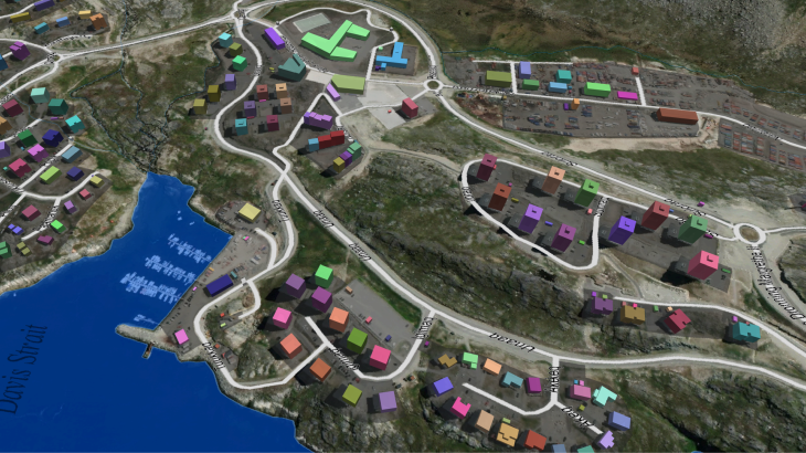
3D MAPS OF GREENLAND CITIES
🔔This mapping product covers more than 100 sq. km of the 3D city models.
Visicom's advanced mapping products support any RF tool format (ATOLL, PLANET, MENTUM PLANET, PATHLOSS etc.). Our geodata made specifically for the telecom industry provide precise knowledge about the 3D environment in order to help operators to plan, implement and improve the performance of their radio networks.
Now 14 cities are ready in 3D, namely:
✅ 3D map of Nuuk
✅ 3D map of Aasiaat
✅ 3D map of Illussat
✅ 3D map of Kangerlussuaq
✅ 3D map of Kulusuk
✅ 3D map of Maniitsoq
✅ 3D map of Nanortalik
✅ 3D map of Narsaq
✅ 3D map of Paamiut
✅ 3D map of Qaqortoq
✅ 3D map of Sisimiut
✅ 3D map of Tasiilaq
✅ 3D map of Upernavik
✅ 3D map of Uummannaq
The total covered area is about 100 sq.km.
⚠ Our geodata catalogue includes over 6000 cities across 130+ countries.
✉ Contact us to receive a free sample of the 3D city Model.


