PYONGYANG 3D GEODATA
3D MODEL OF PYONGYANG
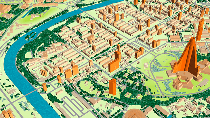
This mapping product covers 700 sq. km of Pyongyang 3D city model (Capital of North Korea).
The delivered data has been converted into the ESRI GRID / SHP format.
3D geodata accuracy – 2 m in X,Y,Z.
The delivered package includes:
✅ Digital Terrain Model
✅ Digital Surface Model
✅ Land Use Map
✅ Building Heights Model
✅ Vector Data
✅ Text labels
✅ Orthoimage
We understand the precise geodata requirements to design next-generation networks in mmWave frequencies range. Based on our 19-years experience we offer the most cost-effective solution for any territory fitted to your budget. Please visit our webpage "Pilot Projects for 5G Planning over the World".
Download the free data sample of Pyongyang digital model in order to explore more details
Send us your request for more information
Video report available here


