Sacramento 3d digital map for LTE, 5G, IoT/ US market case study
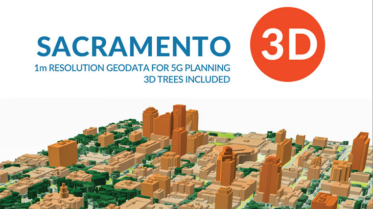
Sacramento 3d digital map
Visicom enhanced coverage at the US market and has finished 8 map projects in 2018 for 5G, IoT and smart city services.
Main features of the latest digital geodata package for Sacramento:
- 3D geodata accuracy is 1-2 meters in X,Y,Z along with over than 99% completeness of buildings layer for each city.
- For production were used neural networks algorithms with semiautomatic post-processing to ensure the positional and vertical accuracy of buildings and trees.
Sacramento 3D City geodata could be recalculated in any customized data format.
Explore brochure with technical details for Sacramento and related US digital maps
The Sacramento (US) digital map package for Radio Network Planning and simulation (5G, LTE) includes:
Digital Terrain Model (DTM), Digital Surface Model (DSM), Highly accurate 3D Buildings with roof details, 3D vectors of Vegetation and Bridges, Vector Trees Model, Clutter/Land Use/Land Cover, Obstacles (Clutter) Heights, transportation network/roads, vector data layers and Population map.
The Sacramento (US) 3D digital map package for GIS-projects/services (BIM, IoT, smart city, a base map for navigation/land management) includes:
3D building footprints, built-up-blocks bridges, overpasses, roads, vegetation (classified by types), POI (points of interest), hydrography, population distribution models.
Our geodata catalogue includes over 4600 cities and 110+ countries.
Send us your request for more information


