VISICOM 5G PILOT PROJECTS

VISICOM 5G PILOT PROJECTS
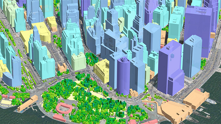
Explore Visicom 3D geodata tailored to 5G planning. 1 m resolution data provide highly accurate and precise input for efficient and accurate predictions of radio wave propagation in the core city.
3D models include:
- 3d buildings;
- 3d vegetation;
- 3d bridges.
3D Model includes not only high-resolution buildings but also individual trees and their canopy height with 1-2 m accuracy.
Start your 5G planning project with advanced quality geodata to have the best understanding of your complex urban environment.
Europe: Barcelona (Spain), Athens (Greece), Brussels (Belgium).
USA: Chicago, Sacramento, New York, San Francisco, Santa Clara, Euless.
Asia: Malaysia, South Korea, Hong Kong, Singapore, China.
Africa: Lagos (Nigeria).
Middle East: Dubai, Abu Dhabi (UAE).
We support any RF tools format.
Please download brochure 5G Trials Visicom
Contact us to receive a free sample of 3D city Model.
Our geodata catalogue includes over 5000 cities across 120+ countries.


