2D Urban Models
Visicom 2D Urban Models are medium-resolution databases for the planning of macro-cellular networks in an urban environment
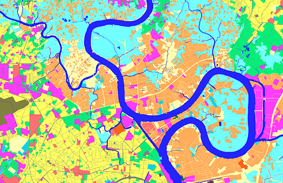
2D City Models data set:
- Digital Terrain Model (DTM)
- Clutter / City Land Use Model (13-20 classes)
- Vector Model (8 classes)
- Text Labels (names of settlements, rivers, railways, etc.)
- Resolution: 5-20 m
- Application: RF planning of macro-cellular networks in urban and sub-urban environments
Additional layers may be included as well: - Orthoimagery - Population Distribution Data - Urban Land Use Models - Fully integratable with 3D Models
2D Urban City Models may be integrated into Regional Models: - for highly-populated territories with complex build-up and infrastructure in countrywide or vast regional models - to improve the accuracy of regional models - for integrated network planning in urban and suburban areas.
We guarantee
- Precise and up-to-date mapping information
- Extra-accurate 3d buildings
- Detailed and high-resolution terrain
- Flexible price fitted to customer budget
- Delivery in any RF planning tool and GIS format
Data formats
- Alcatel A955
- Aircom Asset
- Atoll Forsk
- CelPlanner
- ICS Telecom
- NetPlan
- AutoCAD
- ESRI ArcGIS
- MapInfo
- Microstation
- Neva
- Odyssey
- Pathloss
- Mentum Ellipse
- Mentum Planet
- Nokia NetAct
- ASCII XYZ
- Raster images
- TIFF and GeoTIFF
- ERDAS Imagine Image
- ER Mapper Raster
- ENVI Image Format
- Generic Binary