Regional Models
Regional Maps – type of digital maps with medium-sized resolution used for networks planning and optimization projects over large regions or countrywide.
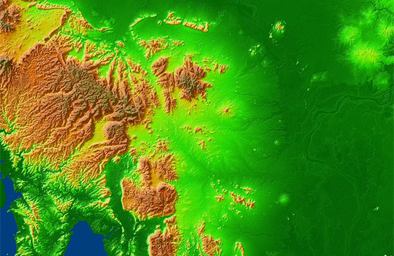
Regional Models data set:
- Digital Terrain Model (DTM) - Clutter / Land Use Model (13-18 classes) - Vector Model (8 classes) - Text Labels (names of settlements, rivers, railways, etc.) - Resolution: 20-50 m - Sources: Satellite images with 5-15 m resolution, SRTM/ASTER DEM data, Topographic maps of 1:50,000-1:200,000 scales
Additional layers may be included as well:
- Orthoimagery - Population Distribution Data - Detailed Administrative Borders
Regional Models may be integrated with 2D Urban ones to improve their accuracy in urban and suburban areas.
We guarantee
- Precise and up-to-date mapping information
- Extra-accurate 3d buildings
- Detailed and high-resolution terrain
- Flexible price fitted to customer budget
- Delivery in any RF planning tool and GIS format
Data formats
- Alcatel A955
- Aircom Asset
- Atoll Forsk
- CelPlanner
- ICS Telecom
- NetPlan
- AutoCAD
- ESRI ArcGIS
- MapInfo
- Microstation
- Neva
- Odyssey
- Pathloss
- Mentum Ellipse
- Mentum Planet
- Nokia NetAct
- ASCII XYZ
- Raster images
- TIFF and GeoTIFF
- ERDAS Imagine Image
- ER Mapper Raster
- ENVI Image Format
- Generic Binary
Order product