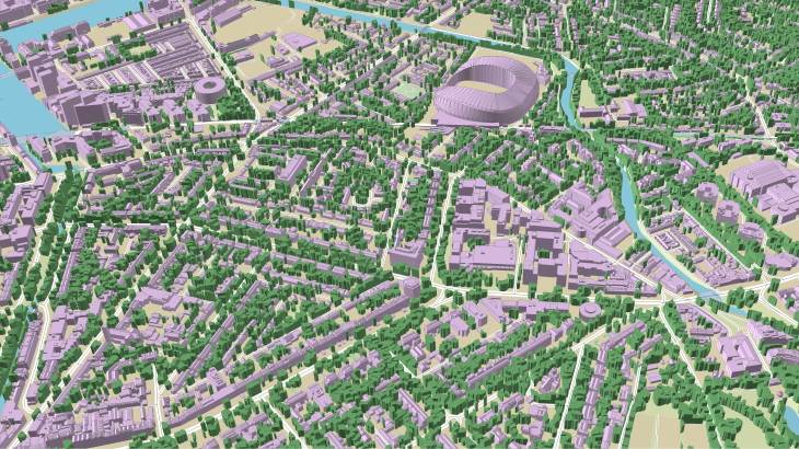
**Modelling Level of Detail 2 (LOD2) + 3D Trees**
Roof shapes are the most significant improvement for LoD 2 buildings with comparison of LoD 1.
Data represent 3D building shapes including complex architectural forms: sloping roofs, roof furniture, elevators shafts, towers, spires.
LODs 2.0 and 2.1 building models are produced for various tasks of environmental management like solar energy assessment, GIS and architecture projects, 3D visualization of cities and developed in multiple GIS formats (Rhino, Arc GIS, AutoCAD dwg, SketchUp skp, fbx, obj etc.). The parameters of azimuth, tilt angle, area of flat parts, and roof height can be calculated and assigned for each roof element.
A contemporary city, as a rule, involves lots of parks, squares, recreation areas, tree plantations, etc. In some cities, the buildings are completely shrouded in foliage. 3D trees models ensure an accurate and reliable 5G network planning process, allowing placing a required number of base stations for the stable signal and full coverage. We produce 3D vegetation data as separated canopies, where each one has unique height, and individual 3D Trees with high-level accuracy in height and size of crown outlines.
- Precise and up-to-date mapping information
- Extra-accurate 3d buildings
- Detailed and high-resolution terrain
- Flexible price fitted to customer budget
- Delivery in any RF planning tool and GIS format
- Alcatel A955
- Aircom Asset
- Atoll Forsk
- CelPlanner
- ICS Telecom
- NetPlan
- AutoCAD
- ESRI ArcGIS
- MapInfo
- Microstation
- Neva
- Odyssey
- Pathloss
- Mentum Ellipse
- Mentum Planet
- Nokia NetAct
- ASCII XYZ
- Raster images
- TIFF and GeoTIFF
- ERDAS Imagine Image
- ER Mapper Raster
- ENVI Image Format
- Generic Binary