LoDs 1.0 and 1.1 buildings
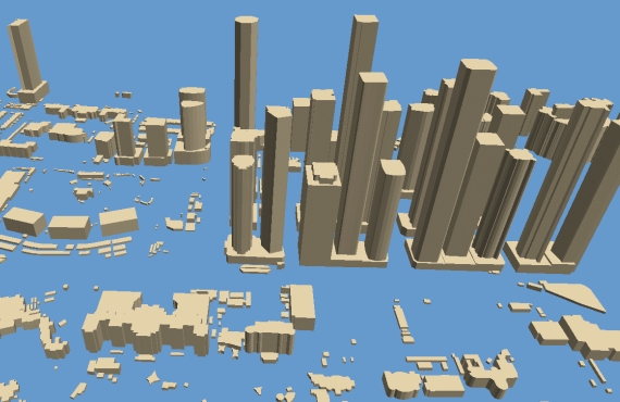
Visicom Modelling Level of Detail 1 (LOD1)
LODs 1.0 and 1,1 represents building footprints with height information. The different structural entities of a building are aggregated to simple blocks and not differentiated in detail. Each building has a height attribute defined as maximum building height. Roof surfaces are flat.
These building sets can be used in 3D modelling align with countrywide planning both for telecommunications and for utilities projects
See also LOD 1,2 and LOD 1,3 Models – LOD 2 Models – LOD 2 Model and 3D Trees
We guarantee
- Precise and up-to-date mapping information
- Extra-accurate 3d buildings
- Detailed and high-resolution terrain
- Flexible price fitted to customer budget
- Delivery in any RF planning tool and GIS format
Data formats
- Alcatel A955
- Aircom Asset
- Atoll Forsk
- CelPlanner
- ICS Telecom
- NetPlan
- AutoCAD
- ESRI ArcGIS
- MapInfo
- Microstation
- Neva
- Odyssey
- Pathloss
- Mentum Ellipse
- Mentum Planet
- Nokia NetAct
- ASCII XYZ
- Raster images
- TIFF and GeoTIFF
- ERDAS Imagine Image
- ER Mapper Raster
- ENVI Image Format
- Generic Binary
Order product