LoDs 1.2 and 1.3 buildings
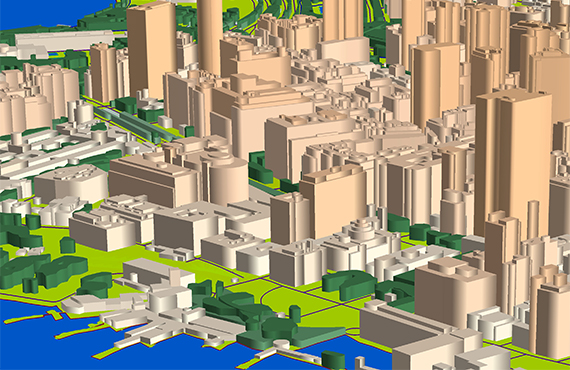
Level of Detail: 1.2 and 1.3
LoDs 1.2 and 1.3 represent building footprints with height information. A building can consist of several parts, each with a different height. No slope roofs processed.
LOD 1 is the best choice and usually used 3D buildings data for RF-planning in cities and urban areas.
LOD1.2 features: each building is depicted with a common outline with assigned attribute of maximum height
LOD1.3 features: each building or its part is depicted with a generalized shape of roof. All the differences in height as well as additional roof furniture and add-ons are shown.
See also LOD 1,0 and LOD 1,1 – LOD 2 – LOD 2+3D Trees
We guarantee
- Precise and up-to-date mapping information
- Extra-accurate 3d buildings
- Detailed and high-resolution terrain
- Flexible price fitted to customer budget
- Delivery in any RF planning tool and GIS format
Data formats
- Alcatel A955
- Aircom Asset
- Atoll Forsk
- CelPlanner
- ICS Telecom
- NetPlan
- AutoCAD
- ESRI ArcGIS
- MapInfo
- Microstation
- Neva
- Odyssey
- Pathloss
- Mentum Ellipse
- Mentum Planet
- Nokia NetAct
- ASCII XYZ
- Raster images
- TIFF and GeoTIFF
- ERDAS Imagine Image
- ER Mapper Raster
- ENVI Image Format
- Generic Binary
Order product