Visicom has been producing the geodata for wireless telecommunication industry worldwide since 1999. Due to our long-term experience we are able to implement the projects of various level of sophistication for 3G, 4G, 5G, WiMAX and LTE technologies.
— WE SUPPORT ALL RF-PLANNING TOOLS FORMATS — OUR DATA ARE COMPATIBLE WITH ANY PROPAGATION MODELS TYPE — WE PRODUCE 3D/2D MAPS FOR ANY TERRITORY PROVIDING CUSTOMIZED SOLUTIONS FOR EACH CLIENT
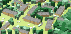
MODEL TYPES: 3D Models for City/Urban planning, 2.5D Models as budget solution for suburbs, 2D Urban Model, 2D Regional Models, Population Maps
AVAILABLE DATA LAYERS: — Digital Terrain Model, Digital Surface Mode — Clutter/Land Use Model — 3D Buildings Model, 3D Bridges Model, 3D Trees Model — Vector Model (Linear Objects) — POI, Addresses, Population Map — Otrhoimage
DO YOU NEED GEODATA FOR FAST DELIVERY? Research our data portfolio to find ready-to-use 2D and 3D models Ask us for free data samples
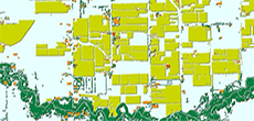
- 2.5D Geodata for rural areas
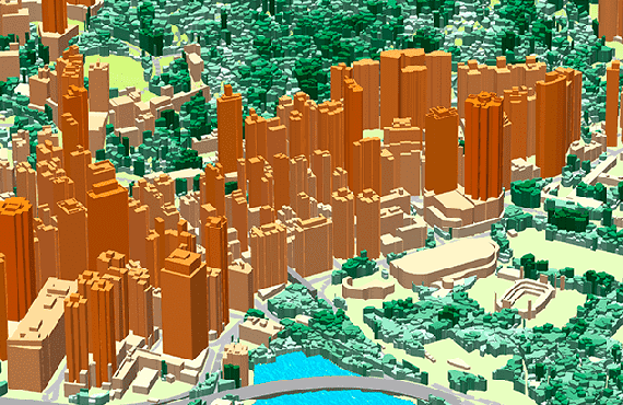
- 3D Geodata for 5G Planning

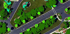
- 3D TREES (CANOPY) MODEL
- 3D SLOPED ROOFS MODEL
- Precise and up-to-date mapping information
- Extra-accurate 3d buildings
- Detailed and high-resolution terrain
- Flexible price fitted to customer budget
- Delivery in any RF planning tool and GIS format
- Alcatel A955
- Aircom Asset
- Atoll Forsk
- CelPlanner
- ICS Telecom
- NetPlan
- AutoCAD
- ESRI ArcGIS
- MapInfo
- Microstation
- Neva
- Odyssey
- Pathloss
- Mentum Ellipse
- Mentum Planet
- Nokia NetAct
- ASCII XYZ
- Raster images
- TIFF and GeoTIFF
- ERDAS Imagine Image
- ER Mapper Raster
- ENVI Image Format
- Generic Binary