Visicom delivers mapping products for efficient management in such sectors as:
1. Municipal GIS systems
2. Road infrastructure planning
3. Navigation and logistics
4. Urban environment planning
5. LTE networks planning for airports and railroad zones
6. Terrain obstacles identification
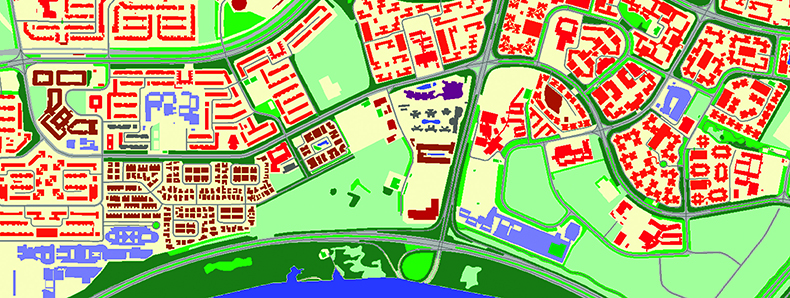
Digital maps for the transportation industry include:
1. 3D Urban models for planning and simulation
2. Land use (clutter) models
3. Basic vector maps (including road network with street names, buildings, addresses, POI)
4. Administrative and zip-code (postal) boundaries
5. Population maps
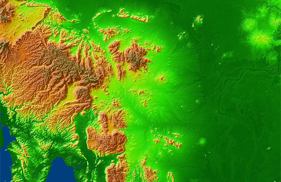
6. Digital Terrain Model (DTM) for initial planning of transport infrastructure
7. Digital Surface Model (DSM)/ Clutter Height
8. API map services empowered by Visicom online web map: Map tiles, Geocode services, Route optimization and Tracking
- 3D Maps

- Geospatial Data
- Regional Models
- Precise and up-to-date mapping information
- Extra-accurate 3d buildings
- Detailed and high-resolution terrain
- Flexible price fitted to customer budget
- Delivery in any RF planning tool and GIS format
- Alcatel A955
- Aircom Asset
- Atoll Forsk
- CelPlanner
- ICS Telecom
- NetPlan
- AutoCAD
- ESRI ArcGIS
- MapInfo
- Microstation
- Neva
- Odyssey
- Pathloss
- Mentum Ellipse
- Mentum Planet
- Nokia NetAct
- ASCII XYZ
- Raster images
- TIFF and GeoTIFF
- ERDAS Imagine Image
- ER Mapper Raster
- ENVI Image Format
- Generic Binary