• 2022-12-26
    Russian war crimes on sattellite photos

    The russian federation added energy terrorism to the list of its war crimes against Ukraine.

    Since October 2022, Russian criminals have been trying to destroy Ukrainian energy infrastructure by launching massive missile attacks on peaceful cities. Imagine spending at least one day without electricity, water, and heating. And now imagine that Ukrainian civilians are forced to live without these comforts of civilization for several days or weeks in winter.

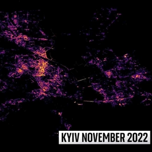
    Here are the visible results of rocket attacks on Kyiv in November and December.

    A detailed Sky News analysis of NASA satellite data shows the effect of attacks. (https://news.sky.com/story/the-energy-war-satellite-images-show-the-scale-of-russian-attacks-on-ukraine-infrastructure-12773049). Every morning, at about 1.30 am, NASA's Suomi and NOAA-20 satellites pass over Ukraine. High-resolution imagery from the two satellites, shared exclusively with Sky News, shows how weak the city lighting has become.

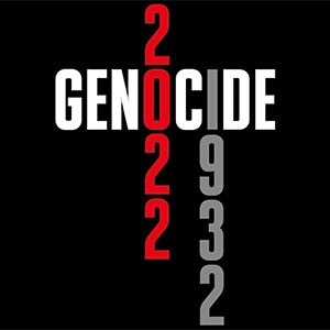
    Russia continues its course of the genocide of the Ukrainian people: murders, mass shootings, torture, destruction of homes, and now attempts to freeze Ukrainians, leaving us without electricity and therefore without heating.

    While celebrating Christmas and the New Year, the world should be aware of a constant threat nearby - a terrorist state that is not planning to stop.

    Nevertheless, Ukrainians are indomitable in spirit, and we will win because we stand for universal human values. Next year we will rebuild our cities, and they will shine again because the light always defeats the darkness. We thank our friends for their support during these difficult times. Stand with Ukraine!

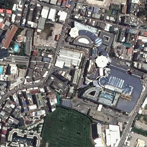
    Kyiv on satellite images in January 2022:

    Kyiv on satellite images in January 2022

  • 2022-12-23
    Merry Christmas and Happy New Year 2023

    Dear customers, friends and guests of our site,*

    We wish you and your families Happy Holiday Season and a prosperous New Year!

    May the New Year bring you happiness, success and love in the peaceful World.

    Our team sincerely thanks you for your support, your trust and loyalty and look forward to continuing our collaboration in 2023. Despite the war in Ukraine, we work for you, supporting your current and future projects.

    VISICOM team with the best wishes

  • 2022-11-27
    Holodomor of 1932-1933 was a Genocide

    Today Ukrainians all over the world commemorate the victims of Holodomor in 1932-1933 – a man-maid famine and an act of genocide against the Ukrainian people organized by the Soviet government to destroy the Ukrainian nation as a political factor and social entity.

    “Death solves all problems. No human, no problem.” - said Joseph Stalin, leader of the Soviet Union until 1953. During winter 1932-33, 17 people died from hunger in Ukraine every minute, 1000 people died every hour, 25,000 died every day. According to demographic studies, the number of victims in Ukraine can be estimated at about 3 million to 7 million.

    As of 2022, 17 countries have recognized Holodomor as genocide on the state level. Starvation was used by the Soviet authorities as a cheap and efficient weapon against strangling Ukrainian resistance to the Communist regime.

    This year, 90 years after Holodomor, for Ukrainians, the date feels like a tragic deja vu since Russia’s methods of today’s war against Ukraine show nothing but its tendency to repeat historical patterns. Putin continues Stalin’s policy of Ukraine genocide: not only by bombs and missiles that fall almost daily on Ukrainian cities, but also by the threat of darkness, cold, and hunger.

    #Holodomor #RussiaIsATerroristState #RussianWarCrimes

  • 2022-10-30
    OUR RECENT PROJECTS 3 QUARTER 2022

    We are glad to represent our projects completed within recent 3 months for our telecom clients as well as for other vertical markets like smart cities, solar energy assessments and environmental management.

    There are 2D maps for 7 countries, 3D maps for 114 cities, 3D countrywide database and LOD 2.1 buildings with pitched roofs for need of solar energy development.

    Due to usage of deep convolutional neural networks (CNN) and algorithms of automatically learning through training models, we achieved high level of accuracy compatible to manual source data processing. Usage of AI-algorithms allows accomplishing rapid extraction of cartographic features; at the same time, it can be applied at very large areas. The CNN support extraction of accurate special information about buildings, vegetation and water objects within cities, urban areas and even for a whole country what is very important as for 5G networks planning as for any environmental monitoring projects.

    More information about our recent project can be found here (Pressreleaseq3_2022.pdf).

    Please Contact us for free samples and more information about 2D/2.5D/3D geodata, or Download the free 2D/2,5D/3D data samples ourselves from our web-site.

    In these hard for our country times, the customers believe in us and our capacity to accomplish the projects with traditional high level of quality. We are very thankful to all our friends and partners for their support and confidence in our reliability.

  • 2022-10-17
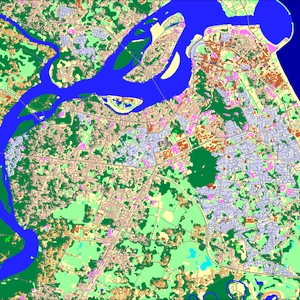
    10m resolution Countrywide Maps

    VISICOM REGIONAL MAPS LINE

    CREATED USING AI TECHNOLOGY OF MULTISPECTRAL SATELLITE IMAGES PROCESSING

    The manual data correction process and multilevel quality control provide accurate, consistent and detailed landscape and urbanized areas classification

    Products features:

    • 10m resolution
    • Accurate land use classification
    • Last available administrative division
    • Imagery source: 5m and 10m resolution multispectral images
    • Vintage: 2021-2022
    • Easy to use due to supporting of all major RF-planning tools and GIS formats

    DATA FORMATS: ATOLL, ASSET, PLANET, ESRI shp, MapInfo, ICS Telecom, GeoTIFF and others

    Products include:

    • Digital Terrain Model (DTM_
    • Clutter/Land Use Model
    • Street/Road Networks
    • Railways
    • Water Objects
    • Detailed Administrative Boundaries

    Supported industries:

    • Telecom
    • Climate change mitigation
    • Flood mapping
    • Green infrastructure deployment
    • Utilities
    • Transportation


    10m resolution Map of Philipines

    Fresh Geodata available today:

    Country

    Area, sq.km

    Bangladesh 148 460
    Cambodia 181 035
    Malaysia 329 847
    Myanmar 676 577
    Pakistan 803 940
    Philippines 300 000
    Singapore 927
    South Korea 100210
    Sri lanka 65 610
    Taiwan 36197
    Thailand 513 120
    Vietnam 331 210


    Download the brochure 10m resolution Countrywide Maps 2022 .pdf

    For more than 20 years, we have been studying all the nuances of creating geospatial data and the needs of our customers pertaining to different industries. The learned experience allows us to optimize the processes and ensure maximum cost-effectiveness.
    Contact us for the free samples and more information about 2D/2.5D/3D geodata.

    Download the free 2D/2,5D/3D data samples

    Send us the request for more information

  • 2022-09-14
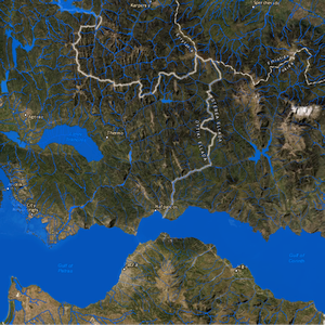
    GREECE NATIONWIDE WATERCOVER

    The National coverage of water objects realized by Visicom is a high-precision vector map generated by leveraging our AI-based algorithms developed for high-resolution satellite images processing.

    Covering 131 957 sq. km across the country, Visicom’s database of water objects provides an accurate and up-to-date digital representation of the water environment including:

    RIVERS, LAKES, SPRINGS, SWAMPS, LAGOONS, DITCHES and other objects categorized into 31 different classes.
    TOTALLY WE COLLECTED ABOUT 77000 WATER OBJECTS FEATURING INDIVIDUAL NAMES IN ENGLISH AND GREEK

    Greece Hydrography

    This unique dataset serves as the foundation for many land use and city planning applications, telecom as well as for a diverse range of environmental management tasks, namely:

  • 2022-09-12
    3D buildings of Greece Countrywide

    3D BUILDINGS FOR GREEK CITIES, 2022

    Our new 3D countrywide project was realized for Greece that includes 3D buildings throughout the territory of Greece, including every island, city, village, etc.

    Geodata represents 3D Buildings collected for whole country, that can be used for radio frequency planning of 4G or 5G mobile communication networks, urban planning, architecture, etc.

    Visicom, having many years of experience in 3D map creating, constantly improves the technology, quality, and speed of production, which allows us to provide our customers with high-quality 2D maps, 3D maps, population maps, and any other spatial data in a short time.

    Download the free 3D data sample of Greece 3D city model**

    Send us the request for more information

  • 2022-09-08
    HACKER ATTACK ON VISICOM SERVICES

    Dear friends and partners,

    This week, VISICOM websites were attacked using DDOS technologies from the territory of Russia. In this way, the enemies resorted to cartographic warfare, as insidious, senseless, and stupid as the entire war that russia started against Ukraine.

    russian hackers use methods as ridiculous and dirty as those that the russian army uses when killing and torturing civilians. Methods as dirty as those that the russian government uses when blackmailing Europe with gas and the fear of cold winters, and Africa with grain and the threat of famine.

    But none of them will succeed in hacking Ukrainian websites, breaking the Ukrainian army, or the Ukrainian nation. DDOS attacks caused a temporary failure in our site's operation, including processing request forms like "Contact us". Currently, the work of our services has been restored.

    Dear users, if you sent a request through the form on the website on September 7-8th, please repeat it. We work, as always, for our customers and for our victory.

    GLORY TO UKRAINE!

  • 2022-08-24
    Happy Independence Day, Ukraine!

    Independence is not just a word or an abstract concept for Ukrainians.

    This is the national trait of our people; it is an essential part of our mentality, because freedom, courage and dignity are always in our hearts.

    Independence is an opportunity to live freely and with dignity on our land!

    Independence, free will, freedom - things that have always been the most important for us, Ukrainians.

    WE ARE INVINCIBLE BECAUSE WE ARE FREE!

    WE ARE INVINCIBLE BECAUSE WE ARE UNITED!

    WE WILL WIN BECAUSE WE ARE ON THE SIDE OF THE LIGHT!

    Glory to the heroes who defend our land. Glory to every Ukrainian who fights for our freedom.

    We are grateful to the entire democratic world for uniting to oppose fascist russia.

    We are grateful to all our friends around the world for helping us to overcome the evil and the darkness.

    GLORY TO UKRAINE! WE ARE FREE, WE ARE ALIVE, WE ARE UKRAINE!

  • 2022-08-19
    ICEYE Signs Contract to Provide Government of Ukraine with Access to Its SAR Satellite Constellation

    The contract signed with the Serhiy Prytula Charity Foundation will initially provide the Government of Ukraine with the full capabilities for one of ICEYE’s satellites already in orbit.

    Helsinki, FINLAND – August 18, 2022 – ICEYE, the global leader in persistent monitoring with radar satellite imaging, has signed a contract with the Serhiy Prytula Charity Foundation which will provide the Government of Ukraine with ICEYE’s Synthetic Aperture Radar (SAR) satellite imaging capabilities.

    As part of the agreement, ICEYE will transfer full capabilities of one of its SAR satellites already in orbit for the Government of Ukraine’s use over the region. The SAR satellite will be operated by ICEYE. In addition, ICEYE will provide access to its constellation of SAR satellites, allowing the Ukrainian Armed Forces to receive radar satellite imagery on critical locations with a high revisit frequency.

    Since the beginning of the Russian invasion in Ukraine, the Serhiy Prytula Charity Foundation has focused its efforts on fundraising money for the needs of Ukraine’s Armed Forces, including the recent acquisition of four Bayraktar drones.

    “ICEYE owns the most developed radar satellite imaging technology in the world as of today,” says Serhiy Prytula, founder of the Serhiy Prytula Charity Foundation. “This agreement is a significant step in responding to the Government of Ukraine’s urgent request for critical earth observation data and it will greatly benefit our Armed Forces.”

    “With this agreement, ICEYE further builds on its efforts to provide objective data and technological support to Ukraine,” says Rafal Modrzewski, CEO of ICEYE. “We firmly believe SAR technology and its capabilities will continue to add significant value to the Government of Ukraine, now enabled by the work of the Serhiy Prytula Charity Foundation.”

    Owning the world’s largest SAR satellite constellation, ICEYE delivers proven and reliable Earth Observation solutions and is the only organization in the world to offer the rapid delivery of high-precision SAR satellites and data to its customers, allowing them to take full control of their mission.

    At any given time, most of the Earth is covered in clouds or darkness. Unlike traditional Earth observation satellites, ICEYE’s small radar imaging satellites can form high-resolution images of areas of the Earth in daylight, at night, and through cloud cover. In other words, they can collect images and data from any part of the Earth multiple times a day, with the necessary reliability for critical decision making. ICEYE has successfully launched 21 spacecraft to date and operates the world’s largest fleet of commercial SAR satellites.

    ABOUT ICEYE

    ICEYE delivers unmatched persistent monitoring capabilities for any location on earth. Owning the world’s largest synthetic-aperture radar constellation, the company enables objective, data-driven decisions for its customers in sectors such as insurance, natural catastrophe response and recovery, security, maritime monitoring and finance. ICEYE’s data can be collected day or night, and even through cloud cover. For more information, please visit www.iceye.com

  • 2022-08-17
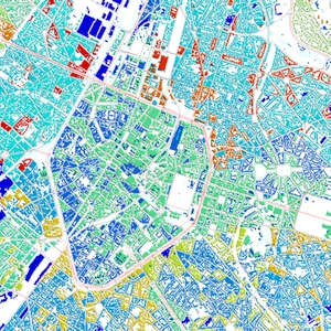
    REGIONAL&POPULATION MAP OF BELGIUM 2022

    We continue to cooperate with telecom companies that operate in Europe, producing 2D and 3D mapping products to completely cover it with high-quality geodata.

    One of our recent project – 2D Regional model of Belgium produced with 10m resolution – involves:

    • Digital Terrain Model
    • Land Use (Clutter model)
    • Vector data of street/roads network
    • Detailed 5-level administrative division:
      1. Country
      2. Regions
      3. Provinces
      4. Districts
      5. Municipalities (communes)
    • Population Distribution Model

    Preview of data layers you can look over below.

    Belgium has relatively moderate topography which can be seen by the DTM example.

    That is why the population of the country is distributed evenly, except for Brussel and several large cities of Belgium.

    For the PopMap production we used Official population census data 2011 for Belgium + Official Belgium Population Projection figures data of 2022.

    The Population map includes population density per each cell of the raster grid.

    Sample of PopMap, 10m resolution

    Sample of Land Use, 10m resolution

    The Geodata produced within this project can be applied not only for mobile networks planning but for needs of roads networks developing, urban planning, etc.

    The PopMap data can be widely used for various social and economic projects, e.g. for geomarketing, targeting applied for e-commerce, etc.

  • 2022-07-26
    VISICOM 3D and 2D MAPS FOR HUNGARY TELECOM MARKET

    Hungary Telecom Market is growing in recent years and is expected to have continued growth over the forecast period to 2025. The growth in the industry is mainly due to increasing urban population with the corresponding increasing of the mobile phones that supports 3G, 4G and 5G services across the country. Some of the 2G networks have already been closed, and all of the major 2G/3G platforms are expected to be shut by the end of 2025. By 2029 the majority of mobile connections will be on 5G.

    We support all mobile operates for years starting from 2G networks development. Now we propose extra-accurate geodata for 5G – from 2D and 2.5D countrywide maps to 3D maps of any city in Hungary.

    DELIVERED DATASETS

    DTM / Clutter Model (Land Use) / Vector Model / Building footprints

    LANGUAGE SUPPORT HUNGARIAN & ENGLISH

    AVAILABLE GEODATA

    • 10m resolution 2D Model for entire country
    • 3D Buildings for all country
  • 2022-07-13
    OUR RECENT PROJECTS 1-2 QUARTERS 2022

    During last 3 months of 2022 VISICOM team produced and delivered to our customers Regional models for more than 2,000,000 sq. km, 3D urban models for 80 cities in 6 countries, GIS database for 7 countries including 3D building coverage for contrywides.

    We also continue our cooperation with players of vertical markets, particularly for solar energy assessments, providing them 3D data with pitched roof details.

    Despite the war, we kept the operability of our company, fully restored all working processes and even increased the production capacity.

    In these hard times, the customers believe in us and our capacity to accomplish the projects with traditional high level of quality.We are very thankful to all our friends and partners for their support and confidence in our reliability.

    Download the brochure to learn more about OUR RECENT PROJECTS

    Contact us for the free samples and more information about 2D/2.5D/3D geodata.

    Download the free 2D/2,5D/3D data samples

  • 2022-07-05
    3D GEODATA FOR SOLAR RESOURCE ASSESSMENTS

    Solar energy is used worldwide and currently, we are witnessing an increasing trend in its usage for generating electricity and heating/desalinating water.

    Today, Photovoltaics (PV), also called solar cells, is one of the fastest-growing renewable energy technologies, and is ready to play a major role in the future global electricity generation mix.

    Solar PV installations can be combined to provide electricity on a commercial scale, or arranged in smaller configurations for mini-grids or personal use. Using solar PV to power mini-grids is an excellent way to bring electricity access to people who do not live near power transmission lines, particularly in developing countries with excellent solar energy resources.

    SOLAR ROOF PV POTENTIAL MODELLING

    Solar resource assessments are a core method for developing and deploying solar energy plants. In turn, 3D buildings and 3D vegetation are key initial sources for evaluating solar resource availability and running the solar energy simulations.

    High-accuracy 3D datasets provide high solar project value and increase its performance. Precise and up-to-date geodata ensures the relevant information to make a better decision. Data details, accuracy, and relevance are critical parameters for solar resource assessment and modeling.

    LOD3 3D buildings manufactured by Visicom for solar energy projects involve such small elements as roof furniture, elevators shafts, towers, spires, and also sloping roof elements.

    The assigned parameters:

    • azimuth
    • tilt angle
    • area of flat parts
    • roof height

    are calculated for each element separately, creating the background for producing solar rooftop maps (solar cadaster). The high accuracy of the building elements' footprints is tailored specifically to the estimation and calculation of the solar energy potential for each roof.

    SAMPLE OF DATA FOR ROOF SURFACES

    Sample of data for Roof Surfaces

    PREVIEW OF FINAL BUILDINGS DATA

    PREVIEW OF FINAL BUILDINGS DATA

    PREVIEW OF FINAL BUILDINGS DATA

    To create a 3D data set for large areas where solar stations are planned to be installed, LIDAR data are used among other sources. It is possible to achieve completeness and precision of ≥85% if the density of LIDAR points is more than 8 per one sq.m, and ≥90% if the density of LIDAR points is more than 15 per one sq.m. Due to the precise setting of the threshold coefficients used in the recognition of obstacles, our LIDAR processing algorithm allows us to recognize buildings and the main elements of roofs, allocate tree crowns, and restore the structure of buildings closed by crowns. After recognition and vectorization, the necessary attributes of roofs, heights, area, and slope of the roof elements are assigned to the buildings and trees.

    Automation of the process of buildings recognition allows us to quickly produce high-quality 3D data sets for large territories in urban and suburban areas.

    3D BUILDINGS SET BASED ON LIDAR DATA PROCESSING

    3d buildings set based on LIDAR data processing

    A complete set of 3D data may include: DTM, DSM, building footprints and vegetation crowns as 3D .shp multipatch dataset.

  • 2022-06-10
    3D Model of London, pitched roofs LOD3

    We are happy to continue our virtual journey through the Great Britannia and present our new completed 3D printing project.

    Our customer, CHISEL&MOUSE always provides fascinating and spectacular orders. This time it is a 3D model of the historical part of Britain's capital city, London.

    A very high quality 3D model performed at LOD3, with pitched roofs and their detailed elements. The data for this model was made based on the satellite images of 30 cm resolution, which allowed collecting every tiny elements of houses and roofs.

    It is always a pleasure to perform projects for this customer, because they are always challenging and require extreme precision.

  • 2022-06-08
    Countywide 2D model of Great Britain for RF planning

    We are delighted to work with many companies in the UK, both in the telecom market and in adjacent industries.

    Our latest projects are a countrywide model for RF-planning and a LOD 3D model of London, which included pitched roofs and complex architectural elements.

    A regional 2.5D map of the country, totaling 228,947 sq km, including all islands within the UK.

    Resolution - 20m
    Count of clutter clusters - 21

    Read more about the 3D model of London in our next news and watch the video on YouTube.

    We are very grateful to the government and people of Britain for their comprehensive assistance to Ukraine. Thank you to the entire country, led by Prime Minister Johnson, who made the right choice in the war unleashed by russia not only against Ukraine, but also against the entire civilized world, and showed her foresight and knowledge of European history.

  • 2022-05-24
    3D RF MAP FOR HAGERSTOWN, USA

    VISICOM team completed 11 projects and started 14 new projects within last 3 months.

    We continue to support our clients worldwide, implementing our long-term experience in 2D/2.5D/3D maps production with traditional high level of quality.

    3D model of Hagerstown is one of our 3D project for the USA.

    Here are some details:
    The 3D model accuracy in XYZ – 2 m LE95.
    Coverage - about 150 sq.km

    3D obstacles include 3D Buildings, Trees and Bridges as well as other artificial objects, vector layers like roads/streets network and Land Use classified in 28 classes. All these elements together provide the accurate and detailed representation of city infrastructure that is obvious source for accurate RF planning and task management in other industries such as architecture, smart cities, solar energy etc.

    VISICOM constantly improves the technology and quality of geodata production, providing our customers with fast delivery of high-quality 2D and 3D maps, population maps as well as any other spatial data.

  • 2022-05-19
    You can rely on Visicom as always

    Dear Partners, Customers and Subscribers!

    85 days of inhuman Russia’s war against Ukraine passed. Someone from our team is not in his/her houses; someone is abroad as refugee, but generally the Visicom team works. We did not stop the customer’s service for our regular clients and even got new orders and long-term contracts. Our customers trust in our company, as well as we believe and support Ukraine and our defenders – armed forces of Ukraine.

    Despite the war we kept the operability of our company, fully restored all working processes and even increased the production capacity. During the recent three months, we successfully finalized more than 10 projects and received new orders focused on 12 countries, namely: Greenland, Belgium, Portugal, Israel, Great Britain, Salvador, Qatar, Malaysia, Saudi Arabia, Singapore, USA, Taiwan, Greece, Turkey, Hungary, Kazakhstan, UAE, Thailand, Pakistan, Bangladesh, Cambodia. These projects were ordered on various data types – 2D, 2.5D and 3D, and on different coverages starting from separate cities up to entire countries.

    In these hard times, the customers believe in us and our capacity to accomplish the projects with traditional high level of quality; we will not let them down.

    We are very thankful to all our friends and partners for their support and confidence in our reliability.

    More news about our projects will come soon. Looking forward to further partnership.

  • 2022-02-24
    Russian invasion! We need your support!

    Dear friends and partners! Support us with our struggle with russin aggression!

    The National Bank of Ukraine has opened a special account to raise funds for the Ukrainian Army. Anyone from any country can donate!
    The account is multi-currency. It is opened for transfers of funds from international partners and donors, any person as well as from Ukrainian business and citizens.
    For donations in USD:
    SWIFT Code NBU: NBUA UA UX
    JP MORGAN CHASE BANK, New York
    SWIFT Code: CHASUS33
    Account: 400807238
    383 Madison Avenue, New York, NY 10179, USA
    Bank account: UA843000010000000047330992708
    For donations in GBP:
    SWIFT Code NBU: NBUA UA UX
    Bank of England, London
    SWIFT Code: BKENGB2L
    Account: 40000982
    Threadneedle Street, London EC2R 8AH, UK
    Bank account: UA843000010000000047330992708
    For donations in EUR:
    SWIFT Code NBU: NBUA UA UX
    DEUTSCHE BUNDESBANK, Frankfurt
    SWIFT Code: MARKDEFF
    Account: 5040040066
    IBAN DE05504000005040040066
    Wilhelm-Epsteinn-Strabe 14, 60431 Frankfurt Am Main,Germany
    Bank account: UA843000010000000047330992708
    Для зарахування коштів у національній валюті:
    Банк: Національний банк України
    МФО 300001
    Рахунок № UA843000010000000047330992708
    код ЄДРПОУ 00032106
    Отримувач: Національний банк України
    ❗️REPOST❗

    You could find news about russian invasion on BBC web
    https://www.bbc.com/news/live/world-europe-60454795

  • 2022-02-21
    Israel 2D and 3D maps

    Israel will close 2G (GSM) and 3G networks by the end of 2025

    Due to competently planning of radio networks, 4G/ LTE services are available almost everywhere in the country in the sphere of medicine, biotechnology, agriculture, science as well as military industry. By continuing the development of telecom industry, Israel held an auction in August 2020 for frequencies in various spectrums for 5G networks deployment.

    One of the drivers to launch and develop the 5G networks should be the complete abandonment of the outdated standards, which will be valid till 2025. The set of transition events includes: - priority deployment of the 5G network across the entire country; - tenders for the equipment purchase from vendors like Nokia, Ericsson, etc.; - tenders for RF-planning tool and accurate RF-maps purchase fitted to 5G-networks; - step-by-step network planning. -

    Visicom always supports telecom operators, equipment and software vendors providing high quality, up-to-date and accurate 2D and 3D digital maps for the new generation of cellular networks deployment.

  • 2022-01-19
    RF Map of Bangkok 3D, Thailand

    Thailand was the first country in Southeast Asia to launch commercial 5G services. The Thai government aims to become an ASEAN digital infrastructure hub and transform the country into a digital economy. According to the Office of the National Broadcasting and Telecommunications Commission (NBTC) the 5G market is expected to increase to $15.9 billion in 2022.

    VISICOM is currently supporting the telecom industry providing 3D, 2D and 2.5D maps over all country for needs of RF planning and optimization, providing high level of geodata accuracy.

    Now we are glad to represent 1m resolution 3D model of Bangkok. Other 3 cities Chang Mai, Khon Kaen, Phuket and 10m resolution countrywide map are coming soon. Extra-quality of the Bangkok 3D map tailored to 5G planning requirement in any RF-toll formats like Atoll, Asset, Planet etc.

    More detailed information as well as free data samples can be provided on your request.

    Send us the request for more information

    Download the free 3D data sample of Bangkok 3D city model

    Explore our 3D data here lorem

  • 2021-12-21
    MERRY CHRISTMAS AND HAPPY NEW YEAR 2022

    DEAR VALUED COLLEAGUES AND PARTNERS,

    As another year ends, we would like to sincerely thank you for supporting us and for your genuine goodwill.

    We appreciate your trust and loyalty and look forward to continuing our collaboration in 2022.

    We wish you and your families Happy Holiday Season and a prosperous New Year!

    Stay healthy and merry

    VISICOM team

  • 2021-12-17
    3D RF MAP FOR HUSTON USA

    3D RF MAP FOR HUSTON USA

    Visicom team added one more 3D RF-map to our growing portfolio - 1 m resolution 3D model of Huston city for 5G planning.

    The model accuracy in XYZ – 2 m LE95.

    3D obstacles include 3D Buildings, Trees and Bridges as well as other artificial objects, vector layers like roads/streets network and Land Use classified in 28 classes. All these elements together provide the accurate and detailed representation of city infrastructure that is obvious source for accurate RF planning and task management in other industries such as architecture, smart cities, solar energy etc .

    Visicom, having long-term experience in 3D map development, constantly improves the technology and quality of geodata production providing our customers with fast delivery of high-quality 2D and 3D maps, population maps and any other spatial.

    Download the free 3D data sample of USA

    Send us the request for more information

  • 2021-11-10
    Our recent projects 3-4 quarters 2021

    THE LATEST PROJECTS FROM VISICOM
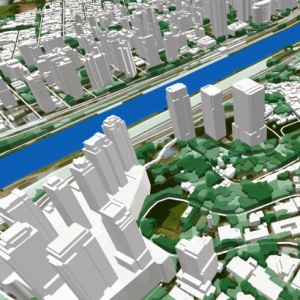
    (image: 3D model Tórshavn, Faroes Islands)

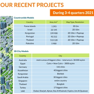
    During the third and fourth quarters of 2021 VISICOM team produced and delivered to our customers Regional models for more than 700,000 sq. km, 3D urban models for 271 cities in 11 countries, GIS database for 3 countries and more than 1 000 000 square kilometers.

    COUNTRYWIDE MODELS

    Country

    Area, sq.km

    Map Type, Resolution

    Faroes Islands 1 393 3D model, 2m
    Israel 22 145 2D model, 10m
    Kyrgyzstan 199 900 2D model, 10m + Population map
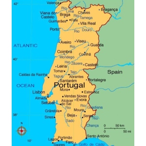
    Portugal 92 212 2D model, 10m + Population map
    Thailand 513 120 2D model, 10m + Population map

    3D CITY MODELS

    Country

    City

    Australia metro areas of the biggest cities
    Egypt Cairo + New Cairo
    Germany 142 cities
    Kazakhstan 40 biggest cities
    Kyrgyzstan Bishkek
    Saudi Arabia 30 biggest cities
    Singapore Total country
    Thailand Bangkok
    Turkey 17 biggest cities
    UAE Dubai, Sharjah, Ajman, Ras Al Khaimah, Fujeira, Um Al Quaiwan

    GIS DATABASE

    Country

    Area, sq.km

    Data layer

    Taiwan 36193 3d buildings, water
    Ukraine 603700 3d buildings, addresses, postcode, admin bounds, water, roads

    Download the brochure OUR RECENT PROJECTS 2021!

    For more than 20 years, we have been studying all the nuances of creating geospatial data and the needs of our customers pertaining to different industries. The learned experience allows us to optimize the processes and ensure maximum cost-effectiveness.
    Contact us for the free samples and more information about 2D/2.5D/3D geodata.

    Download the free 2D/2,5D/3D data samples

    Send us the request for more information

  • 2021-10-19
    MAPS FOR LATIN AMERICA COUNTRIES

    3D RF MAP FOR LATIN AMERICA

    Do you need 3D data over large areas? Need to deploy or upgrade a 5G or 4G network?

    Visicom specialize in production of highly accurate 3D city or country maps for the telecom sector since 2000.

    Our customers are mobile operators, equipment and software manufacturers for network planning. You can join the team of world leaders who use our 3D data worldwide.

    Visicom, having many years of experience in 3D map creating, constantly improves the technology, quality, and speed of production, which allows us to provide our customers with high-quality 2D maps, 3D maps, population maps, and any other spatial data in a short time.

    Download the free 3D data sample of Bolivia

    Download the free 3D data sample of Colombia 3D city model

    Download the free 3D data sample of Brazil 3D city model

    Send us the request for more information

    Watch a video here lorem

  • 2021-10-07
    Architecture is a passion and 3D visualization is a necessity

    Friends, recently we told you about one of our clients – CHISEL&MOUSE. They are known to specialize in mini-models developing focusing on modern architecture, physical 3D maps, etc. Indeed, it can be any kind of home accessories to decorate your apartment.

    Today we are going to tell you about other partners of ours, their complete opposite. Founded in 2008, REDVERTEX is a powerful team with more than 160 employees in Miami, #Dubai and Sofia.

    Today REDVERTEX is a well-known studio specializing in the following trends:
    ➢ Architectural visualization;
    ➢ 2D and 3D animation;
    ➢ 360 degree panoramas;
    ➢ Augmented reality integration;
    ➢ etc.

    They have two things in common with CHISEL & MOUSE crafters:

    Differences:

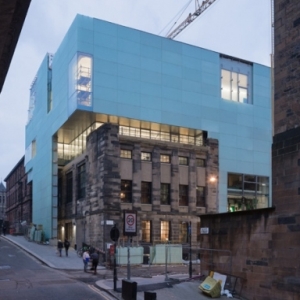
    • Craftsmen create mini-models, often replicas of famous structures that already exist. For example - the School of Art in Glasgow (Scotland) or the Central Station in Helsinki (Finland).
    • The studio designs structures of fantastic scale, such as the Concert Hall in Kaunas (Lithuania), Dubai's Creek Tower, Saudi's British bank, and others.

    The second, less noticeable difference is that the CHISEL & MOUSE mini-models are based on a retrospective, historical view of already known constructions.

    At the same time, the developers from REDVERTEX are looking to the future, as evidenced by the above-noted fantasticness of their models, both realized and those that are still in the design phase.

    REDVERTEX, as well as CHISEL & MOUSE, successfully use 3D models from Visicom to create their 3D products, both virtual and physical, thus acknowledging quality and resource efficiency.

    The data used by the above-mentioned companies are universal and, as a rule, can be used without modification for different tasks or projects.

    Send us the request for more information or download our CAD sample here

  • 2021-10-01
    3D buildings and hydrography of Croatia

    3D BUILDINGS FOR CROATIAN CITIES, 2021

    Our new 3D countrywide project was realized for Croatia with its magnificent Adriatic Sea, mesmerizing mountains, beautiful greenery located between lots of rivers and lakes.

    Geodata represents 3D Buildings collected for whole country and also include detailed hydrography - every river, lake, pond etc., that can be used for radio frequency planning of 4G or 5G mobile communication networks, urban planning, architecture, etc.

    Visicom, having many years of experience in 3D map creating, constantly improves the technology, quality, and speed of production, which allows us to provide our customers with high-quality 2D maps, 3D maps, population maps, and any other spatial data in a short time.

    Download the free 3D data sample of Croatia 3D city model**

    Download the booklet "3D buildings and hydrography of Croatia"

    Send us the request for more information

    Watch a video here lorem

  • 2021-09-20
    From 3D map to 3D sculpture

    Buildings and cityscapes have been capturing the human imagination for millennia. Urban landscapes with their mix of architecture, roads, and parks influence the course of history.

    Pulsating and ever-growing cities are like living organisms. They provide humanity with shelter, recreation, work, study, etc.

    We, in turn, research them. In architecture, for example, we try to find physical and emotional signs of this kind of artwork. Eventually, we often admire it so much that we begin to reproduce it in mini-models – graphically or on a larger scale.

    That's how Visicom's UK customers do it, the renowned craft masters at CHISEL & MOUSE.

    The latter, in turn, is known for its quite original production approach. According to it, the creative process is based on a combination of manual labor (hence the name "chisel") and innovative technologies (the term “mouse” is “responsible” for them).

    Obviously, in order to create a quality model of an industrial facility it is required to have not only specific manual competence, but also extreme patience and a propensity for scrupulous thoroughness (see video).

    Consequently, since 2011, brothers Robert and Gavin Paisley have been casting and handcrafting precise physical mini-copies of architectural monuments and cityscapes.

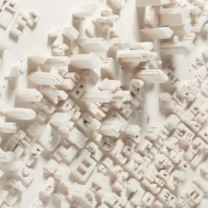
    Visicom cooperates with Chisel and Mouse in terms of supplying them with high-quality 3D maps. The ones that later serve as basis of fantastic 3D paintings. Imagine the slice of the artwork itself: here you have satellite data, and 3D printing, and handwork with plaster. In other words, the path from the satellite to the wall in your living room is quite long and intense.

    Order 3D maps for your business from us and 3D paintings for your lofts from our British friends.

    In both cases, it's a win-win solution.

  • 2021-09-09
    Population map of Portugal 2021

    2D map and population data of Portugal, 2021

    Population data gathering is always challenging especially in case of up-to-date data searching. It looks like a quest. Sometimes it can be arduous but years of experience give results. This time, our team made not only a mere population map of Portugal, but also a complete 2D map of 10m accuracy covering the mainland and all the islands.

    Now our customer knows where and how many people live in municipalities, or in parishes, or even in city blocks.

    Visicom, having years of experience in 3D map creating, constantly improves the technology, quality, and speed of production, which allows us to provide our customers with high-quality 2D maps, 3D maps, population maps, and any other spatial data in a short time.

    Send us the request for more information

    Watch a video here lorem

  • 2021-08-18
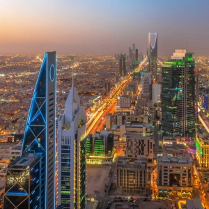
    3D cities of Saudi Arabia

    3D BUILDINGS FOR SA CITIES, 2021

    Saudi Arabia is a country which has been developing rapidly in recent decades, and accordingly the construction is carried out quite intensively. The companies focusing on telecommunications (2D or 3D RF maps), architecture (3D models LOD3), Smart City, urban planning (3D city models LOD2 or LOD3), solar energy (3D building models with roof azimuths), in order to make pragmatic and cost-effective decisions affecting the final result need actual Geo data regarding houses, their heights, number of floors, etc.

    Our current very interesting project is collection of 3D Buildings database for all Saudi Arabia. Below is a list of cities that are already available or will be available soon.

    This project includes the following cities:

    City

    Area, sq.km

    Buildings

    3D maps Riyadh 4800+ 2500000+
    3D maps of Jeddah & Mecca 5000+ 2000000+
    3D maps of Dammam 12000+ 1500000+
    3D maps of Al Hufuf 31000+ 750000+
    3D maps of Al Lith 1000+ 590000+
    3D maps of Al Muzahmiyah 1000+ 450000+
    3D maps of Al-Kharj 1600+ 410000+
    3D maps of As Sejir 1800+ 400000+
    3D maps of Ash Sharqiyah 700+ 320000+
    3D maps of At Taif 3600+ 250000+
    3D maps of Buraydah 3500+ 200000+
    3D maps of Hafar Al-Batin 4000+ 170000+
    3D maps of Hail 700+ 165000+
    3D maps of Khamis Mushait 500+ 130000+
    3D maps of Medina 700+ 130000+
    3D maps of Najran 400+ 71000+
    3D maps of Sakaka 5000+ 24000+
    3D maps of Tabuk 200+ 11000+
    3D maps of Tharmada 600+ 6000+
    3D maps of Yanbu'al-Bahr 700+ 2500+


    Visicom, having many years of experience in 3D map creating, constantly improves the technology, quality, and speed of production, which allows us to provide our customers with high-quality 2D maps, 3D maps, population maps, and any other spatial data in a short time.

    Download the free 3D data sample of Saudi Arabia 3D city model**

    Send us the request for more information

    Watch a video here lorem

  • 2021-08-10
    3D cities of Turkey

    3D BUILDINGS FOR TURKISH CITIES, 2021

    Visicom as an established and well recognized enterprise keeps on supporting telecom and GIS companies in Turkey providing them with accurate 3D city maps.

    Our current very interesting project is collection of 3D Buildings database for all Turkey. Below is a list of cities that are already available or will be available soon.

    This project includes the following cities:

    City

    Area, sq.km

    Buildings

    - 3D Istanbul 1500+ 1200000+
    - 3D Ankara 911+ 360000+
    - 3D Konya 321+ 336000+
    - 3D Kayseri 300+ 584000+
    - 3D Izmir 300+ 168000+
    - 3D Antalya 260+ 272000+
    - 3D Bursa 225+ 296000+
    - 3D Kocaeli 210+ 128000+
    - 3D Adana 190+ 280000+
    - 3D Eskişehir 140+ 140000+
    - 3D Mersin 140+ 144000+
    - 3D Gaziantep 135+ 248000+
    - 3D Denizli 120+ 124800+
    - 3D Diyarbakır 110+ 108000+
    - 3D Malatya 100+ 100800+
    - 3D Hatay 95+ 93600+
    - 3D Şanlıurfa 80+ 88000+

    For more than 20 years, we have been studying all the nuances of creating geospatial data and the needs of our customers pertaining to different industries. The learned experience allows us to optimize the processes and ensure maximum cost-effectiveness.


    ANKARA 3D BUILDINGS

    Download the free 3D data sample of Turkey 3D city model**

    Send us the request for more information
    Watch a video here lorem

  • 2021-06-23
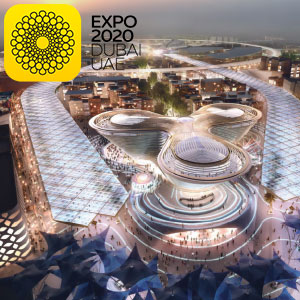
    3D map of Dubai Exhibition Centre (DEC), UAE

    Expo 2020 is scheduled to be a World Expo on October 20th, 2020. Due to the pandemic situation caused by COVID-19, the new dates are 1 October 2021 – 31 March 2022.

    Despite being postponed, Visicom regularly updates the 3D view of the Expo Center and the surrounding areas. Our extra fresh data can be delivered immediately to use in 5G planning, simulation, architecture design etc.

    Visicom supports architects and engineers in multiple industries with up-to-date, reliable and accurate geodata:

    • 3D Buildings, Bridges and Trees models;
    • Landscape and Terrain features;
    • Vector data of Streets and Roads networks.

    Watch a video here lorem

  • 2021-06-02
    Our recent projects 2021

    THE LATEST UPDATES FROM VISICOM

    During the first and second quarters of 2021 VISICOM team produced and delivered to our customers Regional models for more than 500,000 sq. km, 3D urban models for 60 cities in 9 countries, GIS database for 5 countries and more than 5 000 000 square kilometers.

    COUNTRYWIDE MODELS

    Country

    Area, sq.km

    Map Type, Resolution

    Taiwan 36 193 3D building footprints
    Papua New Guinea 462 840 2D 20m + Popmap

    3D CITY MODELS

    Country

    City

    Albania Durres
    Australia metro areas of biggest cities – total area is 38 000 sq.km
    Belarus Minsk
    Greenland Nuuk, Pituffik
    Qatar Doha (393 sq.km)
    Saudi Arabia 20 biggest metro cities – total area is 80 000 sq.km
    Sweden Stockholm
    Turkey Istanbul, Ankara, Bursa, Izmir (in production)
    Ukraine 22 biggest cities

    2,5D CITY MODELS

    Country

    Map Type, Resolution

    Australia Biggest metro areas – 80 000 sq. km
    Belarus Minsk

    COUNTRYWIDE GIS DATABASE

    Country

    Area, sq.km

    Data layer

    Argentina 2 800 400 Address, postcode, road
    Indonesia 1 905 000 Address
    Kosovo 10 887 Address, postcode, admin
    Malta 316 Address, postcode
    Ukraine 603 700 Address, postcode, road

    LOD3 slope roof models – Small countries around the world (Antigua and Barbuda, Mauritius)


    Download the brochure OUR RECENT PROJECTS 2021!

    For more than 20 years, we have been studying all the nuances of creating geospatial data and the needs of our customers pertaining to different industries. The learned experience allows us to optimize the processes and ensure maximum cost-effectiveness.
    Contact us for the free samples and more information about 2D/2.5D/3D geodata.

    Download the free 2D/2,5D/3D data samples

    Send us the request for more information

  • 2021-04-26
    3D COUNTRYWIDE MODEL OF UKRAINE

    Always supporting the Ukrainian Telekom market from 2G to 5G networks deployment, we permanently update and upgrade our 2D and 3D data for all of Ukraine.
    For now, high-quality 2D and 3D maps for regional, urban, and city planning include:
    Settlements - 40,000
    Buildings - 12,500,000
    Roads - 600,000 km
    Points of address - about 5,000,000
    as well as other objects of infrastructure, hydrography, vegetation, etc.
    Visicom has an ambitious plan to collect a database of buildings over the country and complete the 3D model of all Ukraine. Preliminary we estimated that the database would contain about 20 000 000 objects, taking into account that buildings with footprint area starting from 16 sq.m will be included.
    The production process is based on the technology of the manmade object recognition and classification developed by our experts with the usage of ML and AI algorithms.

    Our Geodata can also be used in industries such as architecture, urban planning, smart cities, solar energy, environmental management, etc.

    Visicom's advanced mapping products support any RF tool format (ATOLL, PLANET, MENTUM PLANET, PATHLOSS etc.). Our geodata made specifically for the telecom industry provide precise knowledge about the 3D environment in order to help operators to plan, implement and improve the performance of their radio networks.

    Our geodata catalogue includes over 6000 cities across 130+ countries.
    ✉ Contact us to receive a free sample of the 3D city Model.

  • 2021-03-24
    Greenland 3D cities

    3D MAPS OF GREENLAND CITIES

    🔔This mapping product covers more than 100 sq. km of the 3D city models.

    Visicom's advanced mapping products support any RF tool format (ATOLL, PLANET, MENTUM PLANET, PATHLOSS etc.). Our geodata made specifically for the telecom industry provide precise knowledge about the 3D environment in order to help operators to plan, implement and improve the performance of their radio networks.

    Now 14 cities are ready in 3D, namely:

    ✅ 3D map of Nuuk
    ✅ 3D map of Aasiaat
    ✅ 3D map of Illussat
    ✅ 3D map of Kangerlussuaq
    ✅ 3D map of Kulusuk
    ✅ 3D map of Maniitsoq
    ✅ 3D map of Nanortalik
    ✅ 3D map of Narsaq
    ✅ 3D map of Paamiut
    ✅ 3D map of Qaqortoq
    ✅ 3D map of Sisimiut
    ✅ 3D map of Tasiilaq
    ✅ 3D map of Upernavik
    ✅ 3D map of Uummannaq
    The total covered area is about 100 sq.km.

    Our geodata catalogue includes over 6000 cities across 130+ countries.
    ✉ Contact us to receive a free sample of the 3D city Model.

  • 2021-03-10
    COUNTRYWIDE 3D MODEL OF TAIWAN 2021

    3D MAPS OF TAIWAN CITIES FOR CELLULAR NETWORKS PLANNING AND OTHER MARKETS

    🔔We would like to introduce you to our products for Taiwan, that now cover the all major cities. There are 3D models that include high-resolution 3D buildings and vegetation, road networks, terrain data and landscape.

    Visicom ® produces high-level geodata for 5G planning because we have 20 years of experience to cooperate with telcos and operators worldwide.*
    That is why you can be sure of the quality of our products.

    In 2 months 3D model of 2 m resolution for the all territory of Taiwan will be completed. Visicom's advanced mapping products support any RF tool format (ATOLL, PLANET, MENTUM PLANET, PATHLOSS etc.). Our geodata made specifically for telecom industry provide precise knowledge about the 3D environment in order to help operators to plan, implement and improve the performance of their radio networks.

    Now 12 cities and their suburb are ready in 3D, namely:

    ✅ 3D maps of TAIPEI CITY and NEW TAIPEI
    ✅ 3D map of KAUSHUNG
    ✅ 3D map of TAICHUNG
    ✅ 3D map of HSINCHU
    ✅ 3D map of TAINAN
    ✅ 3D map of TAOYAN
    ✅ 3D map of PINGTUNG
    ✅ 3D map of LINYAN
    ✅ 3D map of GANGSHAN
    ✅ 3D map of HUALIEN
    ✅ 3D map of XIHU
    ✅ 3D map of CHAGHUA
    The total covered area is about 1500 sq.km.

    More cities will be available soon.

    Our geodata catalogue includes over 6000 cities across 130+ countries.
    ✉ Contact us to receive a free sample of the 3D city Model.

  • 2021-02-16
    3D RF PLANNING MAPS FOR CITIES OF GERMANY

    3D GEODATA FOR GERMANY 2020

    Visicom as an established and well recognized enterprise keeps on supporting all telecom and GIS companies in Germany providing them with accurate 3D city maps. All the models are performed at high quality level with attention to every little detail of building, terrain, transportation network, etc. In the previous year, VIsicom completed several projects for Germany that cover various large cities with 3D and 2.5D models. More information is in the brochure PDF here!

    This project includes the following cities:

    City

    Area

    - Berlin> 1 100 sq.km
    - Cologne> 650 sq.km
    - Frankfurt>300 sq.km
    - Hamburg> 800 sq.km
    - Jenna> 100 sq.km
    - Leipzig> 400 sq.km
    - Montabaur> 100 sq.km
    - Munich>700 sq.km
    - Rosenheim~50 sq.km


    More cities will be available soon.

    For more than 20 years, we have been studying all the nuances of creating geospatial data and the needs of our customers pertaining to different industries. The learnt experience allows us to optimize the processes and ensure maximum cost-effectiveness.
    Contact us for the free samples and more information about 2D/2.5D/3D geodata.


    Download the free 3D data sample of Germany 3D cities model

    Send us the request for more information

  • 2021-01-28
    3D MAPS FOR SOLAR ENERGY

    Detailed maps are essential and mandatory background for spatial analysis and management of natural resources. Precise and up-to-date geodata ensures the relevant information to make a better decision.

    Solar energy is used worldwide and is increasing popularity for generating electricity or heating and desalinating water. It’s an excellent way to provide electricity to people who live far from power lines, especially in developing countries with outstanding solar resources.

    Supporting of environmental managing market, we are happy to cooperate with one of the most famous company - International Renewable Energy Agency (IRENA), that develops, implements, and propagate renewable energy technologies to support urban planning in developing countries.

    *IRENA is an intergovernmental organisation that supports countries in their transition to a sustainable energy future and serves as a nexus for international cooperation and a repository of technology and resource on renewable energy. Within the project of autonomous power supply for remote areas, IRENA has developed a web-application SolarCItyEngine built to assist homes, businesses, and municipal authorities in evaluating the prospects for electricity generation using rooftop-mounted solar batteries. SolarCity Engine combines ultra-high-resolution three-dimensional building footprint and solar irradiation models, computed at 50 centimeters (cm) grid cells.

    Global Atlas SolarCityEngine LOD3 3D buildings manufactured by Visicom for that project, including such small elements as roof furniture, elevators shafts, towers, spires, as well as taking into account the sloping roof elements. The assigned parameters of azimuth, tilt angle, area of flat parts, and roof height are calculated for each element separately creating the background for producing solar rooftop maps (solar cadaster). The high accuracy of the building elements' footprints is tailored specifically to the estimation and calculation of the solar energy potential for each roof.

    Kadun Buildings ID Colored

    LOD3 data include also 3D tree models with separate canopies heights since vegetation could have the essential effect for the calculation of the solar potential.

    3D buildings and 3D trees for solar energy calculation Visicom geospatial data provides a high level of details in urban areas that allow recognize, visualize and analyze the changes in the natural and manmade environment. LOD3 3D data for various tasks of environmental management are produced and developed in multiple GIS formats like ArcGIS, ERDAS Imagine/ER Mapper, MapInfo, and AutoCAD Map.

  • 2021-01-15
    VISICOM RECENT PROJECTS 4TH QUARTER 2020

    Despite the COVID-19 and quarantine, Visicom team worked very efficiently in 2020. Particularly, in the 4th quarter of 2020, we completed 25+ projects for more than 2,500,000 sq km, providing high-quality geodata for various customers and markets (telecom, solar energy, architecture, smart cities, etc.). We sincerely thank all our partners and customers for their trust, loyalty, and support as well as for new interesting opportunities and projects.

    Our completed geo projects in Q4 2020:

    3D MAPS for 126000sq.km:

    2D MAPS for 1853000sq.km:

    • 2D map of Ukraine countrywide
    • 2D map of Belarus countrywide
    • 2D map of Burundi countrywide
    • 2D map of Cambodia countrywide
    • 2D map of Haiti countrywide
    • 2D map of Timor-Leste countrywide
    • 2D map of Vietnam countrywide
    • Other 2D – over the world

    2.5D MAPS for 237000sq.km:

    Population maps for 598000sq.km:

    • Burundi countrywide
    • Cambodia countrywide
    • Haiti countrywide
    • Timor-Leste countrywide
    • Vietnam countrywide
  • 2021-01-14
    MIDDLE EAST - SAUDI ARABIA - 3D CITIES

    RADIOFREQUENCY (RF) MAPS OF SAUDI ARABIA CITIES FOR CELLULAR NETWORKS PLANNING

    🔔We continue our virtual 3D trip to the wonderful and mysterious Middle East, presenting our telecom projects for Saudi Arabia. More than 600 sq. km of 3D data for 4G and 5G networks planning are available now.

    CITY MODELS:

    ✅ 3D rf map of Jeddah – 200+ km2
    ✅ 3D rf map of Makkah – 200+ km2
    ✅ 3D rf map of Riyadh – 100+ km2
    ✅ 3D rf map of Al-Khobar – 60+ km2
    ✅ 3D rf map of Abha – 10+ km2
    More cities will be available soon.

    Visicom ® produces high-level geodata for 5G planning because we have 20 years of experience to cooperate with telcos and operators worldwide.*
    That is why you can be sure of the quality of our products.
    We have 3D buildings and vegetation models for 5G network planning which are fully optimized for use with Millimeter Wave (mmWave) frequencies and can be used in different tools like Atoll, Asset, Planet, ICS, etc.

    Our geodata catalogue includes over 6000 cities across 130+ countries.
    ✉ Contact us to receive a free sample of the 3D city Model.
    You may also be interested in: 3D DATA FOR MIDDLE EAST

  • 2020-12-29
    3D and 2.5D geodata for RF planning of Tanzania

    RADIOFREQUENCY (RF) MAPS OF TANZANIA CITIES FOR CELLULAR NETWORKS PLANNING

    🔔 We would like to propose accurate 2,5D and 3D maps for the network planning phase for a reasonable level of prices.

    Visicom ® produces high-level geodata for 5G planning because we have 20 years of experience to cooperate with telcos and operators worldwide.*
    That is why you can be sure of the quality of our products.
    We have 3D buildings and vegetation models for 5G network planning which are fully optimized for use with Millimeter Wave (mmWave) frequencies and can be used in different tools like Atoll, Asset, Planet, ICS, etc.

    CITY MODELS:

    ✅ 3D rf map of Dar es Salaam – 217 Area, km2
    ✅ 2.5D rf map of Dar es Salaam – 1403 Area, km2
    ✅ 3D rf map of Dodoma – 26 Area, km2
    ✅ 2.5D rf map of Dodoma 3D, 5m – 369 Area, km2
    More cities will be available soon.

    Content of city models:

    • DTM
    • Land Use/Clutter Model
    • Clutter Heights Model
    • 2D building layer with an indication of the height
    • Basic vector layers: roads, streets, water lines, etc.

    Our geodata catalogue includes over 6000 cities across 130+ countries.
    ✉ Contact us to receive a free sample of the 3D city Model.

  • 2020-12-23
    Merry Christmas and a prosperous New Year

    Visicom team wishes you a Merry Christmas and a prosperous New Year.

    We would like to sincerely thank all our partners and customers for their trust, loyalty, and support in these difficult times.

    Stay healthy and merry!

    We hope to see you face-to-face in 2021 and look forward to further successful cooperation next year.

  • 2020-12-22
    3D map for rf planning of Cairo Egypt

    3D DATA FOR RF PLANNING OF CAIRO EGYPT

    With a population of over 9 million people, Cairo is by far the largest city in Egypt and one of the world's great megacities. Cairo is associated with Ancient Egypt, rich in historical heritage, namely ancient mosques, madrasas, hammams, and fountains.
    However, now it is a well-developed megapolis which keeps on building up with many contemporary constructions and houses. Our last project for Cairo includes 2 587 sq. km of a detailed 3D mapping model of Big Cairo tailored for RF-planning as well as for smart city planning. Learn more with the city virtual tour

    The team of Visicom, as always, tries to save the most details of the cities in our 3D maps, reflecting not only the location of buildings, structures, vegetation, road network, etc but the spirit of the cities.

    DELIVERED DATASETS
    DTM / Clutter Model (Land Use) / Vector Model / Building footprints

    Download the booklet about the project "3D MAP OF CAIRO EGYPT" to see more details.
    You may also be interested in: 3D DATA FOR MIDDLE EAST

  • 2020-12-17
    3D countrywide model of Czech Republic

    3D DATA FOR ALL CZECH REPUBLIC INCLUDE

    The Czech Republic is an incredible and impressive country with a large number of architectural monuments of different eras. Whenever we do such radio planning projects, we see the charm of these old buildings and really want to visit this country and breathe the atmosphere of this vintage environment, drink a cup of fragrant coffee made according to ancient recipes.

    The team of Visicom, as always, tries to save the most details of the cities in our 3D maps, reflecting not only the location of buildings, structures, vegetation, road network, etc but the spirit of the cities.
    This time we present to your attention a detailed 3D model of the Czech Republic, which includes

    • 3D City model of Prague - 416sq.km
    • 3D City model of Ostrava - 195sq.km
    • 3D City model of Brno - 155sq.km
    • 3D City model of Liberec - 96sq.km
    • 3D City model of Zlin - 82sq.km
    • 3D City model of Plzen - 74sq.km
    • 3D City model of Ceske Budejovice - 58sq.km
    • 3D City model of Hradec Kralove - 56sq.km
    • 3D City model of Olomouc - 52sq.km
    • 3D City model of Pardubice - 50sq.km
    • 3D City model of Usti nad labem - 49sq.km
    • 3D City model of Jihlava - 32sq.km
    • 3D City model of Karlovy Vary - 20sq.km
    • and all other cities, towns, villages,

    with the possibility of use not only in radio planning projects but also in other markets, such as the web, electronic games, solar cadaster, urban planning, smart cities, etc.

    DELIVERED DATASETS
    DTM / Clutter Model (Land Use) / Vector Model / Building footprints

    LANGUAGE SUPPORT CZECH & ENGLISH

    3D BUILDINGS LOD2 INCLUDE ATTRIBUTES:
    Street name/ Building number /Number of floors /Number of flats / Populations

    Download the booklet about the project "3D map of Czech Republic" to see more details.
    You may also be interested in: 3D GEODATA FOR EUROPEAN 5G NETWORK DEPLOYMENT

  • 2020-12-10
    3D DATA FOR MIDDLE EAST

    3D CITIES OF MIDDLE EAST 2020

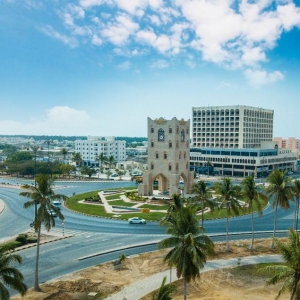
    In urban areas with fewer propagation distances, dense and high-rise buildings, sometimes complicated relief, the accurate 3D geodata is an essential component of RF design: accurate simulation to support deployment, operation, and optimization of mobile networks.
    We use recent vintage high-resolution stereo imagery to create 1 or 2 or 5 m geodata in LOD2 quality. 3D geodata accuracy – 2-3 m in x,y,z.
    This project includes the following cities and countries:

    COUNTRY: BAHRAIN

    City

    Area

    Full 3D Country Model of BAHRAIN791 sq.km


    Download the free 3D data sample of Manama city model. to see more details.

    COUNTRY: OMAN

    City

    Area

    City model of BAHLA17 sq.km
    City model of DUQM58 sq.km
    City model of IBRA43 sq.km
    City model of IBRI45 sq.km
    City model of JALAN BANI BU HASSAN66 sq.km
    City model of NIZWA51 sq.km
    City model of QURIYAT10 sq.km
    City model of SALALA86,6 sq.km
    City model of SINAW10 sq.km
    City model of SUR39 sq.km
    City model of TILKAI4 sq.km

    TOTAL

    429.6 sq.km


    Download the free 3D data sample of MUSCAT city model. to see more details.


    COUNTRY: QATAR

    City

    Area

    3D model for rf planning of DOHA1312 sq.km


    Download the free 3D data sample of DOHA city model. to see more details.

    COUNTRY: UNITED ARAB EMIRATES

    City

    Area

    Number of LOD1 Buildings

    3D Map of ABU DHABI473 sq.km132048
    3D Map of AJMAN65 sq.km50621
    3D Map of DUBAI1628 sq.km296543
    3D Map of FUJAIRAH50 sq.km28885
    3D Map of RAS AL KHAIMAH151 sq.km82248
    3D Map of SHARJAH169 sq.km96017
    3D Map of UMM AL QUWAIN45 sq.km17440
    TOTAL:2578 sq.km703802


    Download the free 3D data sample of UAE city model. to see more details.

    COUNTRY: EGYPT

    City

    Area

    3D City Model of CAIRO2587 sq.km


    Download the free 3D data sample of CAIRO city model. to see more details.

    Digital Surface Model (DSM), Digital Terrain Model (DTM) and Digital Elevation Model (DHM) were produced based on 3D terrain features which were derived from overlapping satellite imagery is taken from two different locations (stereo imagery).

    Highly accurate building vectors with associated height values as attributes are captured through three-dimensional feature extraction in our photogrammetric software.
    Clutter/Land Use/Land Cover describes the surface and built-up features that influence radio wave propagation. They are classified into different classes: classes of built-up areas, water classes, classes of landscape and vegetation. Urban Land Use map is produced from multispectral satellite imagery by the method of automatic classification with subsequent manual photo-interpretation and modification.

    Download the booklet about project "3D RF map of Middle East" to see more details.

    Usually, outside the areas of 3D city coverage, operators still require geodata for RF planning and optimization in suburbs. We propose 2D Urban Model, 2.5D Urban Models, 2D Regional Models with clutter height with 5, 10, 20 m resolution, with DTM, clutter (land use) and vector layers. Our geodata catalogue includes over 1500+ 3D City Models, 4500+ cities 2D Urban Models and 65+ Coutrywide model for regional planning.

    Send us the request for more information

  • 2020-11-04
    Countrywide 3D model of Bahrain 2020

    We continue our excursion to the Middle East ...
    This time Visicom team accomplished a project for the Bahrain telecom market and collected geodata for a 3D model across the country, which is about 766 sq. Km. Most of the area of this marvelous country is a desert with refineries, but the capital of Bahrain - Manama and other settlements are masterpieces of contemporary architecture with complicated architectural shapes of buildings. We were able to partially convey this beauty in our 3D models, which can be observed in the video below.

    This telecom project includes not only the full coverage of 3D geodata of Bahrain but also detailed 3D models of the following settlements:

    • 3d map of Manama - 31.62 sq.km
    • 3d map of Muharraq - 34.6 sq.km
    • 3D map of the Reef - 41 sq.km
    • 3D map of the Sitra - 22.5 sq.km
    • ...

    By the way, this geodata can also be used in other industries and markets, for example, web, electronic games, urban planning, architecture, agriculture, and many others

  • 2020-11-02
    3D GEODATA FOR MAJOR OMAN CITIES

    Any single day without a new 3D project.
    Visicom is pleased to introduce a new one.
    This time it is a 3D model of Oman cities for further telecom market application. Nevertheless, it can be successfully implemented in other markets and projects.

    Stereo 3D City of Oman, 5 m resolution with vegetation as polygons:

    City - Area,

    • 3D map of Bahla - 17 km²
    • 3D map of Duqm - 58 km²
    • 3D map of Ibra - 43 km²
    • 3D map of Ibri - 45 km²
    • 3D map of Jalan Bani Bu Hassan - 66 km²
    • 3D map of Nizwa - 51 km²
    • 3D map of Quriyat - 10 km²
    • 3D map of Salala - 86,6 km²
    • 3D map of Sinaw - 10 km²
    • 3D map of Sur - 39 km²
    • 3D map of Tilkai - 4 km²
      TOTAL: 429,6 km²

    DELIVERED DATASETS Digital Terrain Model (DTM) / Clutter (Land Use) Model / Obstacles Heights Model – 3D Buildings and engineering construction, vegetation / Vector model / Text labels / Orthoimage

  • 2020-10-22
    3D BUILDINGS MODEL OF HUNGARY

    CITIES INCLUDED INTO 3D MAP OF HUNGARY:

    • 3D model of Budapest - 525 sq.km
    • 3D model of Budapest rest metropolitan area - 1105 sq.km
    • 3D model of Debrecen - 460 sq.km
    • 3D model of Kecskemét - 321 sq.km
    • 3D model of Nyíregyháza - 274 sq.km
    • 3D model of Miskolc - 236 sq.km
    • 3D model of Szeged - 207 sq.km
    • 3D model of Bekéscsaba - 193 sq.km
    • 3D model of Székesfehérvár - 170 sq.km
    • and more...
      TOTAL OF 3D AREA - 4628 SQ.KM

    DELIVERED DATASETS
    DTM / Clutter Model (Land Use) / Vector Model / Building footprints

    LANGUAGE SUPPORT HUNGARIAN & ENGLISH

    3D BUILDINGS LOD2 INCLUDE ATTRIBUTES:
    Street name/ Building number /Number of floors /Number of flats / Populations

    Download the booklet about the project "3D map of Hungary" to see more details.
    You may also be interested in: 3D GEODATA FOR EUROPEAN 5G NETWORK DEPLOYMENT

  • 2020-08-31
    Forestry infrastructure mapping

    The events of recent years show that particularly in Ukraine and globally in the world, the demands in wood have been significantly increased. Because of that, many uncontrolled and unauthorized loggings appeared. Thereby we see a stunning decrease of forest areas and as a result a shortening of the naturals lungs of the Earth. Consequently, this leads to crucial changes in climate and the emergence of floods, storms, soil erosions, etc.

    In order to prevent a mass logging and to monitor the number of forestry areas at a state level, it is essential to know the forestry dynamic, it means to monitor all potential changes from year to year. However, there is a question:
    - How to handle such a huge volume of work at a cost-effective price?

    Visicom company has developed and successfully implemented the technology aimed at constant monitoring of forestry areas and vegetation within urban areas based on satellite images. Below we are presenting this approach, which can be deployed either at the local level or at the nationwide level. The proposed technology allows us to preserve the green spaces and to save significant amounts of money, which may have been invested in the deployment of such a monitoring/tracking system.

    1. SATELLITE IMAGES

    Depending on the final models accuracy demands (national, regional, city, local) the images of the various resolution starting from 0.5m (the most accurate data for city and local usage) up to 10m (for national and regional usage) can be used for the mapping of forestry and agriculture areas, city infrastructure, environmental solar/wind energy production projects, etc. Satellite types

    Image 2, Satellite types

    2. FEATURES DETECTION AT THE NATIONAL OR REGIONAL SCALE LEVEL

    The task list might include the following:

    • establishment and maintenance of the national (regional) forest DB;
    • vegetation registration;
    • logging and planting planning;
    • other,

    depending on the demands, the proposed approach includes vegetation areas detection based on satellite images (the picture below depicts the Sentinel image) and further calculation of areas according to regular forest types (foliar, coniferous, mixed)
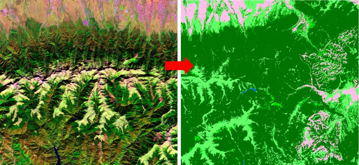
    Vegetation detection using satellite images

    Image 3, Vegetation detection using satellite images

    3. PERMANENT DATA UPDATE

    A permanent data update allows forecasting of increasing and decreasing forestry areas depending on the natural causes and disasters and human activity.
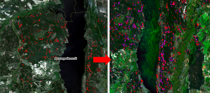
    Permanent detection of forest logging

    Image 4 Permanent detection of forest logging

    Permanent detection of loggings using Sentinel images with simultaneous areas calculation (from 500 sq.km) let control any possible unauthorized loggings and perform the following tasks:

    • Damage estimation and forecast;
    • Statistic data collection regarding humans role in forestry areas reduction;
    • Research the dependence of environmental indicators (in case of any) on areas of green spaces.

    For illustrative purposes please see the following image: Data collected during 2017-2018

    Image 5, Data collected during 2017-2018.

    4. DETAILED MAPPING OF FORESTRY AREAS

    Detailed mapping of forestry areas based on satellite images of 0.5m-2m resolution can be used for various purposes:

    • Control of valuable trees growth;
    • Prediction of floods impact and consequences;
    • Control of fire safety and forecast of damages;
    • Other.

    Vegetation detection featuring the clustered vegetation and classification by types (foliar, coniferous, mixed, unique tree species):
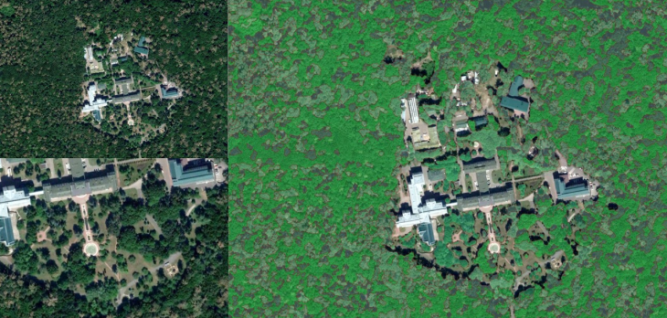
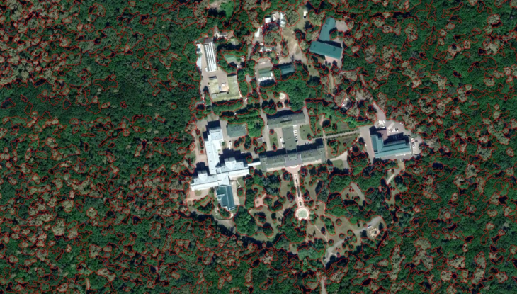
    Vegetation detection featuring the clustered vegetation and classification by types 1

    Vegetation detection featuring the clustered vegetation and classification by types 2

    Vegetation detection featuring the clustered vegetation and classification by types 3

    5. VEGETATION DETECTION IN URBAN AND SUBURBAN AREAS

    This method implies to use the most accurate images of 0.3-1m resolution and is applicable in vegetation detection within city areas: parks, forested parks, gardens, square parks. For each detected parcel, the area is calculated (including bushes, lawns). In addition, the output data can be presented as a detailed map where the trees (up to every single separate tree) can be detected based on the images of high resolution only (HR resolution satellite images).

    In its turn, it will give a possibility for:

    • Registration of vegetation unit, even to within 1 tree;
    • Accurate mapping of vegetation;
    • Maintenance of various environment-oriented DBs (e.g. the DB of the oldest trees )
    • Assessment of the state of the vegetation.

    Geo-DB of the oldest trees

    Image 9, Geo-DB of the oldest trees


    a) The technology of vegetation mapping under the urban setting

    The technology of vegetation mapping under the urban setting

    Image 10, Vegetation mapping in the city

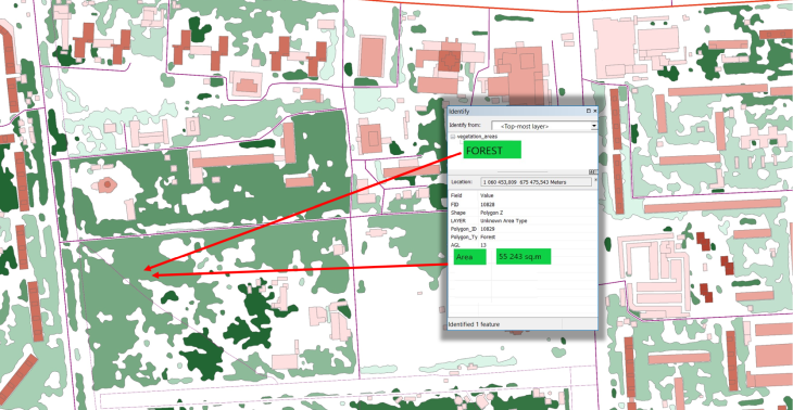
    b) Generating of vegetation vector map: contours, vegetation type, and area
    Vegetation vector map with attributes

    Image 11, Vegetation vector map with attributes
  • 2020-07-17
    3D CITY MODELS OF AUSTRALIAN CITIES 2020

    3D CITIES OF AUSTRALIA 2020

    In urban areas with fewer propagation distances, dense and high-rise buildings, sometimes complicated relief, the accurate 3D geodata is an essential component of RF design: accurate simulation to support deployment, operation, and optimization of mobile networks.
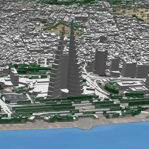
    We use recent vintage high-resolution stereo imagery to create 1 or 2 or 5 m geodata in LOD2 quality. 3D geodata accuracy – 2-3 m in x,y,z.
    This project includes the following cities:

    City

    Area

    Model type

    Melbourne9 486 sq.km
    • 3D MODELS of 2m or 5m resolution
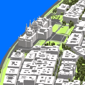
    • 2.5D MODELS of 5m resolution
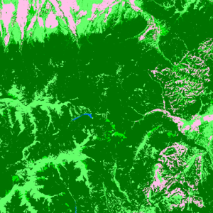
    • 3D MODELS of core cities + 2.5D MODELS of suburbs

    • OPTIONS for VEGETATION REPRESENTATION:

    • - Polygons with average heights

      - 3D Trees model with separate canopies heights

      - Recognition of vegetation types: winter or summer, tropical, sub-tropical

    Brisbane7 462 sq.km
    Perth6 568 sq.km
    Sydney5 176 sq.km
    Adelaide3 541 sq.km
    Canberra1 289 sq.km
    Geelong711 sq.km
    Gold Coast601 sq.km
    Newcastle354 sq.km
    Central Coast353 sq.km


    The total area of the 3D models of Australian cites covers more than 35000 km2.

    Digital Surface Model (DSM), Digital Terrain Model (DTM) and Digital Elevation Model (DHM) were produced based on 3D terrain features which were derived from overlapping satellite imagery is taken from two different locations (stereo imagery).

    Highly accurate building vectors with associated height values as attributes are captured through three-dimensional feature extraction in our photogrammetric software.
    Clutter/Land Use/Land Cover describe the surface and built-up features which influence on radio wave propagation. They are classified into different classes: classes of built-up areas, water classes, classes of landscape and vegetation. Urban Land Use map is produced from multispectral satellite imagery by the method of automatic classification with subsequent manual photo-interpretation and modification.


    Download the free 3D data sample of Brisbane city model and booklet about project "3D RF map of Australian cities" to see more details.

    Usually, outside the areas of 3D city coverage, operators still require geodata for RF planning and optimization in suburbs. We propose 2D Urban Model, 2.5D Urban Models, 2D Regional Models with clutter height with 5, 10, 20 m resolution, with DTM, clutter (land use) and vector layers. Our geodata catalogue includes over 1500+ 3D City Models, 4500+ cities 2D Urban Models and 65+ Coutrywide model for regional planning.

    Send us the request for more information

  • 2020-07-13
    STATE AUTOMOBILE ROADS AGENCY OF UKRAINE STARTED USING VISICOM API

    Our company has been working with the world's leading business players for a long period of time. Among them are Nokia, Huawei, ATDI, Google, TomTom, Vodafone, etc., However, today we are pleased to inform about the recognition we got not from the foreign partners but from our native Ukrainian one, which appreciates our work in the international market, namely the State Agency of Motor Roads of Ukraine (Ukravtodor). This company has connected its own online maps to the Visicom API.
    https://roads.ukravtodor.gov.ua/dashboard/page/map_ukravtodor
    Thanks to many years of hard work and collection of databases, both automated and manual, the map of Ukraine made by Visicom is the most complete, accurate, and informative.
    It is out of the question that the combination of such two "monsters" is a tremendous and accurate project to accomplish. One of the most important issues is about the coordinate systems of them if they are compatible with themselves.
    Undoubtedly, this is a great achievement (https://kmplus.org.ua/ua), which we are happy with and which we are proud of!
    We thank the State Agency of Motor Roads of Ukraine for the recognition. Join us!
    Note: Visicom API is currently available for Ukraine and Belarus

  • 2020-06-04
    3D GEODATA FOR EUROPEAN 5G NETWORK DEPLOYMENT

    OUR 5G PROJECTS IN EUROPE
    VISICOM 3D data contain features of manmade and natural obstacles, as well as precise canopies and trees, that assure accurate 5G networks modeling.

    Italy – Milan
    Hungary – Budapest
    Slovakia – Bratislava
    Czech Republic – Brno
    Czech Republic – Prague
    Sweden – Gothenburg
    Ireland - Dublin –
    Ireland - Castletown –
    France - Marseille
    Spain - Barcelona
    – 16 km2
    – 25 km2
    – 9 km2
    – 30 km2
    – 27 km2
    – 26 km2
    – 35 km2
    – 115 km2
    – 32 km2
    – 30 Area, km2
    – 37 948
    – 29 499
    – 10 042
    – 48 385
    – 30 633
    – 14 477
    – 27 271
    – 212 203
    – 66 314
    – 30 500

    Geodata set includes any 3D obstacles for the best RF planning of 5G network:
    Prague - individual canopy for 5G deployment 2020
    3D trees with individual canopy heights
    Ciudad Real - buildings with sloped roofs for 5G deployment 2020
    3D buildings with sloped roofs and very detailed roofs elements
    The 3D model was produced for the massive MIMO mm-wave network planning and advanced 3D simulation in an urban environment.
    The 2.5 - 3D models alongside the vegetation models are fully optimized for further use with millimeter-wave frequencies and can be used in different specialized tools like Atoll, Asset, Planet, ICS.


    Other 5G projects in Europe: Brussels(Belgium), Athens(Greece), Jorvas(Finland), Warsaw(Poland), Cologne(Germany), London(Great Britain), Cambridge(Great Britain), Cuidad Real(Spain), and many others...

    In order to meet the requirements of the most demanding customers, VISICOM provides the 3D maps comprising the manmade and natural obstacles as well as precise plants information that assures accurate RF planning for 5G modeling.

    📙Please download brochure "3D geodata for European 5G network deployment"
    ☑ Our geodata catalogue includes over 1500 cities across 120 + countries.
    ✉ Contact us to receive a free sample of the 3D city Model.

  • 2020-04-22
    3D MODEL OF MILAN CORE CITY

    We believe that in the very nearest future the beautiful Milan city will be accessible again for business and tourism. Meantime you can use our precise 3D model to research and plan your business and future trips. With no doubts, if you are an RF-engineer, 3D model is the best tool for 5G planning ensuring the development of various IoT services that are actual now as never before.
    The 3D city model of Milan core city was produced with a high level of accuracy and details including a 3D Trees model tailored to the planning of new generation networks. We use recent vintage stereo imagery of 0.3 m resolution and air photos to create 1 m resolution geo-data in LOD2 quality.

    Our 3D maps can be delivered in any popular format:
    ✅ RF-tools: Atoll, Asset, Planet, ISC Telecom, Pathloss, Nokia NetAct, NetPlan …
    ✅ GIS: shp, dwg, obj, rhino, skp, CAD, ESRI ArcGIS

    The data sample are provided at free-of-charge by customer’s request

    We understand the precise geodata requirements that must be met to design next-generation networks in mmWave frequencies range. We also support vertical markets like Smart cities, Transportation, environmental management, etc. Based on our 20-years experience we offer the most cost-effective solution for any territory and in accordance with your budget.

    We also propose 2D Urban Model, 2.5D Urban Models, 2D Regional Models with clutter height with 5, 10, 20 m resolution, with DTM, clutter (land use) and vector layers for RF-planning in suburb.. Our geodata catalogue includes over 4000 cities and 60+ countries.

    Send us the request for more information

  • 2020-03-23
    COVID-19

    Dear Friends, Partners, Customers, Employees, our thoughts are with each of you and your teams at this time. We wish all of you, above all else, health and safety.

    During this difficult and dangerous time for the world's population, we must work together to overcome not only the consequences of COVID-19, but also the global economic crisis, which, as many experts say, will come after it or simultaneously.

    What can we do? Just continue doing our job and be careful.
    5G, due to the application of AI, IoT, Edge will play a crucial role in the global recovery from the COVID-19 pandemic. Therefore, we have provided a remote workplace for each of our employees and our company is still working.

    To see the situation with COVID-19 on the planet generally and in each country separately, below we provide a few links to the maps with actual data reflecting the current status of affairs:

    Global maps (from here ) :
    Coronavirus COVID-19 global cases (Johns Hopkins)
    Novel coronavirus (COVID-19) outbreak timeline map (HealthMap)
    Novel coronavirus infection map (University of Washington)
    COVID-19 surveillance dashboard (University of Virginia)
    Novel coronavirus (COVID-19) situation dashboard (WHO)
    Coronavirus disease 2019 (COVID-19) in the US (CDC)
    Geographical distribution of COVID-19 cases worldwide (ECDC)
    COVID-19 coronavirus tracker (Kaiser Family Foundation)
    COVID-19 coronavirus oubreak (Worldometer)
    Coronavirus: the new disease Covid-19 explained (South China Morning Post)
    Mapping the Wuhan coronavirus outbreak (Esri StoryMaps)

    Ukraine only (newest information):
    Ukraine COVID-19

  • 2020-03-20
    CANADA 3D CITY MODELS

    We contribute to the growth of the mobile network in Canada

    High-resolution geospatial 3D data are vitally important to realize the benefits of the cellular network. Due to the high sensitivity of mmWaves from all obstacles, successful propagation signal setup requires very accurate and detailed obstruction representation including building construction small details and precise 3D canopy.
    Telecommunication operators now are on the stage of signal propagation planning and defining the optimal locations of antennas. 3D Project for Canadian cities for telecom network planning process in the largest population center in Canada includes:

    • 3D City model of Toronto covers 114 sq.km
    • Ottawa – 84 sq.km
    • Edmonton – 76 sq.km
    • Calgary – 133 sq.km
    • Vancouver – 221 sq.km

    3D models of cities meet the requirements of LOD2 quality.
    3D model resolution: 5m.
    3D geodata accuracy – 3-4 m in x,y,z.

    Usually delivered layers:

    • Digital Terrain Model (DTM)
    • ✅ Digital Surface Model (DSM)
    • ✅ Highly accurate 3D building vectors
    • ✅ Clutter/Land Use
    • ✅ 3D Obstacles
    • ✅ Vegetation
    • ✅ Road networks, water bodies, coastline
    • ✅ Solar Energy or Green roof planning

    ☑ More information about 3D geodata for 5G planning.
    ☑ Our geodata catalogue includes over 1500 cities across 120 + countries.
    ✉ Contact us to receive a free sample of the 3D city Model.

  • 2020-03-18
    3D MODEL OF CIUDAD REAL WITH HEIGHTS ATTRIBUTE SLOPED ROOFS

    3D MODEL OF CIUDAD REAL WITH HEIGHTS ATTRIBUTE SLOPED ROOFS

    In urban areas with fewer propagation distances, dense and high-rise buildings, relief, the accurate 3D geodata is an essential component of RF design: accurate simulation to support deployment, operation and optimization of mobile networks. Also, this quality and heights set of geodata can be used in Solar energy planning and Solar Cadastre.

    3D City model of Ciudad Real (Spain) covers the old part of the city. We use recent vintage stereo imagery of 0.3 m resolution to create 2 m high-resolution geodata in the most accurate quality LOD2. 3D geodata accuracy – 2-3 m in x,y,z.

    Digital Surface Model (DSM), Digital Terrain Model (DTM) and Digital Elevation Model (DHM) were produced based on 3D terrain features, which were derived from overlapping satellite imagery is taken from two different locations (stereo imagery).

    The highly accurate building vectors with associated height values as attributes are captured through three-dimensional feature extraction in the photogrammetric apps.

    Clutter/Land Use/Land Cover describes the surface and built-up features, which influence on radio wave propagation. They are classed into different classes: classes of built-up areas, water classes, classes of landscape and vegetation. Urban Land Use map is produced from multispectral satellite imagery by the method of automatic classification with subsequent manual photo-interpretation and modification.

    Download the booklet about the project "3D model and RF map of Ciudad Real (Spain)" to see more details.

    Usually outside the areas of 3D city coverage, operators still require geodata for RF planning and optimization in suburbs. We propose 2D Urban Model, 2.5D Urban Models, 2D Regional Models with clutter height with 5, 10, 20 m resolution, with DTM, clutter (land use) and vector layers. Our geodata catalog includes over 4000 cities and 60+ countries.

    Applications:

    • Environmental Management and Modeling
    • Urban Planning
    • Building Information Modelling
    • WEB-Applications
    • Virtual Games
    • Territorial Marketing
    • Tourism
    • Planning of Utility Networks
    • Real Estate
    • Marketing
    • Disaster Risk Management
    • Wireless Networks Planning
    • mm-wave Planning (5G Planning)
    • Smart Cities
    • Solar Smart Energy Planning and Solar Cadastre

    Send us the request for more information

  • 2019-12-20
    VISICOM COMPLETED PROJECTS

    All the members of Visicom friendly team congratulate our current and future customers with New 2020 Year and Christmas! Wish you all your business goals come true! Hope that 2020 holds success and good fortune in any endeavour you pursue.
    Thank you for interacting with us, we are very thankful!

    We would like to make a quick review about the projects we successfully accomplished in the passing year.

    Summarizing all the finalized works during the 2019 year we can classified them as following:
    ✔ projects for 35 countries;
    ✔ regional models cover about 9590 thousands of sq.km;
    ✔ 3D maps were produced for 25 countries and 216 cities and cover about 32.5 thousands of sq.km;
    ✔ population maps were generated for 9 countries;
    ✔ vector maps as a component of GIS projects cover about 2500 thousands of sq.km

    The projects were different in designation, accuracy, scope and attributive data.
    The cartographic materials, which initially were used for radio signal planning only, have been widely disseminated.
    They were modified into a separate class of geodata, where the following subclasses or vertical markets can be distinctly allocated:
    ✔ telecommunication;
    ✔ smart cities and IOT;
    ✔ architecture;
    ✔ environmental management;
    ✔ retail and geo-marketing;
    ✔ transportation

    Visicom continuously implements innovative technologies and methods of cartographic data processing combining them with already recognized approaches. It allows us to expand the spectrum of geodata production constantly.

    Explore the brochure with full list of our projects completed in 2019

    The off-the-shelf data are available at our website

  • 2019-11-20
    3D MODEL OF MANDALAY (MYANMAR)

    3D MODEL OF MANDALAY

    In urban areas with less propagation distances, dense and high-rise buildings, sometimes complicated relief, the accurate 3D geodata is an essential component of RF design: accurate simulation to support deployment, operation and optimization of mobile networks.

    3D City model of Mandalay covers 215 km2. We use recent vintage stereo imagery 0.3 m resolution to create 2 m high-resolution geodata in LOD2 quality. 3D geodata accuracy – 2-3 m in x,y,z.

    Digital Surface Model (DSM), Digital Terrain Model (DTM) and Digital Elevation Model (DHM) were produced basing on 3D terrain features which were derived from overlapping satellite imagery taken from two different locations (stereo imagery).

    Highly accurate building vectors with associated height values as attributes are captured through three-dimensional feature extraction in our photogrammetric software.

    Clutter/Land Use/Land Cover describe the surface and built-up features which influence on radio wave propagation. They are classified into different classes: classes of built-up areas, water classes, classes of landscape and vegetation. Urban Land Use map is produced from multispectral satellite imagery by method of automatic classification with subsequent manual photo-interpretation and modification.

    See also regional map of Myanmar and 3D City model of Yangon

    Download the free data sample and booklet about project "RF map of Myanmar" to see more details.

    Usually outside the areas of 3D city coverage, operators still require geodata for RF planning and optimization in suburbs. We propose 2D Urban Model, 2.5D Urban Models, 2D Regional Models with clutter height with 5, 10, 20 m resolution, with DTM, clutter (land use) and vector layers. Our geodata catalogue includes over 4000 cities and 60+ countries.

    Send us the request for more information

  • 2019-11-19
    3D MODEL OF YANGON (MYANMAR)

    3D GEODATA OF YANGON

    3D City model of Yangon covers 503 km2. The project was completed for 2 local telecom operators considering their specific RF planning requirements.

    We use recent vintage stereo imagery 0.3 m resolution to create 2 m high-resolution geodata in LOD2 quality. 3D geodata accuracy – 2-3 m in x,y,z.

    Digital Surface Model (DSM), Digital Terrain Model (DTM) and Digital Elevation Model (DHM) were produced based on 3D terrain features which were derived from overlapping satellite imagery is taken from two different locations (stereo imagery).

    Highly accurate building vectors with associated height values as attributes are captured through three-dimensional feature extraction in our photogrammetric software.

    Clutter/Land Use/Land Cover describe the surface and built-up features which influence on radio wave propagation. They are classified into different classes: classes of built-up areas, water classes, classes of landscape and vegetation. Urban Land Use map is produced from multispectral satellite imagery by the method of automatic classification with subsequent manual photo-interpretation and modification.

    See also a regional map of Myanmar

    Download the free data sample and booklet about project "RF map of Myanmar" to see more details.

    Usually, outside the areas of 3D city coverage, operators still require geodata for RF planning and optimization in suburbs. We propose 2D Urban Model, 2.5D Urban Models, 2D Regional Models with clutter height with 5, 10, 20 m resolution, with DTM, clutter (land use) and vector layers. Our geodata catalogue includes over 4000 cities and 60+ countries.

    Send us the request for more information

  • 2019-11-18
    2d country map of Myanmar

    2D Regional mode

    2D Regional model is a medium-to-low-resolution database designed for large-area RF planning. It's the ideal solution in initial network planning and geodata for network planning in rural areas.

    2D Regional RF map of Myanmar covers 676578 km2. We have used recent vintage imagery Sentinel of 10 m resolution to create 20 m resolution geodata. SRTM/ASTER DEM data and available topo maps were processed for DTM/DSM production. Clutter/Land Use/Land Cover are classified into different classes: classes of built-up areas, water classes, classes of landscape and vegetation. Land Use map was produced from multispectral satellite imagery by the method of automatic classification with subsequent manual photo-interpretation and modification.
    Yangon 2D Regional model allows quickly visualize terrain and clutter over large areas or entire countries. It consists of the following integrated layers: digital terrain model (DTM), clutter, linear vectors, orthoimage.

    Data can be delivered in all major RF planning formats Regional Models may be integrated with 2D Urban ones to improve their accuracy in urban and suburban areas.

    Download the booklet about the project "RF map of Myanmar" and free data sample to see more details.
    See also Myanmas 3D Model for RF planning and GIS project:
    - 3D Yangon model - 3D Mandalay model

    Send us the request for more information

  • 2019-09-10
    Tunis 3D for 5G pilot

    3D geodata for Tunis

    Tunisia has started working on the preparing for the launch of 5G networks. The national regulator announced a tender for a study on the technical and economic conditions of launching 5G in the country. It’s expected that 5G licenses will be available in 2021.
    Visicom is ready to support all Tunisian mobile operators in 5G developing.

    1m resolution 3D Map of Tunis is ready to be used in 5G network testing. 3D pilot project covers 30 sq.km of Tunis core city featuring 3D buildings with small roof features, 3D bridges, 3D Trees with assigned canopy heights.
    3D geodata can be delivered in any RF-tools format:
    Atoll, Asset, Planet, ISC Telecom, Pathloss, Nokia NetAct, NetPlan …

    Advanced 3D geodata and implementation of 5G network infrastructure, mm-wave antennas, massive MIMO and fiber wireless access (FWA) technologies enable to present new spectrum of services for the end users. It brings closer the citizens of Tunisia to the IoT technology opportunities such as:
    connected vehicles, smart transport, enterprise low latency IoT, augmented/virtual/mixed reality (AR, VR, MR) etc.

    Based on our 19-years experience we offer the most effective solution for any territory at affordable price.

    Learn more at our webpage "Pilot Projects for 5G Planning over the World"
    Download the free data sample of 3D digital models
    Send us your request for more detailed information

  • 2019-09-05
    3D Model of San Diego

    3D Model of San Diego harbor area

    Geodata include 3D buildings with slope roofs and very detailed roofs elements as well as 3D Trees with individual heights. The 3D Model was produced for the massive MIMO mm-wave network planning and advanced 3D simulation in urban environment.

    Covered area – 50 sq.km
    Can be delivered in any format:
    ✅ RF-tools: Atoll, Asset, Planet, ISC Telecom, Pathloss, Nokia NetAct, NetPlan …
    ✅ GIS: shp, dwg, obj, rhino, skp, CAD, ESRI ArcGIS

    San-Diego-Inside-First

    5G supports higher mobile data rates and Internet of Things (IoT) connectivity that will revolutionize all interactions in our life. 5G enhances 4G LTE capabilities for new IoT applications and creates new opportunities to improve business efficiency. 5G presents exciting possibilities for mobile like cars and vehicles connection, augmented and virtual reality, healthcare monitoring etc.
    Therefore all operators need smart planning to open new prospects provided by 5G technologies.

    San-Diego-Inside-Second

    3D Geodata are basic and keystone for 5G planning. We understand the precise geodata requirements to design next-generation networks in mmWave frequencies range. Based on our 19-years experience we offer the most cost-effective solution for any territory fitted to your budget. Please visit our webpage "Pilot Projects for 5G Planning over the World".

    Download the free data sample of 3D digital models
    Send us request for more information

  • 2019-07-25
    GET YOUR FREE VOUCHER FOR INTERGEO EVENT

    25 years INTERGEO

    Intergeo, provides an opportunity for our customers to visit the exhibition, which will take place in Stuttgart from September 17 till 19, free of charge. Don't miss the geospatial highlight of the year!

    You can't pass up an opportunity to get the latest information about new technologies in geospatial industry, contact us to get your free ticket!

    Visicom will showcase the best-advanced projects, including the 3d digital high precision models for 5G generation network planning.
    (Messe Stuttgart, Messepiazza 1, 70629 Stuttgart, Hall 1, 3, 4 | Entrance East).

    Contact us to get your FREE ticket!

  • 2019-07-23
    3D Geodata For Kuwait

    3D Model of Kuwait

    Visicom is a leading company in the creation of high-quality geospatial data.
    We are working on creating 3D geodata for 5G planning, 2D models, 2.5D models, Population maps, and Regional maps.

    Kuwait 3D City package details:
    ✅ 3D city model covers core city area.
    ✅ 3D Geodata accuracy - 2 m in X,Y,Z.
    ✅ 3D Vegetation and Bridges.

    Also, our company is developing CAD models to provide a full spectrum of services for customers from all over the world, and for all needs.

    Please explore samples of Kuwait
    Our geodata catalogue includes over 5000 cities across 120+ countries.
    Send us request for more information

  • 2019-07-15
    3D CAD models in Digital Mapping

    BIM 3d city model

    Visicom produces a range of 3D building products for 3D visualization, CAD, GIS application as well as for architectural modeling.
    3D modeling is a highly important part in the scenario of the architecture design industry to provide clients with a clearer and realistic look.
    With 3D architecture models, you can easily see the effect in overall design without incurring much cost.
    3D Building products are delivered in formats ready for most 3D application tools like Rhino, ArcGIS and CAD compatible formats.

    Our 3D models provide:

    ✅ True architectural geometry
    ✅ 2-3 m accuracy
    ✅ Roof details
    ✅ Vegetation
    ✅ Precise terrain features

    You can download CAD samples here, just enter “CAD” in search line
    Available cities: Baku, Belgrade, Bucharest, Dhaka, Dubai, Dublin, Havana, London, Makkah, Riaydh

  • 2019-07-05
    Visicom recent projects 2 quarter 2019

    The latest updates from Visicom

    During the 2nd quarter of 2019, Visicom produced Regional models for Romania and Mali countrywide, 15 3D City Models and 27 3D Models in 8 countries tailored to 5G planning.

    2D Regional Models:
    ✅ Romania - Total area: 238 397 sq.km
    Mali - Total area: 1 240 192 sq.km

    2D Urban Model:
    ✅ India - Hyderabad

    Standard 3D City Models:
    ✅ South Africa - Capetown
    ✅ Uzbekistan - Tashkent and 14 biggest cities

    3D City Models for 5G Planning, IoT:
    ✅ Canada - Montreal
    ✅ France - Marseille
    Greenland - 14 biggest cities
    ✅ Kuwait - Al Kuwait
    ✅ North Korea - Pyongyang
    ✅ Taiwan - Taipei
    ✅ Tunisia - Tunis
    United Arab Emirates - Abu Dhabi, Ajman, Dubai, Fujarah, Ras Al Khaiman, Sharjah, Umm Al Quwain

    ☑ You can download for free a List of our recent projects 2nd quarter 2019
    ✉ Contact us to receive a free sample of the 3D city Model

  • 2019-07-02
    3D Model of Marseille, France

    Digital Map of Marseille

    Recently Visicom produced 3D map of Marseille, France that will be used for 5G networks planning! Our maps are based on the most recent satellite imagery and therefore reflect an up-to-date snapshot of urban growth. This is crucial for accurate and up-to-date radio planning, especially in areas with widespread construction.

    ✅ This geographic product covers 27 sq. km of Marseille city area (France)
    ✅ 3D vegetation Model: a group of trees and individual trees with canopy heights
    ✅ 3D Buildings: small roof details, sloping roofs, elevators shafts, tower, spires
    ✅ 3D Bridges with detailed constructions
    ✅ Our data are compatible with any propagation models

    Visicom team presents 3D geodata of Marseille tailored to the new standards of advanced networks. We support requirements of 5G networks providing the best level of details featuring the for obstacles that might block or weaken the radio signals.

    Please explore 3D sample dataset of Marseille
    ✉ Please contact us if you need some additional information
    🔎 Here you can find free data samples of over 5000 cities

  • 2019-06-21
    PYONGYANG 3D GEODATA

    3D MODEL OF PYONGYANG

    This mapping product covers 700 sq. km of Pyongyang 3D city model (Capital of North Korea).
    The delivered data has been converted into the ESRI GRID / SHP format.
    3D geodata accuracy – 2 m in X,Y,Z.

    The delivered package includes:

    Digital Terrain Model
    Digital Surface Model
    ✅ Land Use Map
    Building Heights Model
    ✅ Vector Data
    ✅ Text labels
    ✅ Orthoimage

    We understand the precise geodata requirements to design next-generation networks in mmWave frequencies range. Based on our 19-years experience we offer the most cost-effective solution for any territory fitted to your budget. Please visit our webpage "Pilot Projects for 5G Planning over the World".

    Download the free data sample of Pyongyang digital model in order to explore more details
    Send us your request for more information
    Video report available here

  • 2019-05-28
    3D MODEL FOR 5G PLANNING OF MONTREAL, CANADA

    Visicom contributes to 5g network planning in Montreal

    5G networks will be launched in the early 2020s. Telecommunication operators now are on the stage of signal propagation planning and defining of the optimal locations of antennas. High-resolution geospatial 3D data are vitally important to realize the benefits of the 5G network. Due to the high sensitivity of mmWaves from all obstacles, successful propagation signal setup requires very accurate and detailed obstruction representation including building construction small details and precise 3D canopy.

    3D project for Montreal city center provides high-quality 3D model fitted to all requirements of 5G planning.

    3D model covers 50 km2 of the core city in LOD2 quality.
    3D model resolution: 1m or 2m.
    3D geodata accuracy – 2-3 m in x,y,z.

    Usually delivered layers:

    • Digital Terrain Model (DTM)
    • ✅ Digital Surface Model (DSM)
    • ✅ Highly accurate 3D building vectors
    • ✅ Clutter/Land Use
    • ✅ 3D Obstacles
    • ✅ Vegetation
    • ✅ Road networks, water bodies, coastline Additional layers: Street names, Addresses

    ☑ More information about 3D geodata for 5G planning.
    ☑ Our geodata catalogue includes over 1500 cities across 120 + countries.
    ✉ Contact us to receive a free sample of the 3D city Model.

  • 2019-05-15
    GEODATA OF GREENLAND CITIES

    3D MODELS OF GREENLAND FOR 5G PLANNING

    The aim of the project: 3D digital maps for radio planning purposes, 3D cities map area: 54.3 sq.km.
    3D models have been obtained by neural network algorithms, which were used for 3D features recognition and height detection.
    The final datasets were optimized using machine learning algorithms and finalized by semiautomatic verification procedures at the final stage.

    3D City Models, 2 m resolution:
    Aasiaat, 4 sq.km
    Illussat, 8 sq.km
    Kangerlussuaq, 9 sq.km
    Kulusuk, 1sq.km
    Maniitsoq, 4 sq.km
    Nanortalik, 2 sq.km
    Narsaq, 4 sq.km
    Nuuk, 14 sq.km
    Paamiut, 3 sq.km
    Qaqortoq, 2 sq.km
    Sisimiut, 7 sq.km
    Tasiilaq, 2 sq.km
    Upernavik, 2 sq.km
    Uummannaq, 2 sq.km

    The 3D city models include the following geopackage content:

    • DTM
    • Clutter model/ Land Use
    • Obstacles Height Model as a matrix comprising buildings and engineering constructions
    • Vector model featuring precise 3D building footprints
    • Text Labels

    ✉ Please contact us if you need some additional information.
    🔎 Here you can find free data samples of over 5000 cities. VISICOM'S GEODATA

  • 2019-04-23
    2D GEODATA FOR MALI

    2D REGIONAL MAP OF MALI

    2D Regional map is a medium resolution database generated for nationwide RF network optimization.
    2D Regional map of Mali (Modèle (Сarte) numérique 2d du Mali) covers 1 257 000 sq. km. The latest vintage of Sentinel satellite images were used for land use structure recognition.
    DTM produced from recalculated SRTM V4 data and topographic maps of 1:100 000 scales. Clutter/Land Use/Land Cover are classified into 19 classes of landscape, vegetation, and built-up areas.

    terrainMali

    Model package contains:

    • ✅ Land Use Map (Clutter Model)
    • ✅ Digital Terrain Model (DTM)
    • ✅ Vector layers
    • ✅ Orthoimage

    Data are ready for immediate delivery in major RF planning formats – Mentum Planet, Atoll, Asset, ESRI .shp

    Let us know if you need additional info.
    Our geodata database contains over 4000 cities and 80+ countries.
    Please visit our web-page: 2D REGIONAL MODELS.

  • 2019-04-12
    BELGRADE 3D AND 2D GEODATA

    BELGRADE 3D AND 2D DIGITAL MAP

    Map dataset contains Digital Terrain Model (DTM), extremely precise 3D Buildings with roof details, 3D Vegetation and Bridges, Clutter/Land Use/Land Cover, Obstacles (Clutter) Heights, Transportation Networks.

    • 3D Geodata resolution - 2m or 5m
    • 2D Map of suburb are delivered in 10/20m resolution
    • 206 sq.km - 3D Map of the core city
    • 2811 sq.km - 2D Map of suburban areas
    • Supporting any RF tools format

    Our geodata, created specifically for telecommunication business, gives explicit information concerning the 3D urban location in order to assist operators design plan and to improve the performance of their radio networks. Visicom's advanced mapping products support (Atoll, Asset, Planet, Mentum Planet, Pathloss formats).

    Please explore 3D sample dataset of Belgrade.
    Contact us to receive a free sample.

  • 2019-03-27
    3D MAPS FOR EUROPE

    3D GEODATA FOR 5G DEVELOPMENT IN EUROPE

    Visicom ® to extend the mapping product range for 5G networks planning.
    Having 20 years of experience in cooperation with Telcos and mobile operators worldwide, Visicom extends the variety of geospatial data enabling 5G planning phase both in the urban and rural environment.
    The 2.5 - 3D models alongside the vegetation models are fully optimized for further use with millimetre wave frequencies and can be used in different specialized tools like Atoll, Asset, Planet, ICS.

    Belgium - Brussels
    Greece - Athens
    Finland - Jorvas
    Poland - Warsaw
    Spain - Barcelona
    Ireland - Dublin
    Great Britain - London
    Romania - Bucharest + 7 major cities
    Berlin – 1062 Area, km2
    Cologne – 625 Area, km2
    Frankfurt – 248 Area, km2
    Hamburg – 770 Area, km2
    Jena – 119 Area, km2
    Leipzig – 370 Area, km2
    München – 651 Area, km2
    More cities will be available soon.

    In order to meet the requirements of the most demanding customers, Visicom provides the 3D maps comprising the manmade and natural obstacles as well as precise plants information that assures accurate RF planning for 5G modelling.

    ☑ Our geodata catalogue includes over 1500 cities across 120 + countries.
    ✉ Contact us to receive a free sample of the 3D city Model.

  • 2019-03-20
    GEODATA FOR GERMANY

    DIGITAL MAPS OF GERMAN CITIES FOR 5G NETWORKS PLANNING

    🔔 We would like to propose accurate 3D maps for the 5G network pre-planning phase for a reasonable level of prices.
    Visicom ® produces high-level geodata for 5G planning because we have 20 years of experience to cooperate with telcos and operators world wide.* That is why you can be sure of the quality of our products.
    We have 3D buildings and vegetation models for 5G network planning which are fully optimized for use with Millimeter Wave (mmWave) frequencies and can be used in different tools like Atoll, Asset, Planet, ICS etc.

    2.5D – 3D CITY MODELS, 5m resolutions

    ✅ Berlin – 1062 Area, km2
    ✅ Cologne – 625 Area, km2
    ✅ Frankfurt – 248 Area, km2
    ✅ Hamburg – 770 Area, km2
    ✅ Jena – 119 Area, km2
    ✅ Leipzig – 370 Area, km2
    ✅ München – 651 Area, km2
    More cities will be available soon.

    Content of 3D models:

    • DTM
    • Land Use/Clutter Model
    • Clutter Heights Model
    • 2D building layer with an indication of the height
    • Basic vector layers: roads, streets, water lines etc.

    Our geodata catalogue includes over 5000 cities across 120+ countries.
    ✉ Contact us to receive a free sample of the 3D city Model.

  • 2019-03-12
    VISICOM 5G PILOT PROJECTS

    VISICOM 5G PILOT PROJECTS

    Explore Visicom 3D geodata tailored to 5G planning. 1 m resolution data provide highly accurate and precise input for efficient and accurate predictions of radio wave propagation in the core city.
    3D models include:

    • 3d buildings;
    • 3d vegetation;
    • 3d bridges.

    3D Model includes not only high-resolution buildings but also individual trees and their canopy height with 1-2 m accuracy.
    Start your 5G planning project with advanced quality geodata to have the best understanding of your complex urban environment.

    Europe: Barcelona (Spain), Athens (Greece), Brussels (Belgium).
    USA: Chicago, Sacramento, New York, San Francisco, Santa Clara, Euless.
    Asia: Malaysia, South Korea, Hong Kong, Singapore, China.
    Africa: Lagos (Nigeria).
    Middle East: Dubai, Abu Dhabi (UAE).
    We support any RF tools format.

    Please download brochure 5G Trials Visicom
    Contact us to receive a free sample of 3D city Model.
    Our geodata catalogue includes over 5000 cities across 120+ countries.

  • 2019-02-27
    3D GEODATA FOR HONG KONG

    3D GEODATA FOR 5G PLANNING OF HONG KONG

    • Resolution: 1/2/5m
    • Vertical accuracy - 1-2m
    • Planimetric accuracy - 1-2m

    Our geodata for Hong Kong is the best solution for planning a 5G network. High-resolution, up-to-date map provides the valuable context—an advantageous difference between making informed decisions in the mm-wave environment and taking a guess.

    3D models of Hong Kong include:

    • 3D buildings - small roof details, 1-2m accuracy
    • 3D bridges - detailed engineering constructions
    • 3D vegetation - with assigned height attributes

    3D maps are essential for any smart GIS project. 3D data enable creating virtual urban-utility platforms to make city management more efficient. Visicom manufactures precise, geographically accurate and up-to-date 3D rendering of cities that contains all infrastructure features at various levels of detail.

    Send us a request for more information
    You can download for free a brochure of Hong Kong 3D map.
    List of OTS 3D City Models for SEA Region.
    Please explore the 3D sample dataset of Hong Kong in Atoll, Mentum, ESRI formats.

  • 2019-02-20
    2.5D or 3D geodata which one do you choose?

    COMPARATIVE ANALYSIS OF 3D AND 2.5D MODELS

    Which one do you choose?
    2.5D GEODATA
    From 5m to 10m resolution models.

    Usually, it’s used for the suburb and rural areas.

    Provide precise and cost-effective modelling of obstacles height over large areas.

    Individual buildings footprints, trees, bridges etc. and their heights are not included.

    • 2.5D buildings: buildings and buildings blocks with assigned height attributes, 3m-5m accuracy.
    • 2.5D vegetation: vegetation polygons with assigned height attributes, 5m accuracy.
    • DSM/DTM: 3-5m accuracy in terrain features.
    • SOURCES: 1.5-2.5 m resolution Stereo satellite imagery.

    3D GEODATA
    1-2-5 m resolution geodata for highly accurate networks planning.

    All individual features of roofs and buildings construction are provided.

    3D vegetation or individual trees are included.

    • 3D buildings: 1-3 m accuracy in height, with small roof details.
    • 3D bridges: 1-3 m accuracy and detailed engineering construction.
    • 3D vegetation: detailed vegetation with assigned height attributes.
    • Clutter/land use: includes all land-use features and detailed vegetation layer.
    • SOURCES: 0.3-0.5-1 m resolution stereo satellite imagery, air photos, Lidar data.

    Send us your request for more information and free data samples of 3D and 2.5D models.
    Our geodata catalogue includes over 4000 cities and 80+ countries.

  • 2019-02-15
    3D MAPS FOR ARCHITECTURAL PROJECTS

    3D MAPS FOR ARCHITECTURAL PROJECTS

    Visicom produces a range of 3D building products for 3D visualization, CAD, GIS application as well as for architectural modeling.

    3D modeling is a highly important part in the scenario of architecture design industry to provide clients with a clearer and realistic look.

    With 3D architecture models, you can easily see the effect in overall design without incurring much cost.

    3D Building products are delivered in formats ready for most 3D application tools like Rhino, ArcGIS and CAD compatible formats.
    Our 3D models provide:

    • True architectural geometry
    • 2-3 m accuracy
    • Roof details
    • Vegetation
    • Precise terrain features


    Our geodata catalogue includes over 5000 cities across 120+ countries.
    Send us a request for more information
    You can download for free the sample. (Dublin)

  • 2019-02-11
    3D GEODATA OF SOUTH KOREA

    3D GEODATA FOR 5G PLANNING OF SOUTH KOREA

    If you need to plan the 5G network we have the best solution.
    Visicom will be able to help you with this objective.


    3D SOUTH KOREA project is the latest achievement for our geodata portfolio.
    Please explore samples of South Korea.

    • The 3D city models covering 1064 SQ.KM area of 13 cities across 4 provinces.
    • Budget 3D solution for suburbs and rural areas.
    • 3D geodata accuracy - 3-5 m in X,Y,Z.
    • 3D Vegetation and Bridges.
    • The free data sample of 3D map tailored for 5G planning.


    South Korea 3D Geodata contains highly accurate 3D Buildings with roof details, Clutter/Land Use/Land Cover Model, Vector model, Digital Terrain Model (DTM), Digital Surface Model (DSM), Obstacles Heights (Clutter Heights) Model.


    Visicom focusing on the telecom market for more than 18 years, that’s why you can be sure of the quality of our product.
    Our digital mapping solutions are widely used for world global companies.


    Download the brochure and free data sample of 3D map tailored for 5G planning for more details.
    Our geodata catalogue includes over 5000 cities across 120+ countries.
    Send us request for more information

  • 2019-02-04
    Finland map project tailored to the rural scenario of 5G network planning

    Jorvas (Finland) 3D

    Jorvas (Finland) 3D Dataset was produced as a demo map package for accurate planning of 5G networks and IoT services. The dataset used for radio wave signal simulation in mm-wave 3.5 GHz band rural scenario while 5G and 3D network planning using Visicom highly accurate 3D Trees model (3d Canopy model).

    Rural 3D Model features:
    - 1m resolution 3d buildings with small roof details
    - 1-2m in terrain features
    - detailed vector vegetation up to separate trees with assigned heights
    - derived from high resolution stereo images (0,3-0,5m resolution)
    - tailored to mmWave frequencies characteristics and IoT requirements
    - support of any customizable geodata formats

    3D geodata package for 5G rural Planning contains: Digital Terrain Model (DTM), Digital Surface Model (DSM), highly accurate 3D Buildings with roof details, 3D Trees Model (3D Canopy Model), Clutter/Land Use/Land Cover Model, Obstacles Heights (Clutter Heights) Model, Vector model, Transportation networks etc.

    3D geodata package for IoT could be customized in any representation. The main data layers are 3d low-poly building footprints with assigned attributes of heights, vector vegetation up to alone standing trees with heights, detailed road network, engineering constructions as vectors (namely, bridges, overpasses etc).

    Download the brochure and free data sample of 3D rural map tailored for 5G planning for more details.

    Our geodata catalogue includes over 5000 cities across 120+ countries.

    Send us your request for more information

  • 2019-01-16
    3D MODELS OF Algerian CITIES

    Algeria 3D city package details:

    1. (Land Use) model - 1/2/5 m resolution options in matrix representation;
    2. Digital Terrain Model (DTM) - 1/2/5 m resolution options in matrix representation;
    3. Digital Heights Model (Obstacles matrix, clutter height data) - 1/2/5 m resolution options in matrix representation;
    4. 3D Vector layers of building footprints, bridges and vegetation;
    5. Full road, hydrography vectors layers for each Algeria city;
    6. Detailed Population Maps for each city (in raster and vector representation);
    7. Compatible with Atoll, Mentum Planet, ICS Telecom or any other RF formats.

    Please download the data sample of Algerian cities project and brochure

    The full list of off-the-shelf Algeria 3D maps for Radio Frequency planning presented below:

    3D model of AinBeida – 18 sq km;
    3D model of Algiers – 841 sq km;
    3D model of Annaba – 174 sq km;
    3D model of Batna – 63 sq km;
    3D model of Bechar – 43 sq km;
    3D model of Bejaia – 45 sq km;
    3D model of Biskra – 61 sq km;
    3D model of Blida – 226 sq km;
    3D model of BordjbouArreridj – 27 sq km;
    3D model of Bousaada – 30 sq km;
    3D model of Chlef – 35 sq km;
    3D model of Constantine – 249 sq km;
    3D model of Djelfa – 36 sq km;
    3D model of ElEulma – 20 sq km;
    3D model of ElOued – 61 sq km;
    3D model of Ghardaia – 18 sq km;
    3D model of Guelma – 17 sq km;
    3D model of Jijel – 22 sq km;
    3D model of Khenchela – 37 sq km;
    3D model of Laghouat – 60 sq km;
    3D model of Mascara – 19 sq km;
    3D model of Medea – 21 sq km;
    3D model of Mostaganem – 35 sq km;
    3D model of M'Sila – 32 sq km;
    3D model of Oran – 228 sq km;
    3D model of Ouargla – 92 sq km;
    3D model of Relizane – 26 sq km;
    3D model of Saida – 25 sq km;
    3D model of Setif – 52 sq km;
    3D model of SidibelAbbes – 43 sq km;
    3D model of Skikda – 47 sq km;
    3D model of SoukAhras – 21 sq km;
    3D model of Tebessa – 39 sq km;
    3D model of Tiaret – 32 sq km;
    3D model of Tindouf – 17 sq km;
    3D model of TiziOuzou – 14 sq km;
    3D model of Tlemcen – 10 sq km;
    3D model of Touggourt – 31 sq km;

  • 2019-01-15
    Countrywide map of Algeria 2D

    ALGERIA 2D

    Project for Radio Frequency planning, Geoinformation System and WEB-applications and contains:
    Please download the data sample of Algeria project and data specification

    data for RF planning:
    2D Regional Model of Algeria – 2325731 sq km

    and

    data for GIS project and WEB project:
    Map of Algeria – 2325731 sq km

    Map Project package includes such datasets as:

    Digital Terrain Model (DTM);
    • Land Use Map (Clutter Model) in matrix representation;
    • Text labels;
    • Vector layers.
    • Population map for Algeria (whole country)

  • 2018-12-20
    Romania countrywide map project for telecom operator

    Romania digital map

    Visicom has finished the 2D Regional model that would be used as a digital map for radio frequency planning as part of Telecom project provided by the Romanian mobile operator (telco 3d map).
    The Romania digital map covers the whole territory of the country (238 000 sq.km) with 10m resolution quality.
    It's the best solution for the initial network planning and network planning in rural areas.

    The Romania digital map includes such datasets as:
    1. Digital Terrain Model/DTM 2. Clutter/Land Use Classification/Land Cover Model
    3. Vector Model (detailed road network
    4. Population map as grid (matrix) and vectors with blocks of populated areas
    5. The detailed administrative division for whole country

    In order to satisfy the upcoming 5G implementation were additionally produced the highly accurate 3D models with a 1-2 m resolution of the biggest Romania cities. Please explore more regarding "Romania 3D city digital maps" and "Bucharest 3D city model".

    Romania digital model could be used as a GIS and base map for LTE planning and simulation, IoT, land planning, population distribution modelling.

    Send us the request for more information

  • 2018-12-10
    Sacramento 3d digital map for LTE, 5G, IoT/ US market case study

    Sacramento 3d digital map

    Visicom enhanced coverage at the US market and has finished 8 map projects in 2018 for 5G, IoT and smart city services.

    Main features of the latest digital geodata package for Sacramento:

    1. 3D geodata accuracy is 1-2 meters in X,Y,Z along with over than 99% completeness of buildings layer for each city.
    2. For production were used neural networks algorithms with semiautomatic post-processing to ensure the positional and vertical accuracy of buildings and trees.
    3. Sacramento 3D City geodata could be recalculated in any customized data format.

      Explore brochure with technical details for Sacramento and related US digital maps

    The Sacramento (US) digital map package for Radio Network Planning and simulation (5G, LTE) includes:
    Digital Terrain Model (DTM), Digital Surface Model (DSM), Highly accurate 3D Buildings with roof details, 3D vectors of Vegetation and Bridges, Vector Trees Model, Clutter/Land Use/Land Cover, Obstacles (Clutter) Heights, transportation network/roads, vector data layers and Population map.

    The Sacramento (US) 3D digital map package for GIS-projects/services (BIM, IoT, smart city, a base map for navigation/land management) includes:
    3D building footprints, built-up-blocks bridges, overpasses, roads, vegetation (classified by types), POI (points of interest), hydrography, population distribution models.

    Our geodata catalogue includes over 4600 cities and 110+ countries.

    Send us your request for more information

  • 2018-11-21
    3D Digital Maps of 86 Thailand cities for LTE, 5G, IoT

    Thailand 3D

    Visicom finished the huge Thailand Map Project for Thai mobile operator and extend the 3D digital map coverage over 86 biggest Thailand cities with a total area of 4310 sq.km.

    Data relevance: 2017-2018

    The Thailand digital map package for Radio Network Planning and simulation (5G, LTE) includes:
    Digital Terrain Model (DTM), Digital Surface Model (DSM), Highly accurate 3D Buildings with roof details, 3D vectors of Vegetation and Bridges, Clutter/Land Use/Land Cover, Obstacles (Clutter) Heights, transportation network/roads, vector data layers and Population map.

    The Thailand 3D digital map package for GIS-projects/services (BIM, IoT, smart city, a base map for navigation/land management) includes:
    3D building footprints, built-up-blocks bridges, overpasses, roads, vegetation (classified by types), POI (points of interest), hydrography, population distribution models.

    3D geodata accuracy is 2-3 meters in X,Y,Z along with over than 98% completeness of buildings layer for each city .

    Thailand 3D City geodata could be recalculated in any customized data format.

    Download the brochure with detailed coverage of Thailand city maps in order to explore more details.

    Our geodata catalogue includes over 4600 cities and 110+ countries.

    Send us your request for more information

  • 2018-10-15
    VISICOM DIGITAL MAP PROJECTS, Q3 2018

    VISICOM PROJECTS Q3 2018

    • 3 Countrywide Models: Belarus, Nepal, Zambia. Total area - 1 107 394 sq.km
    • 2D Urban Models of the biggest Zambia cities
    • 3D City Models of the 20 biggest Nepal cities
    • 3D Model of Hanoi (Vietnam) - 400 sq,km of extra-accurate data
    • 3D Model of Havana (Cuba) - 70sq.km of geodata for IoT, RF-Planning
    • Pilot digital map projects for 5G planning in the USA, UAE, Singapore, South Korea, Nigeria, Belgium.

    Visicom geodata is fully compatible with the requirements of RF Planning (LTE, 4G, 5G), IoT, Smart City projects.

    Download Q3 2018 projects overview for more information .

    Contact us and order free data samples.

  • 2018-10-02
    Brussels (Belgium) Geodata for 5G network planning and IoT

    GEODATA FOR 5G NETWORK PLANNING

    Brussels (Belgium) 3D Dataset were produced as pilot package dataset for accurate planning of 5G networks and IoT services.

    Brussels 3D Model features:
    - 1m resolution 3d buildings with small roof details
    - 1-2m in terrain features
    - detailed vector vegetation up to separate trees
    - derived from high resolution stereo images (0,3-0,5m resolution)
    - tailored to mmWave frequencies characteristics and IoT requirements
    - support of any customizable geodata formats

    Brussels 3D geodata package for RF Planning contains: Digital Terrain Model (DTM), Digital Surface Model (DSM), highly accurate 3D Buildings with roof details, 3D Vegetation and Bridges, Clutter/Land Use/Land Cover Model, Obstacles Heights (Clutter Heights) Model, Vector model, Transportation networks etc.

    Brussels 3D geodata package for IoT could be customized in any representation. The main data layers are 3d low-poly building footprints with assigned attributes of heights, vector vegetation up to alone standing trees with heights, detailed road network, engineering constructions as vectors (namely, bridges, overpasses etc).

    Download the brochure and free data sample of Brussels map package for more details.

    Our geodata catalogue includes over 4500 cities across 110+ countries.

    Send us your request for more information

  • 2018-09-11
    Singapore Geodata for 5G network Planning

    Singapore Geodata for 5G network Planning

    Explore the opportunity to improve your planning process with sophisticated 3D Geodata made specifically for 5G network designing.

    3D Model of Singapore is a project for 5G implementation and test drive. We used the last available high-resolution satellite images to meet the advanced requirements of new-generation networks.

    1m resolution 3D Model provides:

    - 3D BUILDINGS with a high level of roof details

    - 3D BRIDGES with detailed engineering constructions

    - 3D TREES (VEGETATION) MODEL made specifically for 5G network

    Visicom’s 3D data meet the features of 5G signal sensitivity and provide absolutely critical accuracy required for modelling precise 5G network propagation characteristics.

    Download the free 3D sample of Singapore model and Singapore 5G report.

    Explore more

    Please contact us for additional information

  • 2018-09-06
    3D Maps for 5G pilot projects

    Explore our 3D Maps for 5G pilot projects all over the world

    1m resolution 3D Maps with detailed 3D Trees layer were produced for testing, planning and trials of 5G Networks.

    Territory of US: Chicago, New York, Santa Clara, San Francisco

    Europe: Barcelona, Brussels

    Asia: Seoul, Singapore

    Middle East: Dubai

    Small cell geodata. 5G cell planning in mm wave sprectrum requires advanced accuracy for geodata, namely using of such map layers as tree (canopy) heights and 3d buildings with detailed roof details both in vector and matrix representation.

    Download the 3D Geodata overview.

    Send us your request for more information or for free data sample.

  • 2018-08-30
    Havana 3D map project for RF Planning

    80 sq,km of Havana 3D city map (Cuba) was the produced for one of the local telecom companies.

    It is one more step of Visicom intensifying walk into Americas map market.

    Havana Geodata Dataset contains: Digital Terrain Model (DTM), Digital Surface Model (DSM), highly accurate 3D Buildings with roof details, 3D Vegetation and Bridges, Clutter/Land Use/Land Cover Model, Obstacles Heights (Clutter Heights) Model, Vector model, Transportation networks and Population map.
    3D geodata accuracy – 2-3 m in X,Y,Z.

    In addition, Havana 3D map package could be used for any GIS, IoT planning projects, all data formats are supported.

    Download the free data sample of Havana digital model in order to explore more details.

    Our geodata catalogue includes over 4000 cities and 80+ countries.

    Send us your request for more information

  • 2018-07-25
    3D GEODATA FOR DUBAI CITY (UAE)

    3D GEODATA FOR DUBAI

    Dubai 3D Model – is a 1500 sq.km of advanced accuracy 3D Map produced for accurate planning of 5G networks.

    Dubai 3D Model features:
    - 1m resolution 3d buildings with small roof details
    - 1-2m in terrain features
    - Precise and detailed bridges and overpasses
    - Tailored to mmWave frequencies characteristics

    Dubai 3D Geodata contains: Digital Terrain Model (DTM), Digital Surface Model (DSM), highly accurate 3D Buildings with roof details, 3D Vegetation and Bridges, Clutter/Land Use/Land Cover Model, Obstacles Heights (Clutter Heights) Model, Vector model, Transportation networks.

    Dubai 3D Model is compatible with any RF planning software and propagation models. Dubai 3D map package could be used for any GIS projects, all data formats are supported.

    Download the brochure and free data sample of Dubai 3D digital model for more details.

    Our geodata catalogue includes over 4000 cities and 80+ countries.

    Send us your request for more information

  • 2018-07-08
    PAPUA NEW GUINEA (PNG) POPULATION MAP PROJECT

    PAPUA NEW GUINEA

    The Population Distribution Model of Papua New Guinea (PNG) covers the whole country - 462 840 km2
    As sources for population map production were used:

    • Visicom clutter model (calculated on the base of accurate vector layers derived from high and middle-resolution satellite imagery and the results of Sentinel/Landsat satellite images classification);
    • Population data figures such as Official Census data for Papua admin divisions, projection figures and population growth coefficients (provided by the National Statistics Office of Papua New Guinea);
    • Boundaries of administrative units with associated population figures (namely, for admin level 4 - Local-Level Government (LLG)/Ward – 297);
    • Visicom population map methodology for model calculation.

    Papua population map produced for use in RF planning demand as raster matrix in the GeoTIFF and GRD formats. The dataset could be presented as a vector map with an assigned population quantity and density per city blocks.

    The resulting Papua Population map dataset could be used for such demands as national economic planning, accomplishing public services, cultural construction tasks, backhaul planning, preliminary planning of mobile or telecom networks.

    In addition, the population map could be integrated with Visicom Countrywide Model for Papua New Guinea including datasets for the whole country: 3D maps for biggest cities, Vector model, Clutter Model, DTM, Heights Model.

    Explore more regarding Visicom Population data products

    Order free Papua population map sample here

  • 2018-07-05
    3D GEODATA FOR 11 CITIES OF PALESTINE (WEST BANK AND GAZA)

    3d geodata of Palestine

    Total coverage of Palestine (West Bank and Gaza) 3D city maps is 557 km2

    This project includes the following cities (areas):

    • Ramalla -33 sq.km
    • AlRam - 4 sq.km
    • Salfit - 3 sq.km
    • Qalqilia - 9 sq.km
    • Bethlehem - 22 sq.km
    • Jenin - 16 sq.km
    • Jericho - 34 sq.km
    • Tulkarem - 27 sq.km
    • Hebron - 66 sq.km
    • Nablus -8 sq.km
    • Gaza – 295 sq.km

    Palestine (West Bank) 3D geodata are produced to be used in any RF planning tool etc.

    Delivered layers:

    • Digital Terrain Model (DTM): 2 m resolution
    • Digital Height Model (DHM): 2 m resolution
    • 3D Building Model: 2 m resolution
    • Accuracy of Building heights: 2m
    • Accurate clutter classifications: 3-4 m plane accuracy
    • Accurate Street Vector classifications: 3-4 m plane accuracy

    Highly accurate Palestine (West Bank) building vectors with associated height values as attributes are captured through three-dimensional feature extraction in our photogrammetric software.

    Clutter/Land Use/Land Cover describe the surface and built-up features which influence on radio wave (RF) propagation. Land Use map is produced from multispectral satellite imagery by the method of automatic classification with subsequent manual photo-interpretation and modification.

    Please download free 3D data sample for Gaza with 1m resolution . Sample dataset presented in Atoll, Asset, Planet formats.

    We propose 2D Urban Models, 2.5D Urban Models, 2D Regional Models with 5 m and 10 m resolutions.

    3D maps of cities are fully compatible with Visicom 2D Urban maps of Palestine (West Bank), Visicom geodata for IoT, LTE, smart cities, etc.

    Ask us for more information.

  • 2018-06-29
    3D GEODATA FOR MAJOR ROMANIAN CITIES

    3D GEODATA FOR MAJOR ROMANIAN CITIES

    3D city models produced for Atoll RF planning tool and cover 1334 sq.km area of major Romanian cities:

    • Brasov – 130 sq.km
    • Bucharest – 410 sq.km
    • Cluj – 116 sq.km
    • Constanca –179 sq.km
    • Craiova – 147 sq.km
    • Iasi –125 sq.km
    • Oradea – 127 sq.km
    • Timisoara – 100 sq.km

    Data contain Digital Terrain Model (DTM), Highly accurate 3D Buildings with roof details, 3D Vegetation and Bridges, Clutter/Land Use/Land Cover, Obstacles (Clutter) Heights, Transportation networks and Population map. 3D geodata accuracy – 2-3 m in X,Y,Z.

    Our geodata made specifically for telecom industry provide precise knowledge about the 3D environment in order to help operators design and improve the performance of their radio networks. 3d network planning for 5g.

    Visicom’s advanced mapping products support any RF tool format (Atoll, Asset, Planet, Mentum Planet, Pathloss etc.)

    Learn more about 2.5D Urban Models for suburbs as more cost-effective solution, 2D Models for regions and countrywide coverage.

    Download the free data sample of Bucharest digital model in order to explore more details.

    Our geodata catalogue includes over 4000 cities and 80+ countries.

    Send us your request for more information

  • 2018-06-20
    3D GEODATA FOR BUCHAREST CITY (ROMANIA)

    3D GEODATA FOR BUCHAREST

    410 sq,km of Bucharest city (Romania) was the first 3D map among other 3D mapping models for 9 biggest Romania cities.
    Bucharest 3D model produced for one of the biggest Romanian operators for 4G network development using Atoll RF planning tool.

    Bucharest Geodata Dataset contains: Digital Terrain Model (DTM), Digital Surface Model (DSM), highly accurate 3D Buildings with roof details, 3D Vegetation and Bridges, Clutter/Land Use/Land Cover Model, Obstacles Heights (Clutter Heights) Model, Vector model, Transportation networks and Population map.
    3D geodata accuracy – 2-3 m in X,Y,Z.

    In addition, Bucharest 3D map package could be used for any GIS, IoT planning projects, all data formats are supported.

    Download the free data sample of Bucharest digital model in order to explore more details.

    Our geodata catalogue includes over 4000 cities and 80+ countries.

    Send us your request for more information

  • 2018-06-05
    Santa Clara Pilot Geodata for 5G network Planning

    PILOT GEODATA

    Explore the opportunity to improve your planning process with sophisticated 3D Geodata made specifically for 5G network designing.

    3D Model of Santa Clara is a pilot project for 5G implementation and test drive. We used the last available high-resolution satellite images and Lidar data to meet the advanced requirements of new-generation networks.

    1m resolution 3D Model provides:

    • 3D BUILDINGS with a high level of roof details
    • 3D BRIDGES with detailed engineering constructions
    • 3D TREES (VEGETATION) MODEL made specifically for 5G network

    Visicom’s 3D data meet the features of 5G signal sensitivity and provide absolutely critical accuracy required for modeling precise 5G network propagation characteristics.

    Download the free 3D sample of Santa Clara model and booklet regarding project "RF geodata for Santa Clara".

    Explore more

    Please contact us for additional information

  • 2018-06-04
    VISICOM PROJECTS 1-2 quarters 2018

    VISICOM PROJECTS 1-2 quarters 2018

    • 3 Countrywide Models: Total area - 3 064 578 sq.km
    • Population maps: Myanmar and Papua New Guinea
    • 2D Urban Models of the biggest United Kingdom cities
    • 3D Models of the biggest Romanian cities
    • 3D Model of Dubai -1500 sq,km of extra-accurate data
    • 71 3D City Models for 8 countries with total area 9525 sq.km
    • Pilot projects for 5G planning in US cities

    Download Visicom’s overview of the mentioned Digital mapping Projects for more information .

    Contact us and order free data samples.

  • 2018-05-31
    Barcelona 3D Geodata

    BARCELONA 3D

    3D City model covers 100 km2 of dense urban CBD area of Barcelona.

    Visicom has currently finished 3D model dataset with advanced accuracy suitable for the needs of 5G planning, smart city planning, IoT.

    Barcelona Geodata parameters in brief:

    • 1-2m in X,Y,Z;
    • 1m resolution matrixes of obstacles and clutter models;
    • 3d builidng footprints (including roof features - up to 4sq.km)
    • 3d vector trees model
    • 3d vector bridges and overpasses layer

    Source material - aerial imagery with the 20cm resolution that gives the opportunity to extract more accurate urban environment data giving detailed roof features and separate trees.

    Download the free data sample of Barcelona digital model in order to explore more details.

    Our geodata catalogue includes over 4000 cities and 60+ countries.

    Send us your request for more information

  • 2018-05-02
    Visicom is looking for digital map resellers

    VISICOM INVITES PROFESSIONAL RESELLERS FOR THE DISTRIBUTION OF DIGITAL MAPPING PRODUCTS WORLDWIDE FOCUSING ON TELECOM MARKET.

    If you would like to become a distributor of Visicom products, please contact us: radioplan@visi.com.ua.

    Please feel free to contact us in order to get additional information.

  • 2018-04-03
    2D RF model of Connecticut state (USA)

    2D RF model of Connecticut state (USA)

    2D Regional model is a medium-to-low-resolution database designed for large-area RF planning. It's the ideal solution in initial network planning and network planning in rural areas.

    2D Regional RF map of Connecticut (USA) covers 14 400 km2. We have used recent vintage imagery Sentinel of 10 m resolution to create 20 m resolution geodata. SRTM/ASTER DEM data and available topo maps were processed for DTM/DSM production. Regional Connecticut Clutter Clutter/Land Use/Land Cover are classified into different classes: classes of built-up areas, water classes, classes of landscape and vegetation. Land Use map was produced from multispectral satellite imagery by method of automatic classification with subsequent manual photo-interpretation and modification.
    2D Regional model allows quickly visualize terrain and clutter over large areas or entire countries. It consists of the following integrated layers: digital terrain model (DTM), clutter, linear vectors, orthoimage.
    Regional Connecticut DTM Data can be delivered in all major RF planning formats Regional Models may be integrated with 2D Urban ones to improve their accuracy in urban and suburban areas.

    Download free data sample to see more details.
    See also another USA 3D Models for RF planning and GIS project:
    3D Model of New York (USA)
    3D Model of San Francisco (USA)

    Send us the request for more information

  • 2018-03-22
    3D model of New York (USA)

    3D GEODATA OF NEW YORK (USA)

    In urban areas with fewer propagation distances, dense and high-rise buildings, sometimes complicated relief, the accurate 3D geodata is an essential component of RF design: accurate simulation to support deployment, operation and optimization of mobile networks.

    We use recent vintage stereo imagery 0.3 m resolution to create 2 m high-resolution geodata in LOD2 quality. 3D geodata accuracy – 2-3 m in x,y,z.
    Digital Surface Model (DSM), Digital Terrain Model (DTM) and Digital Elevation Model (DHM) were produced based on 3D terrain features which were derived from overlapping satellite imagery is taken from two different locations (stereo imagery).

    Highly accurate building vectors with associated height values as attributes are captured through three-dimensional feature extraction in our photogrammetric software.

    ImgNewYork

    Clutter/Land Use/Land Cover describe the surface and built-up features which influence on radio wave propagation. They are classified into different classes: classes of built-up areas, water classes, classes of landscape and vegetation. Urban Land Use map is produced from multispectral satellite imagery by the method of automatic classification with subsequent manual photo-interpretation and modification.

    Download the free data sample of New York city model and booklet about a project "RF map of New York" to see more details.
    See also about 3D model of San Francisco

    Usually, outside the areas of 3D city coverage, operators still require geodata for RF planning and optimization in suburbs. We propose 2D Urban Model, 2.5D Urban Models, 2D Regional Models with clutter height with 5, 10, 20 m resolution, with DTM, clutter (land use) and vector layers. Our geodata catalogue includes over 4000 cities and 60+ countries.

    Send us the request for more information

  • 2018-03-02
    2D city map of SAR (South African Republic) cities (update)

    2D South African Republic

    Project for Radio Frequency planning, Geoinformation System and WEB-applications contains:

    data for RF planning:

    2D Regional Model of Cape Town – 3877 sq.km
    2D Regional Model of Johannesburg – 3182 sq.km
    2D Regional Model of Johannesburg CBD – 118 sq.km
    2D Regional Model of Johannesburg Sandton – 12 sq.km
    2D Regional Model of Pretoria – 1763 sq.km
    2D Regional Model of Pretoria CBD – 23 sq.km
    2D Regional Model of Pretoria Centurion – 19 sq.km
    2D Regional Model of Pretoria menlyn – 7 sq.km
    2D Regional Model of Durban – 1073 sq.km
    2D Regional Model of Port Elizabeth – 551 sq.km
    2D Regional Model of Port Elizabeth CBD – 38 sq.km
    2D Regional Model of Bloemfontein – 436 sq.km
    2D Regional Model of Bloemfontein CBD – 34 sq.km
    2D Regional Model of Polokwane – 99 sq.km
    2D Regional Model of Polokwane CBD – 25 sq.km
    2D Regional Model of Durban – 57 sq.km

    data for GIS project and WEB project:
    Map of Cape Town – 3877 sq.km
    Map of Johannesburg – 3182 sq.km
    Map of Johannesburg CBD – 118 sq.km
    Map of Johannesburg Sandton – 12 sq.km
    Map of Pretoria – 1763 sq.km
    Map of Pretoria CBD – 23 sq.km
    Map of Pretoria Centurion – 19 sq.km
    Map of Pretoria menlyn – 7 sq.km
    Map of Durban – 1073 sq.km
    Map of Port Elizabeth – 551 sq.km
    Map of Port Elizabeth CBD – 38 sq.km
    Map of Bloemfontein – 436 sq.km
    Map of Bloemfontein CBD – 34 sq.km
    Map of Polokwane – 99 sq.km
    Map of Polokwane CBD – 25 sq.km
    Map of Durban – 57 sq.km

    2D Regional model is a medium-to-low-resolution database designed for large-area RF planning. It's the ideal solution in initial network planning and network planning in rural areas. 2D Regional RF map of SAR (South African Republic) cities (2D city models) covers more than 11314 sq.km.
    We have used recent vintage imagery Sentinel of 2 m resolution to create 5 m resolution geodata.
    Herbon 2D DHM
    SRTM/ASTER DEM data and available topo maps were processed for DTM/DSM production.
    2D DTM
    Clutter/Land Use/Land Cover are classified into different classes: classes of built-up areas, water classes, classes of landscape and vegetation. Land Use map was produced from multispectral satellite imagery by the method of automatic classification with subsequent manual photo-interpretation and modification.
    2D clutter web
    2D Regional model allows quickly visualize terrain and clutter over large areas or entire countries. It consists of the following integrated layers: digital terrain model (DTM), clutter, linear vectors, orthoimage.
    Data can be delivered in all major RF planning formats.
    Regional Models may be integrated with 2D Urban ones to improve their accuracy in urban and suburban areas.

    See also 2D Country Models of West Bank (Palestine) for RF planning and GIS project:

    Send us the request for more information

  • 2018-02-21
    High precision 2D city map of West Bank cities

    2D CITY MAP OF WEST BANK CITIES

    Project for Radio Frequency planning, Geoinformation System and WEB-applications contains:

    data for RF planning:
    2D Regional Model of Al-Ram (West Bank) – 3 sq km
    2D Regional Model of Bethlehem (West Bank) – 17,9 sq km
    2D Regional Model of Hebron (West Bank) – 48 sq km
    2D Regional Model of Jenin City (West Bank) – 14,9 sq km
    2D Regional Model of Jericho (West Bank) – 32,7 sq km
    2D Regional Model of Nablus City (West Bank) – 46,6 sq km
    2D Regional Model of Qalqilia (West Bank) – 8,7 sq km
    2D Regional Model of Ramalla (West Bank) – 29 sq km
    2D Regional Model of Salfit (West Bank) – 3,2 sq km
    2D Regional Model of Tulkarem (West Bank) – 26,4 sq km

    data for GIS project and WEB project:
    Map of Al-Ram (West Bank) – 3 sq km
    Map of Bethlehem (West Bank) – 17,9 sq km
    Map of Hebron (West Bank) – 48 sq km
    Map of Jenin City (West Bank) – 14,9 sq km
    Map of Jericho (West Bank) – 32,7 sq km
    Map of Nablus City (West Bank) – 46,6 sq km
    Map of Qalqilia (West Bank) – 8,7 sq km
    Map of Ramalla (West Bank) – 29 sq km
    Map of Salfit (West Bank) – 3,2 sq km
    Map of Tulkarem (West Bank) – 26,4 sq km

    2D Regional model is a medium-to-low-resolution database designed for large-area RF planning. It's the ideal solution in initial network planning and network planning in rural areas. 2D Regional RF map of West Bank cities (2D city models) covers more than 230 sq.km.
    We have used recent vintage imagery Sentinel of 1 m resolution to create 2 m resolution geodata.
    Herbon 2D DHM
    SRTM/ASTER DEM data and available topo maps were processed for DTM/DSM production.
    Herbon 2D DTM
    Clutter/Land Use/Land Cover are classified into different classes: classes of built-up areas, water classes, classes of landscape and vegetation. Land Use map was produced from multispectral satellite imagery by method of automatic classification with subsequent manual photo-interpretation and modification.
    Jericho 2D clutter web
    2D Regional model allows quickly visualize terrain and clutter over large areas or entire countries. It consists of the following integrated layers: digital terrain model (DTM), clutter, linear vectors, orthoimage.
    Data can be delivered in all major RF planning formats.
    Regional Models may be integrated with 2D Urban ones to improve their accuracy in urban and suburban areas.

    See also 2D Country Models of West Bank (Palestine) for RF planning and GIS project:

    Send us the request for more information

  • 2018-02-19
    3D CITY MODELS OF INDONESIAN CITIES

    Indonesia 3D

    Total area of the 3D models of Indonesian cites covers more than 1900 km2.
    This project includes the following cities:
    3D model of Surabaya – 442 sq.km
    3D model of Bandung – 303 sq.km
    3D model of Denpasar – 249 sq.km
    3D model of Medan – 238 sq.km
    3D model of Semarang – 186 sq.km
    3D model of Palembang – 171 sq.km
    3D model of Makassar – 163 sq.km
    3D model of Malang – 79 sq.km
    3D model of Padang – 72 sq.km

    In urban areas with fewer propagation distances, dense and high-rise buildings, sometimes complicated relief, the accurate 3D geodata is an essential component of RF design: accurate simulation to support deployment, operation and optimization of mobile networks. We use recent vintage stereo imagery 0.3 m resolution to create 2 m high-resolution geodata in LOD2 quality. 3D geodata accuracy – 2-3 m in x,y,z.
    Digital Surface Model (DSM), Digital Terrain Model (DTM) and Digital Elevation Model (DHM) were produced based on 3D terrain features which were derived from overlapping satellite imagery is taken from two different locations (stereo imagery).
    Surabaya DHM Highly accurate building vectors with associated height values as attributes are captured through three-dimensional feature extraction in our photogrammetric software.
    Bandung Vector Clutter/Land Use/Land Cover describe the surface and built-up features which influence on radio wave propagation. They are classified into different classes: classes of built-up areas, water classes, classes of landscape and vegetation. Urban Land Use map is produced from multispectral satellite imagery by the method of automatic classification with subsequent manual photo-interpretation and modification.
    Surabaya Clutter See also a regional map of Indonesia

    Download the free data sample of Bandung city model and booklet about project "RF map of Indonesia" to see more details.

    Usually, outside the areas of 3D city coverage, operators still require geodata for RF planning and optimization in suburbs. We propose 2D Urban Model, 2.5D Urban Models, 2D Regional Models with clutter height with 5, 10, 20 m resolution, with DTM, clutter (land use) and vector layers. Our geodata catalogue includes over 4000 cities and 60+ countries.

    Send us the request for more information

  • 2018-02-16
    3D map of Jakarta (Indonesia)

    3D digital map of Jakarta (Indonesia)

    3D City model of Jakarta covers 1727 km2.
    In urban areas with fewer propagation distances, dense and high-rise buildings, sometimes complicated relief, the accurate 3D geodata is an essential component of RF design: accurate simulation to support deployment, operation and optimization of mobile networks. We use recent vintage stereo imagery 0.3 m resolution to create 2 m high-resolution geodata in LOD2 quality. 3D geodata accuracy – 2-3 m in x,y,z.
    Digital Surface Model (DSM), Digital Terrain Model (DTM) and Digital Elevation Model (DHM) were produced based on 3D terrain features which were derived from overlapping satellite imagery is taken from two different locations (stereo imagery).
    Jakarta DEM Highly accurate building vectors with associated height values as attributes are captured through three-dimensional feature extraction in our photogrammetric software.
    Jakarta Vector Jakarta ClutterSee also a regional map of Indonesia

    Download the free data sample of Jakarta city model and booklet about project "RF map of Indonesia" to see more details.

    Usually, outside the areas of 3D city coverage, operators still require geodata for RF planning and optimization in suburbs. We propose 2D Urban Model, 2.5D Urban Models, 2D Regional Models with clutter height with 5, 10, 20 m resolution, with DTM, clutter (land use) and vector layers. Our geodata catalogue includes over 4000 cities and 60+ countries.

    Send us the request for more information

  • 2018-02-15
    2D Country map of Indonesia

    2D Country map of Indonesia

    2D Regional model is a medium-to-low-resolution database designed for large-area RF planning. It's the ideal solution in initial network planning and network planning in rural areas.

    2D Regional RF map of Indonesia covers 1 920 000 km2. We have used recent vintage imagery Sentinel of 10 m resolution to create 20 m resolution geodata. SRTM/ASTER DEM data and available topomaps were processed for DTM/DSM production. Clutter/Land Use/Land Cover are classified into different classes: classes of built-up areas, water classes, classes of landscape and vegetation. Land Use map was produced from multispectral satellite imagery by method of automatic classification with subsequent manual photo-interpretation and modification.
    2D Regional model allows quickly visualize terrain and clutter over large areas or entire countries. It consists of the following integrated layers: digital terrain model (DTM), clutter, linear vectors, orthoimage.
    Indonesia DTM Data can be delivered in all major RF planning formats Regional Models may be integrated with 2D Urban ones to improve their accuracy in urban and suburban areas.

    Download the booklet about project "RF map of Indonesia" and free data sample to see more details.
    See also Indonesian 3D Models for RF planning and GIS project:

    Send us the request for more information

  • 2018-02-06
    3D CITY MODEL OF MECCA (Saudi Arabia)

    3D GEODATA OF MECCA

    In urban areas with fewer propagation distances, dense and high-rise buildings, sometimes complicated relief, the accurate 3D geodata is an essential component of RF design: accurate simulation to support deployment, operation and optimization of mobile networks.

    3D City model of Mecca (Makkah) covers 193 km2. We use recent vintage stereo imagery 0.3 m resolution to create 2 m high-resolution geodata in LOD2 quality. 3D geodata accuracy – 2-3 m in x,y,z.

    Digital Surface Model (DSM), Digital Terrain Model (DTM) and Digital Elevation Model (DHM) were produced based on 3D terrain features which were derived from overlapping satellite imagery is taken from two different locations (stereo imagery).

    Highly accurate building vectors with associated height values as attributes are captured through three-dimensional feature extraction in our photogrammetric software.

    Clutter/Land Use/Land Cover describe the surface and built-up features which influence on radio wave propagation. They are classified into different classes: classes of built-up areas, water classes, classes of landscape and vegetation. Urban Land Use map is produced from multispectral satellite imagery by the method of automatic classification with subsequent manual photo-interpretation and modification.

    See also a regional map of Saudi Arabia

    Download the free data sample and booklet to see more details.

    Usually, outside the areas of 3D city coverage, operators still require geodata for RF planning and optimization in suburbs. We propose 2D Urban Model, 2.5D Urban Models, 2D Regional Models with clutter height with 5, 10, 20 m resolution, with DTM, clutter (land use) and vector layers. Our geodata catalogue includes over 4000 cities and 60+ countries.

    Send us the request for more information

  • 2018-01-16
    VISICOM PROJECTS 2017: IMPRESSIVE RESULTS

    VISICOM PROJECTS 2017

    • 13 Countrywide Models with total area 6 435 761 sq.km
    • 300 2D Urban Models for 16 countries with total area 105 000 sq.km
    • 99 3D City Models for 17 countries:
    • Total area: 23134 sq.km
    • Total quantity of buildings: 24 200 317

    Regional Countrywide Models 2017

    Download Projects overview for more information.(pdf)
    Download free data samples from Visicom catalog or for any territory will be provided on your request

  • 2017-12-28
    HAPPY NEW YEAR AND MARRY CHRISTMAS

    New Year

    Happy New Year and Merry Christmas!

    May the New Year bring with it exciting plans and turn it into great achievements!
    May trusted and reliable partners support You and contribute to successful and ambitiouse business projects and further creative success in the comming year!

    Visicom team with hope for successful fruitful business cooperation with you in future

  • 2017-12-14
    Regional map of West Bank (Palestine)

    Regional map of West Bank

    Project for Radio Frequency planning, Geoinformation System and WEB-applications and contains:

    geodata for RF planning:
    2D Regional Model of West Bank (Palestine) – 6 911 sq km

    and

    data for GIS project and WEB project:
    Map of West Bank (Palestine) – 6 911 sq km

    2D Regional model is a medium-to-low-resolution database designed for large-area RF planning. It's the ideal solution in initial network planning and network planning in rural areas. 2D Regional RF map of West Bank (Palestine) (country model) covers 6 911 sq.km.
    We have used recent vintage imagery Sentinel of 10 m resolution to create 20 m resolution geodata.
    West Bank (Palestine) DHM
    SRTM/ASTER DEM data and available topomaps were processed for DTM/DSM production.
    West Bank (Palestine) DTM
    Clutter/Land Use/Land Cover are classified into different classes: classes of built-up areas, water classes, classes of landscape and vegetation. Land Use map was produced from multispectral satellite imagery by method of automatic classification with subsequent manual photo-interpretation and modification.
    West Bank (Palestine) clutter
    2D Regional model allows quickly visualize terrain and clutter over large areas or entire countries. It consists of the following integrated layers: digital terrain model (DTM), clutter, linear vectors, orthoimage.
    Data can be delivered in all major RF planning formats
    Regional Models may be integrated with 2D Urban ones to improve their accuracy in urban and suburban areas.

    See also West Bank (Palestine) 2D Urban City Models for RF planning and GIS project:

    Send us the request for more information

  • 2017-12-01
    Partial country map of Saudi Arabia

    SAUDI ARABIA

    Project for Radio Frequency planning, Geoinformation System and WEB-applications includes the most populated territories of Saudi Arabi and contains:

    data for RF planning:
    2D Regional Model of Saudi Arabi – 563830 sq.km (total country 2149690 sq.km)

    and

    data for GIS project and WEB project:
    Map of Saudi Arabi – 563830 sq.km

    Project package includes 3 types of data representation:

    1. Vector data model provided as a composition of vector layers in ESRI ArcGIS, Mapinfo or any other GIS formats.
    2. Raster data model presented in Geo-tif format and includes:
      Digital Elevation Model (DEM) (data placed in Height.tif file);
      • Land Use Map (Clutter Model)
    3. Service Data for RF planning tools:
      Digital Terrain Model (DTM);
      • Land Use Map (Clutter Model) in matrix representation;
      • Text labels;
      • Vector layers.
  • 2017-11-29
    3D MODELS OF DUBLIN (IRELAND)

    3D MODELS OF DUBLIN

    Project for Radio Frequency planning, Geoinformation System and WEB-applications and contains:

    geodata for RF planning: 3D City model of Dublin covers 83 sq.km
    In urban areas with fewer propagation distances, dense and high-rise buildings, sometimes complicated relief, the accurate 3D geodata is an essential component of RF design: accurate simulation to support deployment, operation and optimization of mobile networks. We use recent vintage stereo imagery 0.3 m resolution to create 2 m high-resolution geodata in LOD2 quality. 3D geodata accuracy – 2-3 m in x,y,z.
    Digital Surface Model (DSM), Digital Terrain Model (DTM) and Digital Elevation Model (DHM) were produced based on 3D terrain features which were derived from overlapping satellite imagery is taken from two different locations (stereo imagery).
    Highly accurate building vectors with associated height values as attributes are captured through three-dimensional feature extraction in our photogrammetric software.
    Clutter/Land Use/Land Cover describe the surface and built-up features which influence on radio wave propagation. They are classified into different classes: classes of built-up areas, water classes, classes of landscape and vegetation. Urban Land Use map is produced from multispectral satellite imagery by the method of automatic classification with subsequent manual photo-interpretation and modification.

    data for GIS project and WEB project: Map of Dublin – 83 sq km
    Dublin Vector Usually outside the areas of 3D city coverage, operators still require geodata for RF planning map and optimization in suburbs. We propose 2D Urban Model, 2.5D Urban Models, 2D Regional Models with clutter height with 5, 10, 20 m resolution, with DTM, clutter (land use) and vector layers. Our geodata catalogue includes over 4000 cities and 60+ countries.

    Send us the request for more information

  • 2017-11-07
    3D MODELS OF GEORGIAN CITIES

    3D MODELS OF GEORGIAN CITIES

    Project for Radio Frequency planning, Geoinformation System, Smart Cities and WEB-applications and contains:

    data for RF planning:
    3D model of Tbilisi & Rustavi – 747 sq km;
    3D model of Poti – 249 sq km;
    3D model of Kutaisi – 161 sq km;
    3D model of Batumi – 115 sq km;
    3D model of Senaki – 103 sq km;
    3D model of Zugdidi – 87 sq km;
    3D model of Khashuri – 79 sq km;
    3D model of Gori – 56 sq km;
    3D model of Telavi – 42 sq km;

    data for GIS project and WEB project:
    Map of Tbilisi & Rustavi – 747 sq km;
    Map of Poti – 249 sq km;
    Map of Kutaisi – 161 sq km;
    Map of Batumi – 115 sq km;
    Map of Senaki – 103 sq km;
    Map of Zugdidi – 87 sq km;
    Map of Khashuri – 79 sq km;
    Map of Gori – 56 sq km;
    Map of Telavi – 42 sq km;

    Project package includes 3 types of data representation:

    1. Vector data model provided as a composition of vector layers in ESRI ArcGIS or Mapinfo formats.
    2. Raster data model presented in Geo-tif format and includes:
      • Digital Elevation Model (DEM) (data placed in Height.tif file);
      • Land Use Map (Clutter Model)
    3. Service Data for RF planning tools:
      Digital Terrain Model (DTM);
      • Land Use Map (Clutter Model) in matrix representation;
      • Text labels;
      • Vector layers.

    Please download the data sample of Algerian cities project or brochure

  • 2017-10-09
    Intergeo 2017

    INTERGEO 2017 PHOTO REPORT

    It is the third time that Visicom took part in INTERGEO, the world’s largest event for geodesy, geoinformation and land management that comprises a conference and a trade fair.

    This year’s event in Berlin has attracted more than 18,000 visitors from over 100 countries.

    Visicom was one of 580 exhibitors from 37 countries focused on geo-IT target markets.

    The event was successful and very useful for us.
    We met partners and customers from all over the world and had a chance to experience an impressive spirit of innovation, watch wide-ranging presentations and have interactive discussions about different aspects of 3D-modelling.

    Digitalization and innovations in terms of BIM (Building Information Model), virtual reality, UAVs (Unmanned Aerial Vehicle) and smart cities will be high on the agenda next year at INTERGEO and we will be happy to represent Ukraine at the world's most important communications and networking forum for geo-IT.
    Intergeo 2017 Berlin search for new contacts
    Intergeo 2017 Berlin search for new contacts Intergeo 2017 Berlin search for new contacts Intergeo 2017 Berlin search for new contacts Intergeo 2017 Berlin search for new contacts Intergeo 2017 Berlin search for new contacts Intergeo 2017 Berlin search for new contacts

  • 2017-09-27
    3D MODELS OF BOLIVIAN CITIES

    3D GEODATA OF BOLIVIAN CITIES

    Project for Radio Frequency planning, Geoinformation System and WEB-applications and contains:

    data for RF planning:
    3D model of La Paz – 287,5 sq km;
    3D model of Cochabamba – 288 sq km;
    3D model of Potosi – 17 sq km;
    3D model of Caranavi – 2,4 sq km;
    3D model of Tarija – 48,1 sq km;
    3D model of Trinidad – 20 sq km;
    3D model of Sucre – 25,7 sq km;
    3D model of Achacachi – 1,5 sq km;
    3D model of Oruro – 52,4 sq km;
    3D model of Pando – 11,7 sq km;
    3D model of Santa Cruz – 201 sq km;

    data for GIS project and WEB project:
    Map of La Paz – 287,5 sq km;
    Map of Cochabamba – 288 sq km;
    Map of Potosi – 17 sq km;
    Map of Caranavi – 2,4 sq km;
    Map of Tarija – 48,1 sq km;
    Map of Trinidad – 20 sq km;
    Map of Sucre – 25,7 sq km;
    Map of Achacachi – 1,5 sq km;
    Map of Oruro – 52,4 sq km;
    Map of Pando – 11,7 sq km;
    Map of Santa Cruz – 201 sq km;

    Project package includes 3 types of data representation:

    1. Vector data model provided as a composition of vector layers in ESRI ArcGIS or Mapinfo formats.
    2. Raster data model presented in Geo-tif format and includes:
      • Digital Elevation Model (DEM) (data placed in Height.tif file);
      • Land Use Map (Clutter Model)
    3. Service Data for RF planning tools:
      Digital Terrain Model (DTM);
      • Land Use Map (Clutter Model) in matrix representation;
      • Text labels;
      • Vector layers.

    Please download the data sample of Bolivian cities project.

  • 2017-09-21
    POPULATION MAP OF OMAN

    Oman 2D

    Project for Radio Frequency planning, Geoinformation System and WEB-applications and contains:

    data for RF planning:
    Population Map of Oman – 309000 sq km

    and

    data for GIS project and WEB project:
    Vector Map of Oman – 309000 sq km

    Project package includes 3 types of data representation:

    1. Vector data model provided as a composition of vector layers in ESRI ArcGIS, MapInfo or any other GIS formats.
    2. Raster data model presented in GeoTIFF format.
    3. Service Data for RF planning tools.

    Please download the free data sample of Oman project.

  • 2017-09-18
    3D MODELS OF CHINESE CITIES

    3D MODELS OF CHINESE CITIES

    Project for Radio Frequency planning, Geoinformation System and WEB-applications and contains:

    data for RF planning:
    3D model of Baiyu – 1,8 sq km;
    3D model of Batang – 7,3 sq km;
    3D model of Butuo – 3,7 sq km;
    3D model of Chengxiangzhen – 2,3 sq km;
    3D model of Danba – 1,3 sq km;
    3D model of Daocheng – 3,5 sq km;
    3D model of Dawu – 3 sq km;
    3D model of Dechang – 2,2 sq km;
    3D model of Dege – 1,2 sq km;
    3D model of Derong – 0,6 sq km;
    3D model of Ganluo – 2 sq km;
    3D model of Garze – 7,3 sq km;
    3D model of Huidong – 2,2 sq km;
    3D model of Huili – 4,3 sq km;
    3D model of Jinyang – 1 sq km;
    3D model of Jiulong – 2,3 sq km;
    3D model of Kangding – 6 sq km;
    3D model of Leibo – 1,2 sq km;
    3D model of Liangshan – 20,2 sq km;
    3D model of Litang – 5,9 sq km;
    3D model of Luding – 2,7 sq km;
    3D model of Luhuo – 6 sq km;
    3D model of Meigu – 1 sq km;
    3D model of Miyi – 4,2 sq km;
    3D model of Ningnan – 1,6 sq km;
    3D model of Panzhihua – 33 sq km;
    3D model of Puge – 1 sq km;
    3D model of Qiaowazhen – 0,6 sq km;
    3D model of Sertar – 3,8 sq km;
    3D model of Shiqu – 3,6 sq km;
    3D model of Wuguijing – 6,9 sq km;
    3D model of Xiangcheng – 7,6 sq km;
    3D model of Xide – 2,2 sq km;
    3D model of Xinlong – 1 sq km;
    3D model of Yajiang – 1,1 sq km;
    3D model of Yanbian – 2 sq km;
    3D model of Yanyuan – 4,1 sq km;
    3D model of Yuexi – 2,4 sq km;
    3D model of Zhaojue – 2,2 sq km.

    data for GIS project and WEB project:

    Map of Baiyu – 1,8 sq km;
    Map of Batang – 7,3 sq km;
    Map of Butuo – 3,7 sq km;
    Map of Chengxiangzhen – 2,3 sq km;
    Map of Danba – 1,3 sq km;
    Map of Daocheng – 3,5 sq km;
    Map of Dawu – 3 sq km;
    Map of Dechang – 2,2 sq km;
    Map of Dege – 1,2 sq km;
    Map of Derong – 0,6 sq km;
    Map of Ganluo – 2 sq km;
    Map of Garze – 7,3 sq km;
    Map of Huidong – 2,2 sq km;
    Map of Huili – 4,3 sq km;
    Map of Jinyang – 1 sq km;
    Map of Jiulong – 2,3 sq km;
    Map of Kangding – 6 sq km;
    Map of Leibo – 1,2 sq km;
    Map of Liangshan – 20,2 sq km;
    Map of Litang – 5,9 sq km;
    Map of Luding – 2,7 sq km;
    Map of Luhuo – 6 sq km;
    Map of Meigu – 1 sq km;
    Map of Miyi – 4,2 sq km;
    Map of Ningnan – 1,6 sq km;
    Map of Panzhihua – 33 sq km;
    Map of Puge – 1 sq km;
    Map of Qiaowazhen – 0,6 sq km;
    Map of Sertar – 3,8 sq km;
    Map of Shiqu – 3,6 sq km;
    Map of Wuguijing – 6,9 sq km;
    Map of Xiangcheng – 7,6 sq km;
    Map of Xide – 2,2 sq km;
    Map of Xinlong – 1 sq km;
    Map of Yajiang – 1,1 sq km;
    Map of Yanbian – 2 sq km;
    Map of Yanyuan – 4,1 sq km;
    Map of Yuexi – 2,4 sq km;
    Map of Zhaojue – 2,2 sq km.

    Project package includes 3 types of data representation:

    1. Vector data model provided as a composition of vector layers in ESRI ArcGIS or Mapinfo formats.
    2. Raster data model presented in Geo-tif format and includes:
      • Digital Elevation Model (DEM) (data placed in Height.tif file);
      • Land Use Map (Clutter Model)
    3. Service Data for RF planning tools:
      Digital Terrain Model (DTM);
      • Land Use Map (Clutter Model) in matrix representation;
      • Text labels;
      • Vector layers.

    Please download the data sample of Chinesу cities project.

  • 2017-09-06
    3D model of Kyiv (Ukraine)

    3D geodata of Kyiv

    Project for Radio Frequency planning, Geoinformation System and WEB-applications and contains:

    Kyiv on Visicom online maps

    data for RF planning:
    2D urban model of suburban area of Kyiv – 1681 sq km and built-in 3D model of Kyiv – 692 sq km

    data for GIS project and WEB project:

    Map of Kyiv and suburban area – 2373 sq km
    Its a part of detailed map of Ukraine – 610000 sq km

    Project package includes 3 types of data representation:

    1. Vector data model provided as a composition of vector layers in ESRI ArcGIS or Mapinfo formats.
    2. Raster data model presented in Geo-tif format and includes:
      • Digital Elevation Model (DEM) (data placed in Height.tif file);
      • Land Use Map (Clutter Model)
    3. Service Data for RF planning tools:
      Digital Terrain Model (DTM);
      • Land Use Map (Clutter Model) in matrix representation;
      • Text labels;
      • Vector layers.
  • 2017-09-05
    Cesium test
  • 2017-08-22
    3D MODELS OF SUDANIAN CITIES

    3D MODELS OF SUDANIAN CITIES

    Project for Radio Frequency planning, Geoinformation System and WEB-applications and contains:

    data for RF planning:
    3D model of Khartoum – 660 sq km including:

    3D model of Port Sudan – 60 sq km. 3D model of Wad Madani – 49 sq km.

    data for GIS project and WEB project:

    Map of Khartoum – 660 sq km including:

    • Map of Khartoum – 206 sq km;
    • Map of Omdurman – 208 sq km;
    • Map of Khartoum Bahri – 173 sq km;
    • Map of Um Badda – 53 sq km
    • Map of South Khartoum – 15 sq km
    • Map of Karary – 5 sq km

    Map of Port Sudan – 60 sq km
    Map of Wad Madani – 49 sq km

    Project package includes 3 types of data representation:

    1. Vector data model provided as a composition of vector layers in ESRI ArcGIS or Mapinfo formats.
    2. Raster data model presented in Geo-tif format and includes:
      • Digital Elevation Model (DEM) (data placed in Height.tif file);
      • Land Use Map (Clutter Model)
    3. Service Data for RF planning tools:
      Digital Terrain Model (DTM);
      • Land Use Map (Clutter Model) in matrix representation;
      • Text labels;
      • Vector layers.
  • 2017-08-18
    Countrywide map of Sudan 2D

    2D MAP OF SUDAN

    Project for Radio Frequency planning, Geoinformation System and WEB-applications and contains:

    data for RF planning:
    2D Regional Model of Sudan – 1893000 sq km

    and

    data for GIS project and WEB project:
    Map of Sudan – 1893000 sq km

    Project package includes 3 types of data representation:

    1. Vector data model provided as a composition of vector layers in ESRI ArcGIS, MapInfo or any other GIS formats.
    2. Raster data model presented in Geo-tif format and includes:
      • Digital Elevation Model (DEM) (data placed in Height.tif file);
      • Land Use Map (Clutter Model)
    3. Service Data for RF planning tools:
      Digital Terrain Model (DTM);
      • Land Use Map (Clutter Model) in matrix representation;
      • Text labels;
      • Vector layers.
  • 2017-08-17
    2D MODELS AND MAPS OF GEORGIAN CITY AND GEORGIA

    This project was created for RF, GIS and WEB-applications and contains:

    data for RF planning:
    2D Urban Model of Batumi – 115 sq km
    2D Urban Model of Kutaisi – 160 sq km
    2D Urban Model Tbilisi and 2D Urban Model of Rustavi – 750 sq km
    Countrywide 2D Regional Model of Georgia – 73750 sq km

    data for GIS project and WEB project:
    Map of Batumi – 115 sq km
    Map of Kutaisi – 160 sq km
    Map of Tbilisi and map of Rustavi – 750 sq km
    Countrywide map of Georgia (Georgia Country map) – 73750 sq km

    See our maps to view online map of Georgia and
    online map of Tbilisi
    online map of Batumi online map of Kutaisi

    Project package includes 3 types of data representation:

    1. Vector data model provided as a composition of vector layers in ESRI ArcGIS or Mapinfo formats.
    2. Raster data model presented in Geo-tif format and includes:
      • Digital Elevation Model (DEM) (data placed in Height.tif file);
      • Land Use Map (Clutter Model)
    3. Service Data for RF planning tools:
      Digital Terrain Model (DTM);
      • Land Use Map (Clutter Model) in matrix representation;
      • Text labels;
      • Vector layers.
      Resolution of 2D model(cell size of matrix): 5m and 20 m
  • 2017-08-17
    3D MODELS OF NEPAL CITIES

    3D MODELS OF NEPAL CITIES

    Project for Radio Frequency planning, Geoinformation System and WEB-applications and contains:

    data for RF planning:
    3D model of Kathmandu including Lalitpur, Bhaktapur – 112 sq km
    3D model of Dharan – 20 sq km
    3D model of Morang – 25 sq km

    data for GIS project and WEB project:
    Map of Kathmandu including Lalitpur, Bhaktapur – 112 sq km
    Map of Dharan – 20 sq km
    Map of Morang – 25 sq km

    Project package includes 3 types of data representation:

    1. Vector data model provided as a composition of vector layers in ESRI ArcGIS or Mapinfo formats.
    2. Raster data model presented in Geo-tif format and includes:
      • Digital Elevation Model (DEM) (data placed in Height.tif file);
      • Land Use Map (Clutter Model)
    3. Service Data for RF planning tools:
      Digital Terrain Model (DTM);
      • Land Use Map (Clutter Model) in matrix representation;
      • Text labels;
      • Vector layers.
  • 2017-08-16
    3D MODEL OF DHAKA (BANGLADESH)

    3D BANGLADESH

    Project for Radio Frequency planning, Geoinformation System and WEB-applications that covers of 3D model of Dhaka (Bangladesh) – 180 sq km

    Project package includes 3 types of data representation:

    1. Vector data model provided as a composition of vector layers in ESRI ArcGIS or Mapinfo formats.
    2. Raster data model presented in Geo-tif format and includes:
      • Digital Elevation Model (DEM) (data placed in Height.tif file);
      • Land Use Map (Clutter Model)
    3. Service Data for RF planning tools:
      • Digital Terrain Model (DTM);
      • Land Use Map (Clutter Model) in matrix representation;
      • Text labels;
      • Vector layers.

    Resolution of 3D model(cell size of matrix): 5 m

  • 2017-08-14
    Bangladesh countrywide 2D map

    Bangladesh 2D

    Project for RF, GIS and WEB-applications covers of 2D Regional Model of Bangladesh – 139600 sq km

    Project package includes 3 types of data representation:

    1. Vector data model provided as a composition of vector layers in ESRI ArcGIS or Mapinfo formats.
    2. Raster data model presented in Geo-tif format and includes:
      • Digital Elevation Model (DEM) (data placed in Height.tif file);
      • Land Use Map (Clutter Model)
    3. Service Data for RF planning tools:
      • Digital Terrain Model (DTM);
      • Land Use Map (Clutter Model) in matrix representation;
      • Text labels;
      • Vector layers.
      Resolution of 2D model(cell size of matrix): 20 m
  • 2017-08-11
    2.5D and 3D MODELS OF AUSTRALIAN CITIES

    2.5D AND 3D MODELS OF AUSTRALIAN CITIES

    Project for RF planning, GIS and WEB-applications that contains:

    3D model of Canberra – 225 sq km
    3D model of Gold Coast – 74 sq km
    3D model of Perth – 26 sq km
    3D model of Adelaide – 23 sq km
    3D model of Brisbane – 63 sq km
    2.5D model of Shepparton – 749 sq km

    Project package includes 3 types of data representation:

    1. Vector data model provided as a composition of vector layers in ESRI ArcGIS or Mapinfo formats.
    2. Raster data model presented in Geo-tif format and includes:
      • Digital Elevation Model (DEM) (data placed in Height.tif file);
      • Land Use Map (Clutter Model)
    3. Service Data for RF planning tools:
      • Digital Terrain Model (DTM);
      • Land Use Map (Clutter Model) in matrix representation;
      • Text labels;
      • Vector layers.

    Resolution of 2.5D or 3D model(cell size of matrix): 5 m

  • 2017-04-03
    Visicom Recent Projects (1 quarter, 2017)

    Visicom Recent Projects

    During the first quarter of 2017, we focused on the completion of projects all over the world: from Australia till Europe.

    Recent projects:

    • 3D Models of Australia, Bangladesh, Belarus, Armenia, Azerbaijan, Ethiopia, Haiti totally covering more than 4 000 sq km
    • 2D Regional Models of Australia (partially coverage), Bangladesh, Sudan totally covering an area more than 2 200 000 km2.

    Download the booklet for more information on recent projects of Visicom. Our team is always in touch to provide you with all the necessary information about our products, to assist you with pre-sales enquiries, commercial offers, and customer support.

  • 2017-03-29
    3D models of Azerbaijan and Armenia

    3D GEODATA OF AZERBAIJAN AND ARMENIA

    Project for Radio Frequency planning, Geoinformation System and WEB-applications that covers:

    3D map of Yerevan, Armenia – 267 sq km click here to view online map
    3D map of Gyumri, Armenia – 51 sq km
    3D map of Baku, Azerbaijan – 104 sq km
    3D map of Ganja, Azerbaijan – 273 sq km

    1. Vector data model provided as a composition of vector layers in ESRI ArcGIS or Mapinfo formats.
    2. Raster data model presented in Geo-tif format and includes:
      • Digital Elevation Model (DEM) (data placed in Height.tif file);
      • Land Use Map (Clutter Model)
    3. Service Data for RF planning tools:
      • Digital Terrain Model (DTM);
      • Land Use Map (Clutter Model) in matrix representation;
      • Text labels;
      • Vector layers.

    Resolution of 3D model (cell size of matrix): 5 m

  • 2017-03-28
    3D MODEL OF Melbourne (Australia)

    3D MODEL OF MELBOURNE

    Project for Radio Frequency planning, Geoinformation System and WEB-applications that covers Melbourne (Australia) – 503 sq km

    Project package includes 3 types of data representation:

    1. Vector data model provided as a composition of vector layers in ESRI ArcGIS or Mapinfo formats.
    2. Raster data model presented in Geo-tif format and includes:
      • Digital Elevation Model (DEM) (data placed in Height.tif file);
      • Land Use Map (Clutter Model)
    3. Service Data for RF planning tools:
      • Digital Terrain Model (DTM);
      • Land Use Map (Clutter Model) in matrix representation;
      • Text labels;
      • Vector layers.

    Resolution of 3D model(cell size of matrix): 5 m

  • 2017-03-27
    Brunei Darussalam countrywide 2D map

    BRUNEI DARUSSALAM COUNTRYWIDE 2D MAP

    Project for RF, GIS and WEB-applications covers of 2D Regional Model of Brunei Darussalam – 5 800 sq km

    Project package includes 3 types of data representation:

    1. Vector data model provided as a composition of vector layers in ESRI ArcGIS or Mapinfo formats.
    2. Raster data model presented in Geo-tif format and includes:
      • Digital Elevation Model (DEM) (data placed in Height.tif file);
      • Land Use Map (Clutter Model)
    3. Service Data for RF planning tools:
      • Digital Terrain Model (DTM);
      • Land Use Map (Clutter Model) in matrix representation;
      • Text labels;
      • Vector layers.
      Resolution of 2D model(cell size of matrix): 20 m
  • 2017-03-27
    3D Model of Port-au-Prince (Haiti)

    3D GEODATA OF Port-au-Prince

    Project for RF, GIS and WEB-applications covers of 3D Model of Port-au-Prince (Haiti) - 137 sq.km

    Project package includes 3 types of data representation:

    1. Vector data model provided as a composition of vector layers in ESRI ArcGIS or Mapinfo formats.
    2. Raster data model presented in Geo-tif format and includes:
      • Digital Elevation Model (DEM) (data placed in Height.tif file);
      • Land Use Map (Clutter Model)
    3. Service Data for RF planning tools:
      • Digital Terrain Model (DTM);
      • Land Use Map (Clutter Model) in matrix representation;
      • Text labels;
      • Vector layers.
      Resolution of 3D model(cell size of matrix): 5 m
  • 2017-03-27
    2D and 3D models of SAR and Ethiopia

    2D and 3D models of SAR and Ethiopia

    Project for Radio Frequency planning, Geoinformation System and WEB-applications that covers:

    Ethiopia models:
    3D map of Addis-Ababa – 534 sq km and 2D map of Addis-Abeba – 542 sq km
    3D map of Debub Mirab Shewa – 96 sq km and 2D map of Debub Mirab Shewa – 6594 sq km
    3D map of Mirab Shewa – 32 sq km and 2D map of Mirab Shewa – 15340 sq km
    3D map of Misraq Shewa – 37 sq km and 2D map of Misraq Shewa – 10062 sq km
    3D map of North Shewa – 84 sq km and 2D map of North Shewa – 11293 sq km
    3D map of Bahirdar (Mirab Gojjam) – 140 sq km and 2D map of Bahirdar – 16490 sq km
    3D map of Dire Dawa – 40 sq km and 2D map of Dire Dawa – 1058 sq km
    3D map of Gondar – 39 sq km and 2D map of Gondar – 43148 sq km
    3D map of Mekele – 107 sq km and 2D map of Mekele – 10186 sq km
    3D map of Adama – 61 sq km
    3D map of Asosa – 10 sq km
    3D map of Awassa – 50 sq km
    3D map of Gambela – 16 sq km
    3D map of Harar – 24 sq km
    3D map of Jijiga – 32 sq km
    3D map of Semera – 7 sq km

    and SAR (South African Republic) models:
    3D map of Cape Town – 11 sq km and 2D map of Cape Town – 2457 sq km
    3D map of Durban – 14 sq km and 2D map of Durban – 2286 sq km
    2D map of Johannesburg – 1648 sq km and 2D map of Pretoria – 6310 sq km
    2D map of Port Elizabeth – 1958 sq km

    Please download the data sample of Ethiopia and SAR project.

  • 2017-03-24
    2.5D and 3D City models of Belarus

    2.5D and 3D City models of Belarus

    Project for RF planning, GIS and WEB-applications that covers:

    2,5D&3D models of Minsk – 581/307 sq km
    2,5D model of Baranavichy – 232 sq km
    2,5D model of Bobruisk – 308 sq km
    2,5D model of Borisov&Zhodino– 368 sq km
    2,5D model of Brest – 490 sq km
    2,5D model of Gomel – 695 sq km
    2,5D model of Grodno – 496 sq km
    2,5D model of Lida – 198 sq km
    2,5D model of Mogilev – 564 sq km
    2,5D model of Molodechno – 166 sq.km
    2,5D model of Novopolotsk – 490 sq km
    2,5D model of Pinsk – 320 sq km
    2,5D model of Polotsk – 468 sq km
    2,5D model of Rechitsa – 224 sq km
    2,5D model of Slutsk – 196 sq km
    2,5D model of Soligorsk – 164 sq km
    2,5D model of Svetlogorsk – 179 sq km
    2,5D model of Vitebsk – 562 sq km
    2,5D model of Zhlobin – 194 sq km

    Project package includes 3 types of data representation:
    1. Vector Data:
    Vector data model provided as a composition of vector layers in ESRI ArcGIS or Mapinfo formats.
    2. Raster Data:
    Raster data model presented in Geo-tif format and includes:
    • Digital Elevation Model (DEM) (data placed in Height.tif file);
    • Land Use Map (Clutter Model)
    3. Service Data for RF planning tools:
    • Digital Terrain Model (DTM);
    • Land Use Map (Clutter Model) in matrix representation;
    • Text labels;
    • Vector layers.
    Resolution of 2D model(cell size of matrix): 20 m
    Resolution of 2,5D or 3D models(cell size of matrix): 5 m

  • 2017-01-27
    3D model of Sydney (Australia)

    Digital map of Sydney

    3D model of Sydney details:

    • Area: 1110 sq.km
    • Layers: DTM, LandUse, Vectors, Buildings with heights, Orthoimage
    • Resolution: 2 m
    • Data vintage: 08.2016

    Project for Radio Frequency planning, Geoinformation System and WEB-applications and contains:

    data for RF planning:
    3D model of Sydney (Australia) – 1100 sq km

    data for GIS project and WEB project:

    Map of Sydney (Australia) – 1100 sq km

    Project package includes 3 types of data representation:

    1. Vector data model provided as a composition of vector layers in ESRI ArcGIS or any other including Buildings with heights
    2. Raster data model presented in Geo-tif format and includes:
      • Digital Elevation Model (DEM) (data placed in Height.tif file);
      • Land Use Map (Clutter Model)
    3. Service Data for RF planning tools:
      Digital Terrain Model (DTM);
      • Land Use Map (Clutter Model) in matrix representation;
      • Text labels;
      • Vector layers.

    You can download our sample data here Sample of 3D model of Melbourne

  • 2016-12-19
    South Pacific Islands - Regional Maps

    SOUTH PACIFIC ISLANDS - REGIONAL MAPS

    Huge project for RF, GIS and WEB-applications that covers:

    • 20 countries
    • 9 466 islands
    • 571 650 sq.km of land areas
    • 14 350 000 sq,km of total area

    Maps include all usuall layers: DTM, Land Use, Vectors and additional layer of POIs for each island.

    Download brochure for more information about South Pacific Islands

  • 2016-12-19
    Visicom Recent Projects

    During the 4th quarter of 2016 we focused at the completion of projects all over the world: from Australia till Europe.

    Recent projects:

    • 3D Models of Australia, Bangladesh, Belarus, Nepal, Ethiopia, Sudan, Haiti totally covering more than 4 000 km2
    • 2D Regional Models of Australia (partially coverage), Bangladesh, Belarus, Nepal, Sudan totally covering area more than 2 000 000 km2.

    Download the booklet for more information on recent projects of Visicom. Our team is always in touch to provide you with all the necessary information about our products, to assist you with pre-sales inquiries, commercial offers and customer support.

Projects
  • 3D MODEL OF SAUDI ARABI

  • 3D MODEL OF LONDON LOD3

    It is a 3D model of the historical part of Britain's capital city, London.

  • 3D RF MAP FOR HAGERSTOWN(USA)

    3D model of Hagerstown is one of our 3D project for the USA.

  • 3D DATA OF CANADIAN CITIES FOR 5G DEPLOYING

    Our 3D projects for Telecom Canada:
    Visicom 3D Data contain features of manmade and natural obstacles as well as precise canopies and trees that assure an accurate 5G networks modeling
    - 3D Trees Model made specifically for 5G planning
    - 3D Buildings include small roof details
    - 3D Bridges displaying precise and detailed engineering constructions
    - 1m resolution matrixes of DTM, DSM, Clutter, Clutter Heights layers
    alt text

Thanks for your request!
You were unsubscribed!
Some field is empty or invalid!
Contact us
Please, contact us directly if you need information about other models
for your Area of Interest (AOI)
Send
Get in touch
Please contact us directly if you need information about other models
of your Areas of Interest (AOI)
Send